The bulk of Sunday morning was taken up by an eight-mile loop hike through the Cotswolds countryside. The previous day we had purchased a walking map, “North Cotswold Classic Walks (Revised Edition)” (not revised enough, as it turned out).
It was a small party that set out after breakfast — Shannon and myself, her parents, and Bret & Sammy. I was put in charge of the “laminated, waterproof, and tear-resistant” map. The only way the map would get wet on this day was by me sweating on it. Clear skies and temperatures in the mid-eighties again. Having done it a couple of times before, we covered the first leg from Lower Slaughter to Upper Slaughter with ease. Then we headed into the open country to the north. The challenge here was the narrow country roads’ almost non-existent shoulders, forcing the intrepid hiker to thread a needle between occasional traffic and thick hedgerows. Luckily this scenario was somewhat rare, and most of the hike was on public right-of-way trails through meadows, farmland, and wooded areas. A red fox — in considerably better condition than the flea-bitten specimen we saw skulking in Highgate Cemetery — scampered down a sloping orchard into the brush that lined the River Eye.
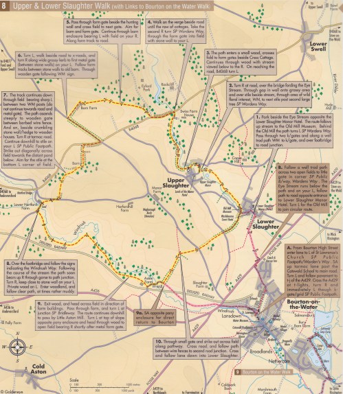
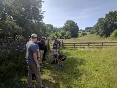
We were just shy of the halfway point when my navigational skills were put to the test for the first time. Our map instructions stated “6. Turn L, walk beside road to x-roads, and turn R along a wide grassy kerb to first metal gate (between stone walls) on your L. Follow farm tracks between stone walls to old barn. Through wooden gate following W/M sign.” The first bit was no problem. It was a delight to have a wide grassy anything along the side of a road to walk on. The first metal gate appeared in due course, we went through it…and nothing on the other side matched the map’s descriptions. No “farm tracks,” but a paved asphalt driveway. No “old barn,” no “wooden gate.” The whole property had been thoroughly upgraded. We took turns peering at the map and pointing at random things, trying to decide if we were in the right place. Did the Navigator screw up, or was the map incorrect? Our shufflings and mutterings drew the attention of the occupants of the property, who glanced at us over their yard fence, and seemed used to seeing confused hikers. We eventually made an educated guess as to direction, and scooted down a steep incline to a little grassy ravine chock-full of cows. According to writer Bill Bryson, several hikers in Britain have been killed by cows over the years. I kept this nugget of information to myself, as the cows showed no more interest in us than the property owners did a few moments ago.
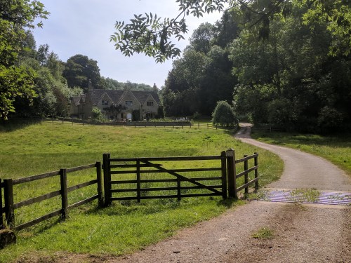
Scrambling up the other side of the ravine, we encountered a way marker that matched the map, and we continued with confidence. There was another slight detour when one of the access gates was blocked, due to that particular pasture being occupied by a couple of sharp-horned steers.
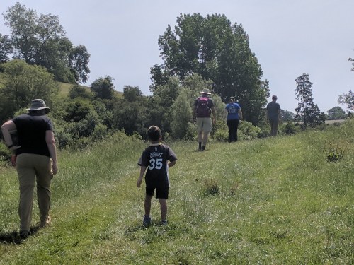
The path grew damper and the shade more frequent as we began to follow the track of a disused railway along a wooded hillside path. When we came to a fork, there was a group of obviously new semi-detached bungalows where the map promised open fields…so I took the wrong fork, thinking the map couldn’t be wrong twice in a row. The sense of going the wrong way grew until I called the group to a halt, and took a chance at us doubling back the way we came. It’s a good thing I did, or we may have ended up in Wales looking at the Irish Sea. We picked our way around the new housing, and sure enough, the proper trail continued.
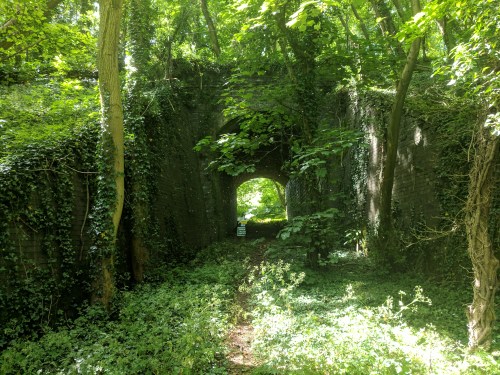
Overgrown tunnel under the disused railway
Upon our arrival back at River Cottage around 1:00, Shannon really wanted to experience the traditional English Sunday lunch of roast beef and Yorkshire pudding. She and a few others headed for the Slaughters restaurant, and I settled in to my hidden den to watch the England v. Panama World Cup game, lunching on crackers, prosciutto, and Peroni. England gave Panama a sound 6-0 drubbing. Post-lunch, Shannon, her mom, and two nieces went horseback riding.
A leisurely afternoon stretched into an equally leisurely evening. I took a hot and criminally long shower, followed by an attempt to completely drain the Irish whiskey bottle so there would be one less thing to pack onto the minibus in the morning. Thoughts turned to dinner as the horseback-riding party returned. Options being limited, we wandered over to the Slaughters once more. Our fluttering waiter had world’s most hard-to-trace accent. Sheila finally pinpointed it as belonging to “Franc,” the fluttering wedding planner played by Martin Short in Father of the Bride.
The next morning we regretfully bade farewell to the wonderful River Cottage. Our new minibus driver seemed to be a carbon copy of our previous minibus driver, John. Silver-haired, stocky, but with a military bearing. Despite his cheery, Northern-accented gregariousness, I never caught his name, and before long, we were so chummy it would be embarrassing to ask. He simply became “Not-John” in my mind.
We were heading for Scotland, and decided to break the drive into two days. After a few hours heading north, passing exits for Birmingham, Manchester, and Liverpool, we stopped at a nondescript roadside service area for a nondescript Burger King lunch. As I pulled a Peroni from the bus’s cooler, Not-John spoke of the day’s World Cup match. He was actively rooting against the Argentinians, still bitter about spending his 19th birthday fighting 1982’s Falklands War. After another hour-and-a-half or so, we were among the green crags and sparkling waters of England’s famous Lake District. We were in the north now, where the pace was a little slower and the people more relaxed. “Lovely” replaced “brilliant” as the one-word expression of approval.
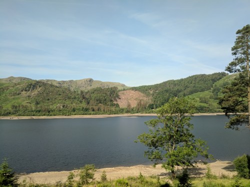
The Lake District
Located entirely in the rustic county of Cumbria, the Lake District is the land of William Wordsworth and Beatrix Potter. If you think the Cotswolds are aesthetically pleasing, the Lake District doubles down. Home of 21 freshwater lakes (almost none of which are actually called lakes — they’re “tarns,” “waters,” or “meres”) and the highest elevations in England, the Lake District receives 12 million visitors per year.
We reached our destination, the Forest Side Hotel in Grasmere, by two that afternoon. William Wordsworth used the locale of what would one day be the hotel as a setting for his narrative poem “Michael”
“Upon the forest-side in Grasmere vale/There dwelt a shepherd; Michael was his name…”
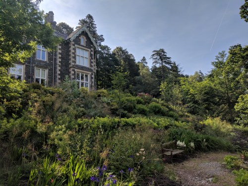
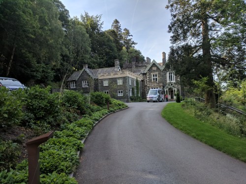
The property was indeed a sheep farm in Wordsworth’s day. The current building was built as a “gentleman’s residence” for one Stephen Heelis in 1853. It remained as a private residence until the 1930s when it became the “Cooperative Holidays Association,” offering organized holiday activities for working-class youths. It was refurbished into a luxury hotel in the late 1990s.
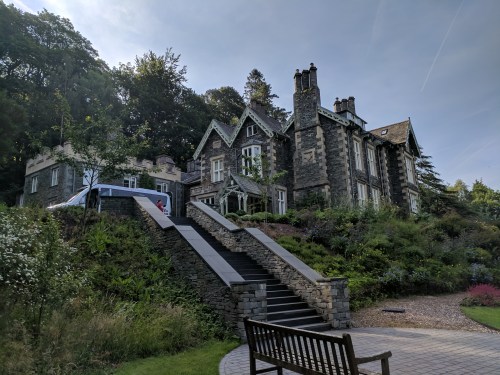
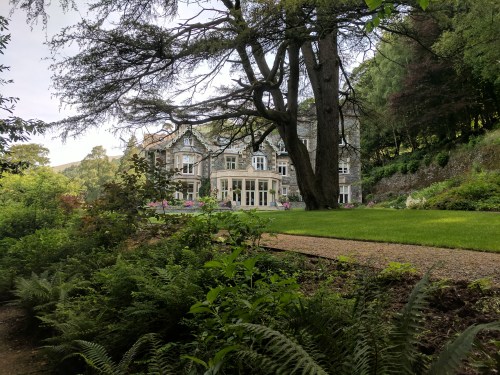
We chose it for our stop en route to Scotland due to its attached restaurant boasting Michelin-star status. “Inspired by the Cumbrian countryside,” the restaurant offered dishes such as venison pastrami with smoked juniper yogurt, West Coast langoustine with asparagus, North Atlantic cod, oyster, and tarragon salsa, and several others that do not crop up on a typical menu. All vegetables are grown in the Forest Side’s own extensive gardens.
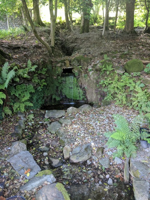
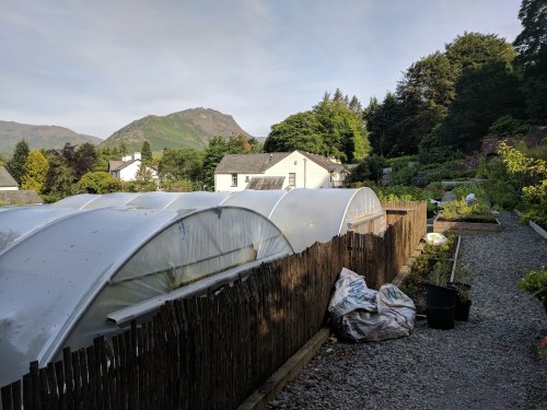
The Forest Side gardens
The porter who brought our bags to our room was the first person to absolutely stump me with the thickness of his Cumbrian accent. My ears are normally very good at parsing the various British dialects, but all I could get from this fellow was “‘ow nit omsby onna rike?” or something of the sort. I could tell it was a question, and luckily, by his gestures, I understood he was asking if I wanted the luggage on the bed, so I didn’t have to embarrass us both by asking him to repeat himself. After a short walk and a nap in our room (complete with a bathroom bigger than my first apartment), Shannon and I met the rest of the party in the lounge for cocktails at six-thirty. The bartender, Michael, was on his summer break from university, and made one of the Forest Side’s signature cocktails, the name and ingredients for which are now lost as I did not jot them down. Whiskey-based, it was one of the best cocktails I’ve had. Old-fashioned-like, but with a touch of more tropical fruitiness. When Michael handed it over to me, I thanked him in the proper northern English way — “cheers” — and received the proper northern English response — “that’s all right, then.”
Dinner was at seven, followed by another round of cocktails on the veranda. The sky finally began to darken around ten, and the mosquitoes forced us inside, but we were sad that the Forest Side was to be a one-night-only experience.
Up and out, with Not-John behind the wheel, by nine-thirty the next morning. We trundled through the furthest northern reaches of England, and scraps of ancient masonry began appearing along the roadside. We had reached Hadrian’s Wall.

Traditionally regarded as the boundary between England and Scotland, Hadrian’s Wall actually lies entirely within England. It extends about 80 miles across one of the narrowest points on the island of Great Britain, from the Tyne estuary in the east to Solway Firth in the west. Construction began in AD 122 on the orders of Roman Emperor Hadrian to manage and protect Roman holdings in the southern half of Britain. Historians now believe the wall may have purposes in addition to fending off Pictish barbarians, such as controlling the flow of goods and making sure customs were paid. Built into the wall were small “milecastle” fortifications every (Roman) mile or so, and larger forts every five miles. Although Roman influence extended far beyond the wall, it represented the demarcation line between civilization and wilderness. Continue reading











































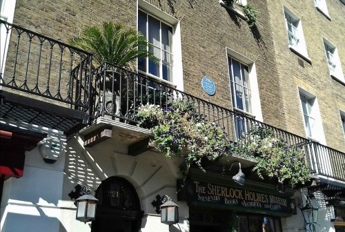
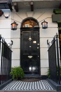 The building that now has official claim to the “221B” address according to the London Post Office is a little further up the block, at what would ordinarily be about 239 Baker Street. It is the Sherlock Holmes Museum, and is housed in an 1815 townhouse whose exterior had the good fortune to actually look quite a bit like the residence described in the Holmes stories. The Sherlock Holmes Society of England got hold of it, meticulously recreated the interior as Doyle imagined it, stuffed it full of artifacts and memorabilia, and opened it to the public in 1990. It was still closed at seven on a Saturday morning, of course, so I walked on.