Today was the first low-key day of the trip. No rushing around to squeeze in as much stuff as possible like we did in London. I slept late enough to actually be a little hungry upon awakening, so I augmented my coffee with a couple of rashers of bacon, and toasted “bloomer” bread with rich, fatty English butter.
There may be no better place in the world for a walk than the Cotswolds. By late morning, we were on one of the many footpaths that criss-cross the woods and pastures surrounding Lower Slaughter, Upper Slaughter, and the larger village of Bourton-on-the-Water. (“Slaughter” comes not from the ultimate fate of many of the area’s sheep, but from “slough,” meaning “wet land.”) We crossed the River Eye (which takes about five steps on a footbridge — the scale of what earns the name “river” is a little smaller over here), noting the trout idling lazily just beneath the surface, and the duck families paddling to and fro. The only thing that could make everything ever more like a children’s storybook setting would be a bunny rabbit. As if on cue, one hopped out from behind a hedge. It was almost sickening how perfect the scene was.


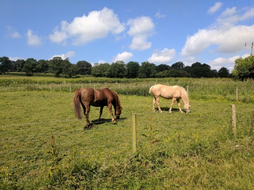
Just beyond the village, our leisurely progress was observed by a herd of curious cows, and two horses wandered over to the fence line to say hello. These horses seemed absolutely delighted to see us and have their noses stroked. Shannon, our group’s true horse aficionado, reached under the jaw of one of them to scratch its ear on the far side. The horse actually leaned into her and closed its eyes in bliss. I have a feeling it would have rolled over to have its belly scratched if we were on the other side of the fence.


The footpath passed by the parish church of St. Lawrence. The interior chancel was preserved from the old Norman church that once stood here back in the 14th century, but the rest of the building dates from 1784. The churchyard was the usual jumble of slender, tilted headstones, and the practice of burying randomly connected family members not only in the same plot but the same grave was very much in evidence. And it seems that tombstone engravers got paid by the word. “Here is interred the mortal remains of Harold Wyckham-Pigg, Esq., parish deacon and beloved husband, father, brother, cousin, and humble servant of the Lord, called home from his earthly toils in his sixty-sixth year of life, Monday the twenty-third of June, eighteen hundred and thirty-six, anno domini. Also, Mrs. Margaret Wyckham-Pigg, beloved daughter-in-law of same, wife of Peter Wyckham-Pigg, solicitor, passed from this life on…etc. etc.” Each line in a different font, like the annoying co-worker who tapes up signs in the office break room.

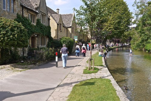
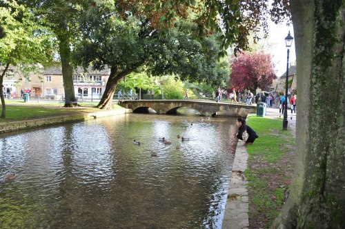
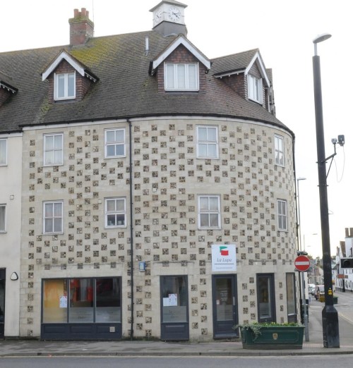
We reached Bourton-on-the-Water just in time to start looking for a place to have lunch. Bourton is often referred to as the “Venice of the Cotswolds” due to the five arched bridges that span the River Windrush as it flows through the center of town. The distinctive yellow limestone buildings that give Cotswold villages their quaint character line the stone channel that carries the river. Like much of the Cotswolds, Bourton-on-the-Water shows evidence of continual habitation since prehistoric times and its name reflects a heavy Saxon influence. “Burgh” meaning camp, and “ton” meaning estate, enclosure, or village. So Bourton is the “village beside the camp.” (On the water.) The camp may have been the remains of an old Roman camp, as Roman-era coins and pottery have been found nearby.

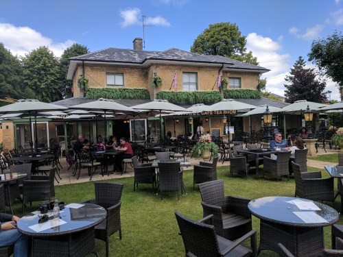
Our choice for lunch was De La Haye’s Cafe Tea Room, where I indulged in what might be my favorite traditional British dish, bangers and mash. The tiny bit of green onion in the mashed potatoes was a brilliant touch. Just across the street from the cafe was Bourton’s war memorial, listing names of the village’s young men lost in World War I and II. Even the smallest village we visited had one of these, a reminder of what a toll these conflicts took on every corner of Britain.
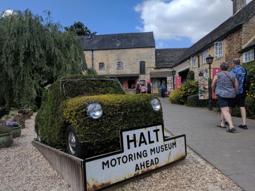
After lunch, some of our party went to the Motoring Museum (“Bourton’s #1 Tourist Attraction”) next door, and a few of us (myself included) wandered back to River Cottage to while away the afternoon reading, dozing, and watching World Cup (Iceland v. Nigeria).
Not even a reach-in.
My father-in-law and brother-in-law are both super-busy-type businessmen, and a two-and-a-half week sojourn overseas was only possible for them thanks to modern technology. Most late afternoons they would have their ever-present laptops open and tabbed up with memos, spreadsheets, and schematics that I could never presume to come close to understanding, while I, as a teacher on summer break, filled my time making ice and peering into the cupboards for more crackers.

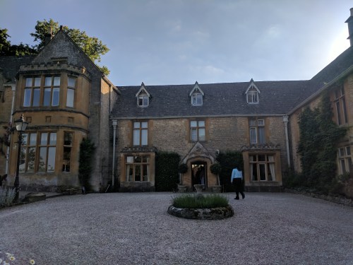
River Cottage living room.
Because I had so much extra time to stake out our lodgings, I commandeered the best room in River Cottage for myself. Behind a small, nondescript wooden door off the kitchen — it looked like it led to a closet or pantry — was a tiny, perfect, wood-paneled study with a low, exposed-beam ceiling, the world’s softest armchair, and a flat-screen TV mounted next to the stone fireplace. This was where I would spend the next few evenings finishing my Nelson biography, sipping whiskey with painstakingly harvested ice, writing up the notes that are the basis for what you’re reading right now, and ignoring accusations of being anti-social. The only downside was the window was right on the heavily-traveled footpath through the village center. On one memorable occasion a Japanese tourist cupped his hands and stared directly into the window, only to find me, drink in hand, staring right back. I raised my glass in friendly salutation, but he seemed terrified and scampered off. I don’t know what he was expecting to see.
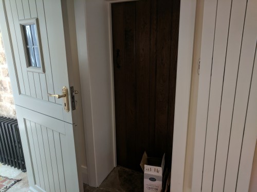
Recessed door to my hideway.

Introvert’s paradise.

River Cottage back garden and sunroom.
Dinner that evening was at Lords of the Manor, just outside Upper Slaughter. We took a different footpath in a different direction, passing by Lower Slaughter’s historic Old Mill, through sun-dappled woods, and sheep pastures where the sheep barely bothered to get out of our way.
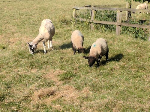

Sheep pasture selfie, on the way to Lords of the Manor.
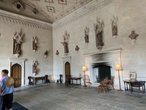
Located in the lower floors of a manor house dating from 1649, Lords of the Manor recently lost its Michelin star due to a change in chefs, but I have no doubt it will soon earn it back. The 19th-century Witts family once occupied the house and grounds, and were the “lords” referred to in the restaurant’s name, and their manor was Upper Slaughter and its surrounding lands. The manor house sits on eight acres of gardens and lawns.

Lords of the Manor in the distance.
After a round of drinks on the outside patio, we were ushered inside for their seven-course signature tasting menu. By the time we approached the finish line, it was growing dark. A few of our party headed back, and some of us stayed, lingering over coffee, dessert, and the last of many, many glasses of wine.

It was full on night-time when the last of us headed out. The woods were no longer sun-dappled, and the uneven sheep pastures seemed designed to give the after-dark traveler a sprained ankle. The sheep themselves, roused from slumber, must have been amused at the sight: a bizarre human parade, half-drunk, picking and stumbling their way through their pasture, guided only by the light of their cell phones. As we re-entered the village, we were yelled at by woman from an upstairs window for excessive noise (i.e., conversing at a normal volume in the ten seconds it took to pass her house.)
A new day brought a new van and driver, this time the amiable John. Square-shouldered and silver-haired with bushy sideburns, and a pouch of pipe tobacco in his vest pocket, John always waved to his fellow bus drivers going in the opposite direction. I felt a little bad that so few waved back.
Today we would be visiting Stonehenge, the ring of massive stone monoliths that has stood in the Wiltshire countryside since prehistoric times. We were originally scheduled to see it en route from London to the Cotswolds, but you know what day that was? June 21. The summer solstice. Stonehenge would have been totally overrun with every New Age fake druid in a thousand mile radius, banging their drums and jabbering to the heavens. But Stonehenge was at the top of most our list of things we wanted to see, so we turned it (and Lacock Abbey) into a day trip on the 23rd.
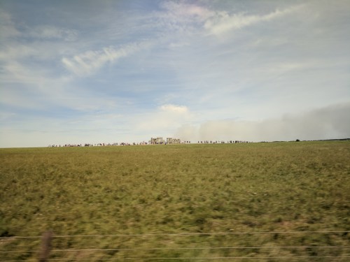
Stonehenge as seen from the van window traveling up the A303.
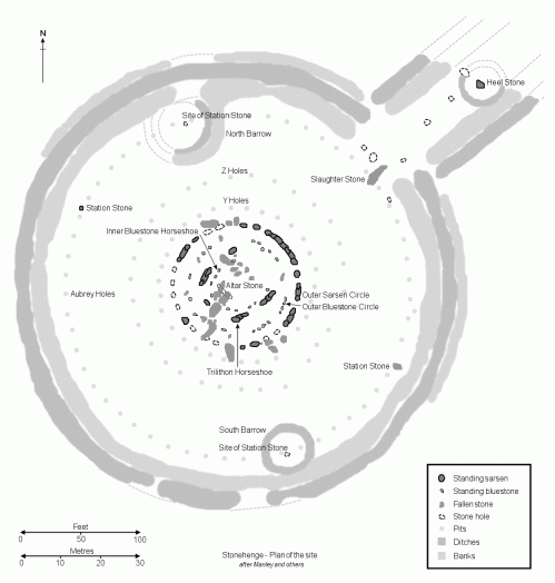
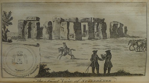
Stonehenge (if it was ever actually completed, which scholars are beginning to doubt) once consisted of four concentric settings — two circles, two horseshoe shapes — made up of two different types of rock. The outer circle consists of carefully shaped rectangular blocks of sandstone known as sarsens. There would have been as many as thirty of these “uprights,” each pair capped by a horizontal lintel. Only seventeen sarsens still stand, and only six horizontal lintels are still in place. Inside the sarsen circle is a ring of much smaller bluestones, many of which are missing or very fragmentary. Inside of that are the largest stones in the monument — a u-shape made of of five sets of sarsen “trilithons” — two standing stones and a horizontal lintel, like the outer ring, but larger in scale. The tallest of these stands 24 feet high and weighs 35 tons. Inside these is a smaller horseshoe of bluestones. The sarsen stones are relatively local, but bluestones of the type used at Stonehenge are only found at a certain place on the Welsh coast, 150 miles away.
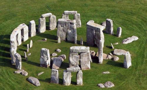
A low earthwork enclosure surrounds the entire monument, and two parallel banks known as the Avenue lead out from the monument’s northeast. The Avenue runs (almost invisibly if you don’t know exactly what to look for) for 1.5 miles and ends at the River Avon. Along the Avenue stands a separate sarsen, the fifteen-foot high “Heel Stone,” so-named because the devil once kicked a heel mark into it (or something like that — stories vary.) A ways behind it is the flat, sixteen-foot “Slaughter Stone,” named due to its resemblance to a sacrificial altar, and the fact that the rainwater that gathers in its surface depressions turns a bloody reddish color due to the iron in the stone itself.
Stonehenge stands on an open area of low grasses and chalky soil known as Salisbury Plain. The plain is full of literally hundreds of prehistoric mounds, barrows, and burial sites, so the area clearly had some significance to prehistoric Britons. Sometime around 3000 B.C., they dug the circular mound that now surrounds the stones. The stones themselves went up around 2500 B.C., likely representing decades of labor by successive generations. Hauling the stones on flat sledges from their quarry site, shaping the stones, and digging deep foundation holes and counter-levering the standing stones into position would all be difficult enough today, let alone in a time where the only tools were made of stone, wood, and bone. Then there’s the question of how the horizontal lintels were put into place, the answer to which is still theoretical. The most commonly accepted theory is that they were hauled up earth ramps, long enough to have a manageable slope, then the ramps were shoveled away leaving no trace. (The blocks of the Egyptian pyramids — constructed at roughly the same time as Stonehenge — were probably put in place via a similar method.)
All to what purpose? Was Stonehenge intended to be a religious temple? An early astronomical observatory? A healing shrine for pilgrims? A necropolis (many graves are scattered through the site)? All of the above? No one ever lived there. It could not be defended if attacked. There are tantalizing clues, such as the fact that the Heel Stone lines up perfectly with the summer solstice sunrise, but there is still no consensus on Stonehenge’s original reason for existing.
Time moved on and the people who made Stonehenge abandoned it. But Stonehenge stayed, although it has seen better days. Its prehistoric constructors vanished into the mists of time, perhaps scattered into the western hills and gradually fading into extinction, but more likely being absorbed by the Bronze Age Celts, who arrived in Britain from mainland Europe in two successive waves beginning as early as 2000 B.C. At one point, the first professional archaeologists believed Stonehenge was the work of these Celts as part of their druidic religion, but it is, of course, much older. The Celtic Britons were conquered by the Romans, who left no record of their thoughts on the monument that was 1,800 years older than Romulus and Remus. Enough Roman coins and pottery shards have been found there to suggest the place was well known to them. The power gap left by the Romans’ retreating army of occupation was filled by the Germanic tribes known as the Angles and the Saxons. Often referred to as another “invasion,” it was probably more of a slow infiltration. The remaining Romanized Britons either intermarried with the Anglo-Saxons (creating the wonderfully eccentric race called the English), or headed west to become the Welsh. In the Middle Ages, it was believed the circle marked the site of a battle between the King Arthur’s old Britons and the Saxon newcomers, and the stones were erected by Merlin the wizard.
The Danes and Vikings had their way with Britain for awhile, too, and of course the Normans, who we’ve already heard so much about…
Stonehenge, crumbling but still there, stood silent witness to all these changes over four thousand years.
In modern times, Stonehenge was on private land for centuries until it was donated to the nation by its last owner, Cecil Chubb, in 1918. The public had unrestricted access to the stones and could wander and picnic among them until 1977, when noticeable deterioration caused them to finally be roped off. For many years, there was just a parking lot and the stones. Finally funds were raised for an elaborate visitor center and museum, which opened in late 2013.
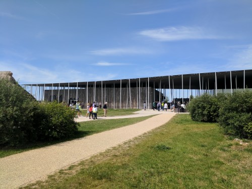
Stonehenge Visitor Center.
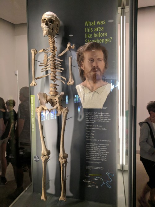
Most of our group wanted to head right out to the stones, but Cam and I lingered at the visitor center, which is certainly an odd-looking building. It was designed to look “lightweight and informal” in direct contrast to the timeless monolithic stones, with an undulating roof that fit in with the rolling Salisbury Plain. Weird as it looked on the outside, the interior was full of displays boasting the most state-of-the-art technology designed to guide visitors through the history of the monument.

Typical high-tech exhibit at the Stonehenge Visitor Center.

Who built Stonehenge? Val Kilmer.
On a summer Saturday, it was more crowded than I could comfortably handle, so I did not give this splendid museum its full due. In an open area behind the visitor center were full-scale recreations of a thatched hut dwelling inhabited by a Stonehenge construction worker, and one of the sledges used to transport the sarsens.

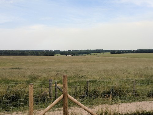
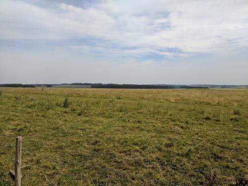
The monument itself was a mile-and-a-half away from the visitor center. Shuttle buses took the less-hardy tourists up the private road every five minutes, but Cam and I decided to take a stroll across a small section of Salisbury Plain. The air was smoky due to what appeared to be a controlled agricultural burn on the northern horizon, and the heat of the day made the walk a little uncomfortable as we began to sweat. Compounding this was Cameron’s phobia of bees, which dive-bombed him every few minutes. (My own phobia — spontaneous public vomiting — would not be a big deal out here.) Still, it was impossible to say the walk was unpleasant. We avoided the main path, and sometimes any path at all. Occasional clusters of woods provided shade at just the right moments. We ambled through green cow pastures (with bored-looking, seen-it-all cows who chewed their cuds and observed us as if we were the exhibits) and meadows bursting with wildflowers. I was also excited to be in (or near) another iconic Beatles location.
It’s been awhile since I’ve mentioned the Beatles, hasn’t it? In their second film, 1965’s colorful caper fantasy Help!, the band is pursued by an evil cult determined to use Ringo as a human sacrifice. In one sequence, in order to have adequate protection they hold an outdoor recording section on Salisbury Plain, surrounded by machine gunners and a ring of tanks.
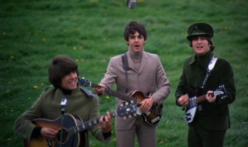

The sequence consisted of two songs — “I Need You” and “The Night Before” — and was filmed somewhere between Stonehenge and the military base to the north at Larkhill.
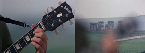
The camera does a quick rack focus past George’s guitar neck to Stonehenge, the only shot of the monument in the film.


Cam and I gazed out towards Larkhill, about three miles distant, trying to match the low hills and treelines to our memories of the film.
The Beatles once ran around somewhere out there on a much cooler day in 1965.
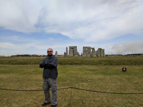
We finally arrived at Stonehenge after our cross-country ramble, and shared our time at the monument with about 500 other people there that day.


As evidence of most people’s fundamental laziness, by merely walking around the stones to the other side, the crowd diminished noticeably, and I could contemplate this prehistoric wonder as if I were alone.


The Heel Stone. The Slaughter Stone, lying flat, is just visible in the middle distance.
We caught the shuttle back to the visitor center, re-grouped, and headed into the nearby town of Amesbury for an Italian lunch at La Lupa (complemented by an extra-large bottle of Peroni.)
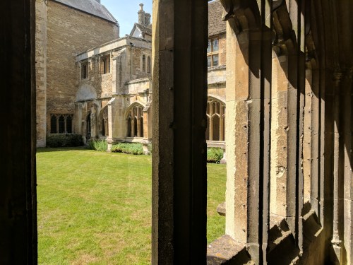
Our second major stop of the day was on the way back to Lower Slaughter via a different route — Lacock Abbey, a 13th-century nunnery and former country home that was chosen as a destination by a few Potter-heads our party due to it being a filming location for the first two Harry Potter films. After pulling into the abbey grounds’ parking lot, which was some distance from the building itself, I continued a family tradition of striding off confidently in the wrong direction. Once we were turned around and on our way, another (newer) family tradition made itself evident — competing for the most Fitbit steps. I was Fitbit-less, and driver John remarked that he got more than enough “steps” in the Army to last him a lifetime. Wait, what was John doing with us? Hired drivers usually stay with the vehicle. But grizzled Army vet John revealed he was a proud Potter-head himself, and wanted to get a look at the place (and take pictures for his sister, an even bigger Harry Potter fan.)

Lacock Abbey, front entrance.
Entry Hall
The original abbey was established in 1232 as a nunnery for members of the Augustinian order. It continued in that capacity until all monasteries were shut down and seized by Henry VIII in the 1530s. The abbey was sold to one of Henry’s loyalists, Sir William Sharington, and he converted it into a country house. Sharington tore down the nunnery’s associated church and used the stone to build the house, but preserved much of the original abbey in the house’s basement and ground floor.
The house eventually came into possession of the Talbot family in the 1700s. William Henry Fox Talbot (1800-77) was a pioneer in the area of photography. In 1835, he made what may be the oldest photographic negative in existence — a shot of one of Lacock Abbey’s latticed windows.


Backside of Lacock Abbey. The famous window is above the entrance.
Lacock Abbey, sometimes referred to as the “Birthplace of Photography,” was given to the National Trust in 1944 by Matilda Gilchrist-Clark, a niece of the last Talbot owner.
The original nunnery portion on the ground floor is bare and bleak, giving a good idea of the lack of material comfort religious adherents in the Middle Ages had to accept.
The upstairs living portion is left pretty much as it was in the 1920s, when the Talbots were still having dinner parties here. It is not overly-restored, and looks a little musty and shabby, which is a nice change of pace after the sumptuous Windsor Castle and Blenheim Palace. It still feels lived-in.
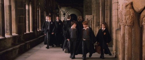
Sure enough, anyone with a familiarity with the films Harry Potter and the Sorcerer’s Stone and Harry Potter and the Chamber of Secrets would immediately recognize several sections of the old abbey. Through the magic of film editing, Lacock Abbey was combined with many other locations (Gloucester Cathedral, Alnwick Castle, Harrow School, some old Oxford buildings) to create Hogwarts School of Witchcraft and Wizardry. (Some of the later Potter films also used Lacock, but not as extensively.)
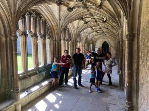
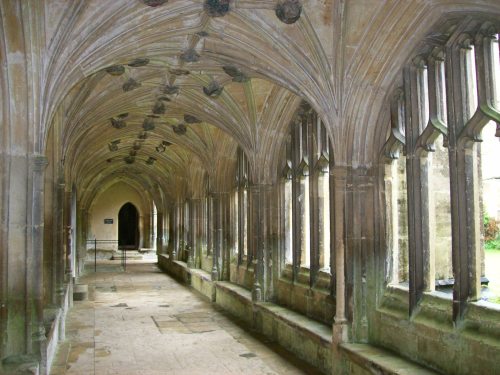
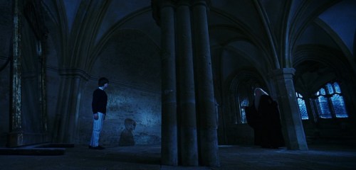
The passageways around the cloister were used several times for Hogwarts hallways.


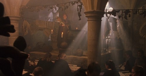
The sacristy — a room for keeping vestments and church furnishings between services — was used as Professor Snape’s classroom.

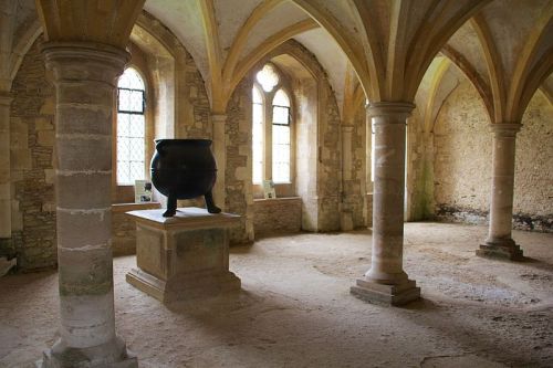
The warming room was used for Professor Quirrell’s classrom. The 16th-century cauldron was not a prop.

The chapter house is where Harry found the Mirror of Erised.
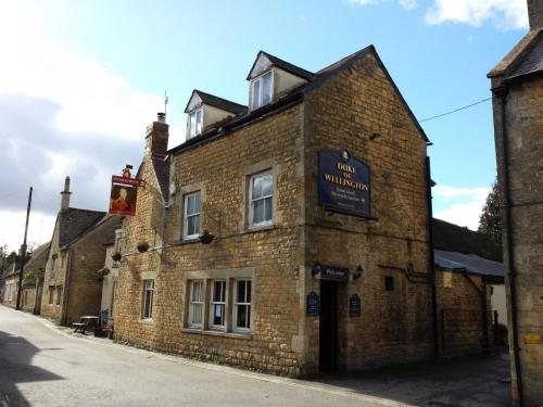
Upon our return to the River Cottage, poor John was chewed out by a local resident for driving our oversized van through the narrow streets of the Square. From the voice and general location of where she popped up, I have little doubt it was the same self-appointed guardian of Lower Slaughter rules and standards that accosted us from the window the night before. We said our farewells to John, and walked to dinner at the Duke of Wellington pub in Bourton-on-the-Water. Another cheeseburger missed the mark (the dry, crumbling patty was more like a slice of meatloaf), but as I’ve said before — the ale was good, the service was friendly, and World Cup soccer was on, so it was all OK. Germany bested Iceland 2-1 with a free kick in the last five seconds of added time.
After dinner, we looked around for an ice cream parlor, but it was just past 8:00, and Bourton really rolls up its sidewalks after a certain point.
