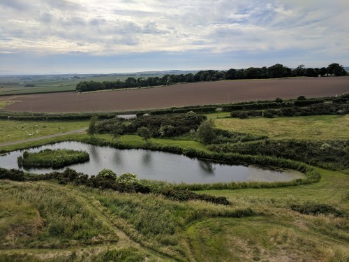
The bulk of Sunday morning was taken up by an eight-mile loop hike through the Cotswolds countryside. The previous day we had purchased a walking map, “North Cotswold Classic Walks (Revised Edition)” (not revised enough, as it turned out).
It was a small party that set out after breakfast — Shannon and myself, her parents, and Bret & Sammy. I was put in charge of the “laminated, waterproof, and tear-resistant” map. The only way the map would get wet on this day was by me sweating on it. Clear skies and temperatures in the mid-eighties again. Having done it a couple of times before, we covered the first leg from Lower Slaughter to Upper Slaughter with ease. Then we headed into the open country to the north. The challenge here was the narrow country roads’ almost non-existent shoulders, forcing the intrepid hiker to thread a needle between occasional traffic and thick hedgerows. Luckily this scenario was somewhat rare, and most of the hike was on public right-of-way trails through meadows, farmland, and wooded areas. A red fox — in considerably better condition than the flea-bitten specimen we saw skulking in Highgate Cemetery — scampered down a sloping orchard into the brush that lined the River Eye.
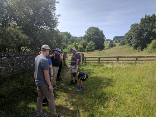
We were just shy of the halfway point when my navigational skills were put to the test for the first time. Our map instructions stated “6. Turn L, walk beside road to x-roads, and turn R along a wide grassy kerb to first metal gate (between stone walls) on your L. Follow farm tracks between stone walls to old barn. Through wooden gate following W/M sign.” The first bit was no problem. It was a delight to have a wide grassy anything along the side of a road to walk on. The first metal gate appeared in due course, we went through it…and nothing on the other side matched the map’s descriptions. No “farm tracks,” but a paved asphalt driveway. No “old barn,” no “wooden gate.” The whole property had been thoroughly upgraded. We took turns peering at the map and pointing at random things, trying to decide if we were in the right place. Did the Navigator screw up, or was the map incorrect? Our shufflings and mutterings drew the attention of the occupants of the property, who glanced at us over their yard fence, and seemed used to seeing confused hikers. We eventually made an educated guess as to direction, and scooted down a steep incline to a little grassy ravine chock-full of cows. According to writer Bill Bryson, several hikers in Britain have been killed by cows over the years. I kept this nugget of information to myself, as the cows showed no more interest in us than the property owners did a few moments ago.
Scrambling up the other side of the ravine, we encountered a way marker that matched the map, and we continued with confidence. There was another slight detour when one of the access gates was blocked, due to that particular pasture being occupied by a couple of sharp-horned steers.
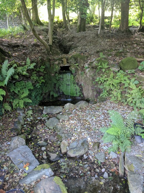
The path grew damper and the shade more frequent as we began to follow the track of a disused railway along a wooded hillside path. When we came to a fork, there was a group of obviously new semi-detached bungalows where the map promised open fields…so I took the wrong fork, thinking the map couldn’t be wrong twice in a row. The sense of going the wrong way grew until I called the group to a halt, and took a chance at us doubling back the way we came. It’s a good thing I did, or we may have ended up in Wales looking at the Irish Sea. We picked our way around the new housing, and sure enough, the proper trail continued.
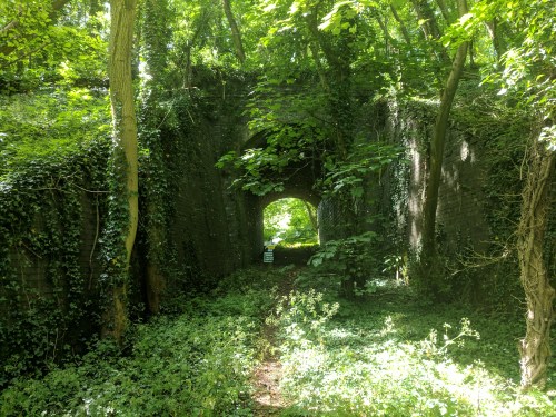
Overgrown tunnel under the disused railway
Upon our arrival back at River Cottage around 1:00, Shannon really wanted to experience the traditional English Sunday lunch of roast beef and Yorkshire pudding. She and a few others headed for the Slaughters restaurant, and I settled in to my hidden den to watch the England v. Panama World Cup game, lunching on crackers, prosciutto, and Peroni. England gave Panama a sound 6-0 drubbing. Post-lunch, Shannon, her mom, and two nieces went horseback riding.
A leisurely afternoon stretched into an equally leisurely evening. I took a hot and criminally long shower, followed by an attempt to completely drain the Irish whiskey bottle so there would be one less thing to pack onto the minibus in the morning. Thoughts turned to dinner as the horseback-riding party returned. Options being limited, we wandered over to the Slaughters once more. Our fluttering waiter had world’s most hard-to-trace accent. Sheila finally pinpointed it as belonging to “Franc,” the fluttering wedding planner played by Martin Short in Father of the Bride.
The next morning we regretfully bade farewell to the wonderful River Cottage. Our new minibus driver seemed to be a carbon copy of our previous minibus driver, John. Silver-haired, stocky, but with a military bearing. Despite his cheery, Northern-accented gregariousness, I never caught his name, and before long, we were so chummy it would be embarrassing to ask. He simply became “Not-John” in my mind.
We were heading for Scotland, and decided to break the drive into two days. After a few hours heading north, passing exits for Birmingham, Manchester, and Liverpool, we stopped at a nondescript roadside service area for a nondescript Burger King lunch. As I pulled a Peroni from the bus’s cooler, Not-John spoke of the day’s World Cup match. He was actively rooting against the Argentinians, still bitter about spending his 19th birthday fighting 1982’s Falklands War. After another hour-and-a-half or so, we were among the green crags and sparkling waters of England’s famous Lake District. We were in the north now, where the pace was a little slower and the people more relaxed. “Lovely” replaced “brilliant” as the one-word expression of approval.
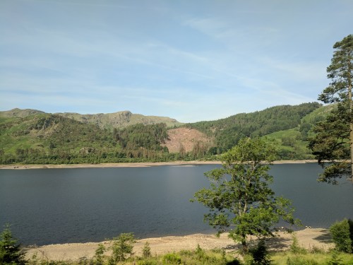
The Lake District
Located entirely in the rustic county of Cumbria, the Lake District is the land of William Wordsworth and Beatrix Potter. If you think the Cotswolds are aesthetically pleasing, the Lake District doubles down. Home of 21 freshwater lakes (almost none of which are actually called lakes — they’re “tarns,” “waters,” or “meres”) and the highest elevations in England, the Lake District receives 12 million visitors per year.
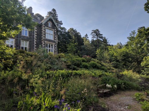
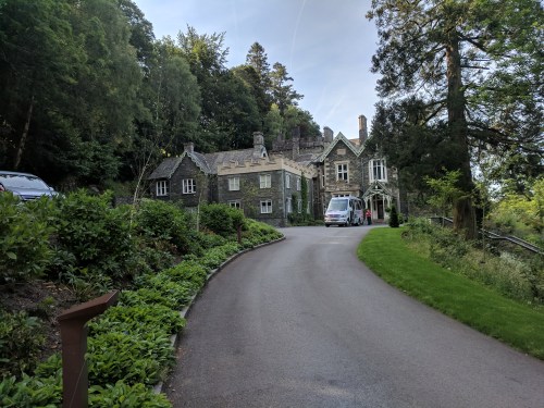
We reached our destination, the Forest Side Hotel in Grasmere, by two that afternoon. William Wordsworth used the locale of what would one day be the hotel as a setting for his narrative poem “Michael”
“Upon the forest-side in Grasmere vale/There dwelt a shepherd; Michael was his name…”
The property was indeed a sheep farm in Wordsworth’s day. The current building was built as a “gentleman’s residence” for one Stephen Heelis in 1853. It remained as a private residence until the 1930s when it became the “Cooperative Holidays Association,” offering organized holiday activities for working-class youths. It was refurbished into a luxury hotel in the late 1990s.
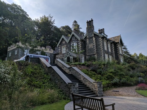
We chose it for our stop en route to Scotland due to its attached restaurant boasting Michelin-star status. “Inspired by the Cumbrian countryside,” the restaurant offered dishes such as venison pastrami with smoked juniper yogurt, West Coast langoustine with asparagus, North Atlantic cod, oyster, and tarragon salsa, and several others that do not crop up on a typical menu. All vegetables are grown in the Forest Side’s own extensive gardens.
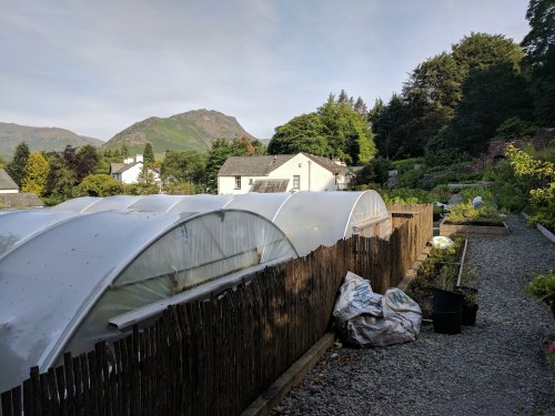
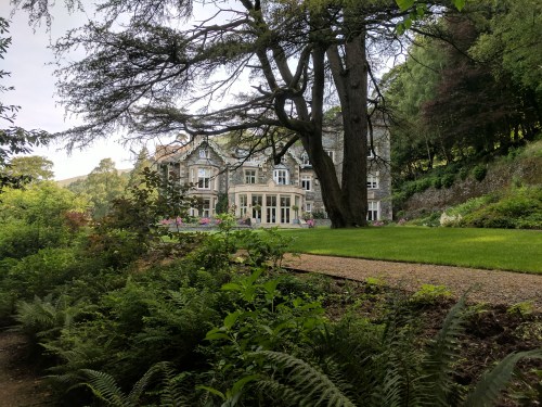
The Forest Side gardens
The porter who brought our bags to our room was the first person to absolutely stump me with the thickness of his Cumbrian accent. My ears are normally very good at parsing the various British dialects, but all I could get from this fellow was “‘ow nit omsby onna rike?” or something of the sort. I could tell it was a question, and luckily, by his gestures, I understood he was asking if I wanted the luggage on the bed, so I didn’t have to embarrass us both by asking him to repeat himself. After a short walk and a nap in our room (complete with a bathroom bigger than my first apartment), Shannon and I met the rest of the party in the lounge for cocktails at six-thirty. The bartender, Michael, was on his summer break from university, and made one of the Forest Side’s signature cocktails, the name and ingredients for which are now lost as I did not jot them down. Whiskey-based, it was one of the best cocktails I’ve had. Old-fashioned-like, but with a touch of more tropical fruitiness. When Michael handed it over to me, I thanked him in the proper northern English way — “cheers” — and received the proper northern English response — “that’s all right, then.”
Dinner was at seven, followed by another round of cocktails on the veranda. The sky finally began to darken around ten, and the mosquitoes forced us inside, but we were sad that the Forest Side was to be a one-night-only experience.
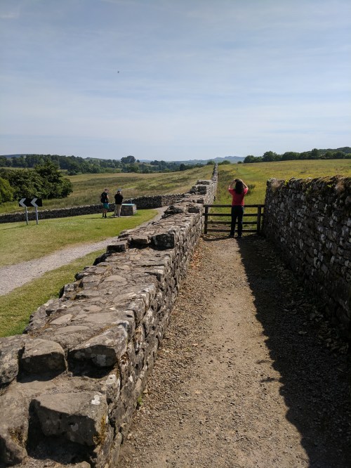
Up and out, with Not-John behind the wheel, by nine-thirty the next morning. We trundled through the furthest northern reaches of England, and scraps of ancient masonry began appearing along the roadside. We had reached Hadrian’s Wall.

Traditionally regarded as the boundary between England and Scotland, Hadrian’s Wall actually lies entirely within England. It extends about 80 miles across one of the narrowest points on the island of Great Britain, from the Tyne estuary in the east to Solway Firth in the west. Construction began in AD 122 on the orders of Roman Emperor Hadrian to manage and protect Roman holdings in the southern half of Britain. Historians now believe the wall may have purposes in addition to fending off Pictish barbarians, such as controlling the flow of goods and making sure customs were paid. Built into the wall were small “milecastle” fortifications every (Roman) mile or so, and larger forts every five miles. Although Roman influence extended far beyond the wall, it represented the demarcation line between civilization and wilderness.
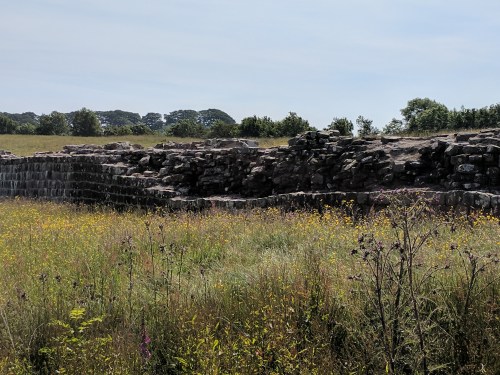
We stopped the minibus at Birdoswald, an old farmhouse built on the ruins of one of the larger Roman forts. The farm at Birdoswald has its own fascinating history going back to at least 1211, and it was functional through 1984, when it was given over to archaeological excavations and opened to the public.

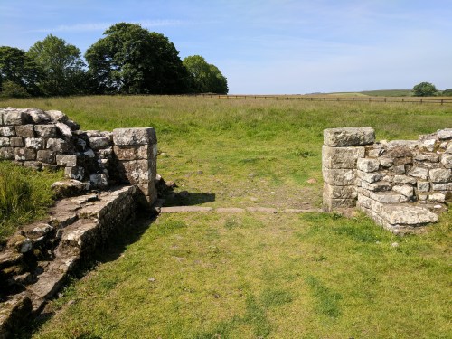
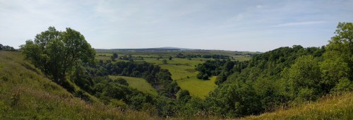
We opted for a self-guided tour, each of us wandering off in random directions. All the self-tour signage was well-placed and very helpful, and the ruins of the old Roman walls, gates, and granaries were clearly visible. The only downside was the ground was almost nothing but sheep shit, deposited by the dozens of woolly friends that wandered freely among the tumbled masonry and tall grass. The Romans called this particular fort “Banna,” meaning a “spur of land,” after its location on a ledge overlooking the River Irthing. The view from the back of where the fort once stood was one of the most amazing of the whole trip — including the 500 or so sheep it encompassed.
View from the rear of the old Roman fort
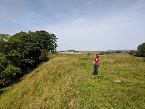
Cam on the edge of the “banna”
Back on the bus, we continued cruising northeast. I happened to be sitting on the left, and was the only one not conversing or staring at my phone. Before I was expecting anything like it, the famous Sycamore Gap appeared out my window. The Sycamore Gap is a deep depression along the route of the wall, with an old sycamore tree growing at its lowest point. It is sometimes referred to as the most photographed tree in Britain. It featured in a key sequence in the 1991 film Robin Hood: Prince of Thieves (although thanks to that film’s fast-and-loose approach to anything regarding historical or geographic fact, the scene is supposed to take place on the southern coast of England). It has become so associated with the movie, it is sometimes referred to now as the “Robin Hood Tree.” But I wasn’t one hundred percent sure that was the actual location as the bus whizzed by. Could there be other sycamore trees in similar gaps? By the time I confirmed it with Google Maps on my phone, it was well behind us. I was the only one to see it, and I wasn’t quick enough to get a picture.

Sycamore Gap. Photo taken from Northumberland National Park website.
We crossed over into Scotland at Carter Bar and stopped for lunch at Jedburgh, the “Historic Gateway to Scotland.” We didn’t see much of it beyond the little cafe called Simply Scottish, which provided basic but hearty fare. I had the mac & cheese. No one was yet brave enough to order the haggis.
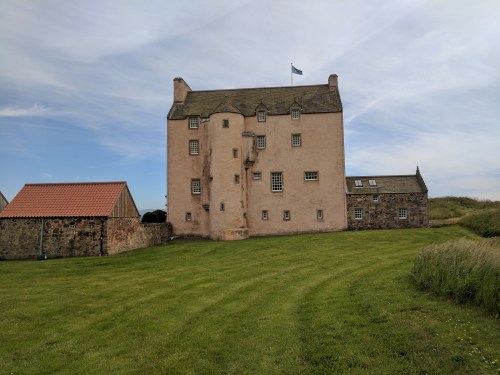
Two more hours on the road brought us to our final destination for the day, and our accommodations for the next three days — Fenton Tower. As we were unloading the minibus, I finally caught Not-John’s name. It was Paul.
Fenton Tower is located near the tiny hamlet of Kingston in the county of East Lothian. One of my only regrets of the trip is that we never made it all the way to the craggy Highlands of Scotland. These rolling Lowlands that now surrounded us were nice enough, but with the blue skies and high temperatures I was put in mind of the wine country back home in California (which is scenic in its own right).

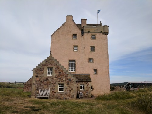
The small bluff which is now home to the tower was probably the location of some kind of fortification since the 11th century. The current structure dates from 1587, and was named for the Fenton family who once owned the surrounding land. Fenton Tower itself was probably built by the Whitelaw family, related to the Fentons by marriage. They didn’t have it long, as it was forfeited to the Carmichaels in 1592. The year before, Fenton Tower provided a comfortable hiding spot for Scottish king James VI (soon to also be James I of England) when he had to take to his heels to escape the wrath of a rebel uprising in Fife.
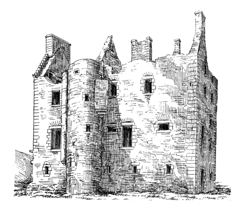
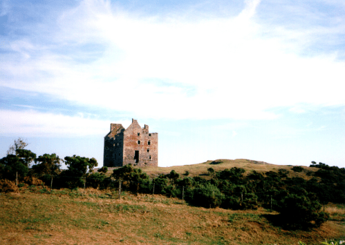
Before restoration. Photo by Martin Coventry, from The Castles of Scotland website
The property changed hands several more times, and finally fell into ruin after being sacked by Oliver Cromwell’s army in 1650.
The ruins brooded on the little bluff for another 340 years, a picturesque patch of various landowners’ hundreds of acres of farmland, until they were restored to luxury accommodations in the 1990s.

Before (taken from the display photo album in the Tower)
After
We had exclusive use of Fenton Tower for three days. A small kitchen staff would roll in to provide breakfast each morning, and return on two of the three nights to do dinner. (On the night we were on our own for dinner, we had pizza delivered from nearby North Berwick.)
After a quarter of an hour sorting out whose room was who’s, and lots of confusion due to two identical sets of staircases leading to two entirely different parts of the Tower, I nearly sent myself into cardiac arrest lugging our 60-pound suitcases into the highest part of the building, five stories up a tiny, winding stone staircase. The unmarked doors didn’t help. Karen ended up taping handwritten name tags on each door. Our room was snug, tucked under the roof eaves, and sported yet another spacious bathroom with a glass-walled shower the size of a small anteroom.
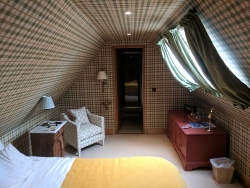

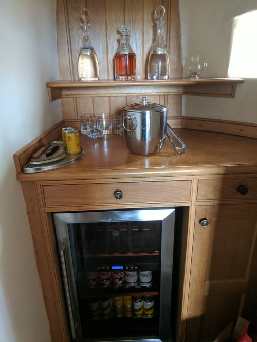
A cozy sitting room opened onto the narrow catwalks of the castle battlements. The top of the bureau had a tray loaded with glasses, bottled water, and several miniature bottles of gin and, of course, Scotch.
Our little upstairs sitting room. In finding a place to plug in my laptop charger, I unplugged wifi for the entire Tower for a day or so. Oops.
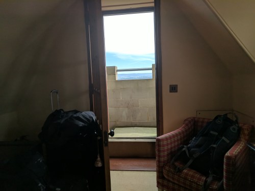
Exit from the sitting room onto the battlements
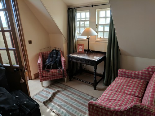
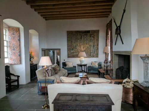
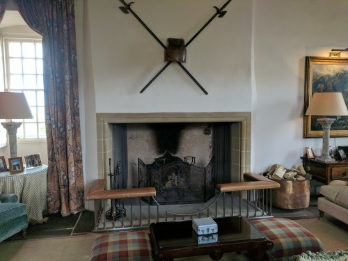
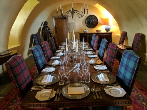
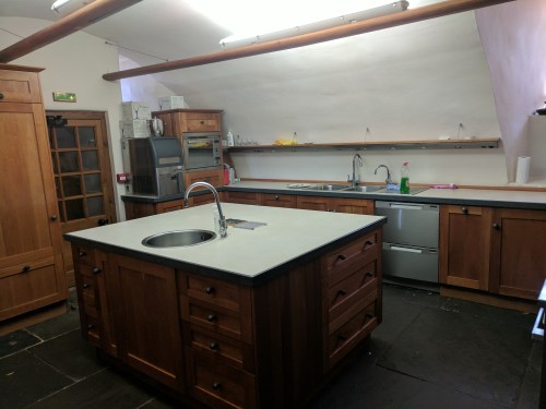
Comfortable as the bedrooms were, the true glory of Fenton Tower is the common areas. The main hall had big windows with panoramic views of the countryside, a wall-sized fireplace, looming bookshelves, and epic tapestries and rugs. The dining area was in the basement, dominated by a twelve-person oak table and overlooked by a suit of armor. A thoroughly modern kitchen was attached. We spent most of our time in the small library just off the main hall. That room was loaded with books on local history, various editions of that day’s newspapers from around the UK, a satellite TV, and a well-stocked bar.
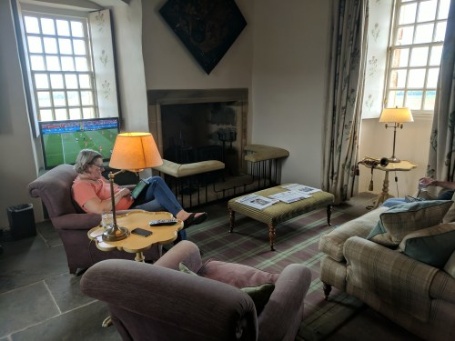
Sheila in the library
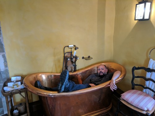
Your Humble Narrator sizing up the copper tub
I awoke in the middle of the night to a stomach ailment that would dog me for the next day or so. The five-story turret staircase was also always a test of endurance. Pleased as I was to have booze handily parked on the dresser, there was no ice bucket. Each time I wanted to nurse a drink in the comfort of my room, there was an epic journey down to the ice machine in the basement and back up. Every time you approached a landing, you felt that your journey had to be over, but there was always another steep uphill turn to navigate. Shannon badly stubbed her toe on the stone stairs moments after arriving, requiring a tight gauze wrapping and limiting her mobility for the next few days. But it was all worth it when we went out onto our garret room’s battlements early the next morning to see a proper Scottish fog finally rolling in.
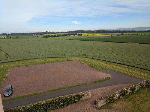
Views from the battlements
Our minibus days were over, so it was off via a couple of hired cars to the great Scottish capital of Edinburgh, about twenty-five miles to the west.
Edinburgh’s unique shabby-genteel look comes from 18th century buildings made of absorbent sandstone streaked black by 19th century Industrial Revolution coal smoke.
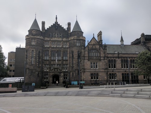
New College. Doesn’t look very new.
The cars deposited us in front of the New College, part of University of Edinburgh, where we were to meet our walking tour guide. The theme of today’s walking tour: Harry Potter. Or, more precisely, J.K. Rowling, who lived in Edinburgh during the creation of the first two books in the series. [2022 Ed. Note: This was right around the time Rowling’s first transphobic comments were making the news in a minor way. We took the tour when we were still hoping she would see reason and walk back her remarks. Sadly, she has since doubled-down on being a horrible bigot.] Rowling took inspiration from various sites and names located through the city. Our tour guide was a 19-year-old University of Edinburgh student from Essex named Monique. Cam, who had never evinced a shred of interest in J.K. Rowling and rarely utters a word in public, was suddenly glued to her every word, and trotted beside her making small talk and asking questions as we headed up the George IV Bridge towards Greyfriars Kirkyard.
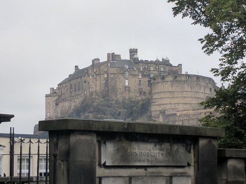
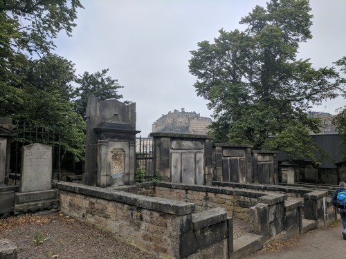
Edinburgh Castle seen from Greyfriars
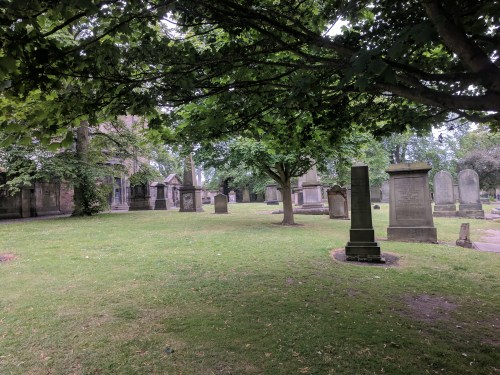
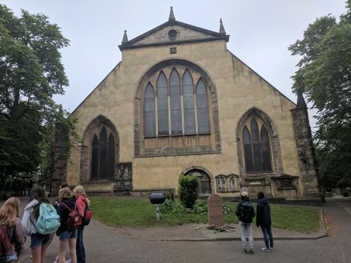
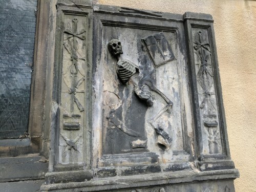
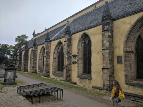
Established in 1561, Greyfriars is a famous cemetery, like Highgate in north London, known for its somber beauty and spooky atmosphere. The fog still hadn’t quite burned off as we entered Greyfriars, and the grey skies set an appropriate tone. We picked our way through the gravestones, and Monique pointed out several markers that bore names that would later be used by Rowling for some of her characters (she often cut through the cemetery to pick her kids up from school.) I hung back, a little pale and living in fearful anticipation of the cramps that would spear my stomach every three to twenty minutes. (The unpredictable timing made it so much worse.)
Most notable of the folks who provided names for Rowling’s characters, perhaps, is William McGonagall, widely regarded as the “worst poet in British history.” His notoriety was such that he even inspired a feature film, The Great McGonagall, starring Goon Show veterans Spike Milligan and Peter Sellers, and featuring several of the poet’s actual works. (The film was as bad as the poet it was mocking. Don’t seek it out.)
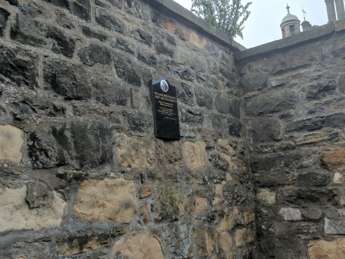
Memorial plaque for the “Great McGonagall.” The grave itself is lost.
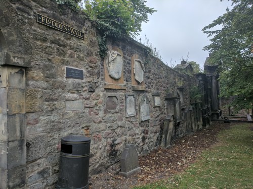
Part of the Flodden Wall, built to protect Edinburgh from a possible invasion by the English in 1513-14, now home to some Greyfriars memorial plaques
The mausoleum of George “Bloody” Mackenzie, Lord Advocate of Scotland in the 1600s, and responsible for the death of hundreds, perhaps thousands, of Covenanters (see below). Since a break-in in 1999, the mausoleum is said to be the site of many vicious physical poltergeist attacks. People report pulled hair, scratches, bruising, even broken fingers.
No visit to Greyfriars would be complete without stopping to pay your respects at the statue of Greyfriars Bobby, a Skye Terrier who supposedly guarded his owner’s grave for fourteen years. Despite the dubiousness of the story, Greyfriars Bobby has always been regarded as a local canine hero, and his 1873 statue tops a drinking fountain at the entrance to the churchyard. As usual, he was surrounded by admiring amateur photographers.
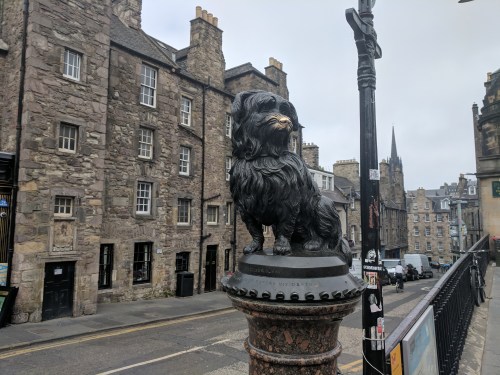
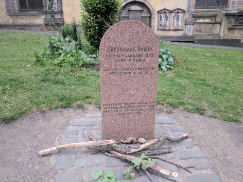
People leave sticks on Bobby’s grave. He was a good boy.
Adjacent to Greyfriars is George Heriot’s School, attended by Rowling’s children back in the 1990s, and which provided the basic inspiration for Hogwarts.
The University of Edinburgh
Our tour took us past the main campus of the University of Edinburgh, where Rowling attended teacher training classes, and past several cafes where Rowling scribbled her tales during free moments. Among the cafes was The Elephant House, which proudly trumpets itself as the “Birthplace of Harry Potter.” Monique disdainfully sniffed that the first Harry Potter book was well underway when Rowling arrived in Edinburgh, and that the most the Elephant House can claim is that Rowling may have done some work on the second book there.

As we headed back to New College, we passed the sloped, winding Victoria Street, lined with tiny shops (including two Harry Potter-themed establishments) which was clearly the model for the Potterverse’s Diagon Alley.

Victoria Street, aka Diagon Alley
We ended the tour staring across the railyards at the Balmoral Hotel, where Rowling took a room to write her final Potter book in well-deserved luxury. We parted ways with Monique (Cam was certainly sorry to see her go), and headed back to Victoria Street for shopping and a pub lunch. Despite a still-complaining stomach, I managed to choke down a plain hot dog and a pint of Tennent’s, the unofficial Scottish national ale. Being in Scotland instead of England, I now noticed we were no longer the loudest people in the pub.

The Balmoral Hotel
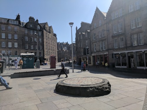
At the foot of Victoria Street was the Grassmarket, the historical market place that served Old Town Edinburgh. Perched on the outcropping known as Castle Rock, Edinburgh Castle loomed over us. As I waited for others in the group to get ice cream, I noted I was sitting practically on top of the Covenanters Memorial, which marks the site of hundreds of public executions. (The Covenanters were a group of hardcore Presbyterians who tried to keep other faiths from encroaching into Scotland. The fact that a bunch of them were executed on this very spot in the late 1680s indicates they kind of blew it.) The last public hanging in the Grassmarket was in 1784.

Pubs in the Grassmarket
The Covenanters Memorial, located on the site of hundreds of hangings
After a quick sightseeing jaunt up the Royal Mile (connecting Edinburgh Castle with Holyrood Palace, the official residence of the British monarch when in Scotland), we met our cars and drivers and headed back to Fenton Tower.
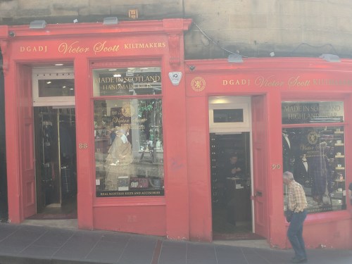
Custom kilts for sale, Victoria Street
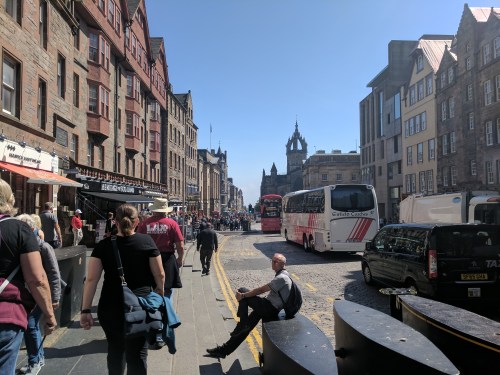
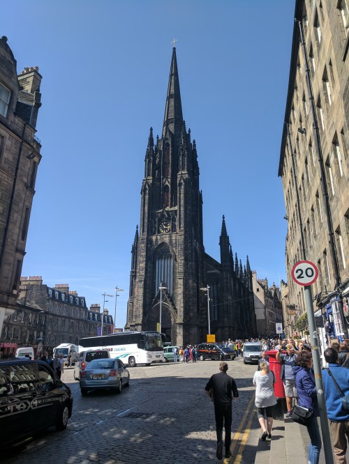
Heading up the Royal Mile
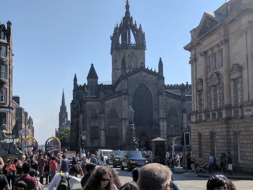
St. Giles’ Cathedral, late 1300s (extensively restored in the 1800s)
Originally home to the Church of Scotland, this Victorian-era building is now known as “The Hub,” a public arts and events building.
We were back by 3:00. Bret, Cam, and the kids played soccer on the Tower lawn, and I attempted to watch a cricket match on the TV. (Shannon remarked that Karen’s Indian father once tried to explain cricket to her, and the explanation took up the entire drive from the Bay Area to Lake Tahoe, and she was still mystified by every aspect of the game.) I squinted at the screen as I tried to make sense of the action unfolding. It was Ireland v. India. The match was being played in India, so the Irish players were so slathered in sunblock that they looked like mimes. Every so often, graphics and stats would appear on the screen. This only added to the confusion. I could recognize what must be players’ names, but the rest looked like someone spilled alphabet soup onto a sudoku puzzle. After a full hour of giving the game my undivided attention, I may have understood less that when I started. Luckily, a much more user-friendly World Cup game was scheduled to begin at 4:30. The pizza arrived at 6:00. I had a single piece and headed up to my isolated tower to nurse my stomach and watch old Monty Python episodes streaming on my laptop while the rest of the gang watched Harry Potter and the Chamber of Secrets.
In the morning, I felt fine and even nibbled a bit of haggis at breakfast.
