The jet lag pendulum swung the other way my second night in England — I spent a sleepless night tossing and turning on my super comfortable mattress, and finally slipped out of bed at 6:15. Denied my chance to take a long walk the previous morning, I knew I wasn’t going to miss this opportunity as watery daylight peeked through the curtains I deliberately left part open. I was walking the streets ten minutes later, watching London wake up on a bleary Saturday morning. “The English don’t do mornings,” one of our later drivers cheerily remarked.
I decided to make my two destinations the (fictional) address of Sherlock Holmes, 221B Baker Street, followed by Trafalgar Square, and check out some more locations associated with the Beatles along the way. A round trip of about five miles. I strolled up Tottenham Court Road, evidently the site of some revelry last night as I stepped over many broken bottles and slicks of what was most likely urine decorating the building corners. Chain stores that are part of the fabric of the lives of every Briton seemed exotic to me — a Boots pharmacy, a Barclays bank, a Mr. Toppers haircuts, a Sainsbury’s supermarket, an Odeon cinema — and were interspersed with shuttered nightclubs and dormant pubs as I headed north to Euston Road. After not seeing a soul on Tottenham Court Road, traffic rumbled along the very busy Euston Road, proving that some people in London were indeed awake. Turning west on Euston, and passing the gaudy tourist trap known as Madame Tussaud’s (the original “wax museum”), it wasn’t long before I arrived at Baker Street.
The legendary address of 221B Baker Street was entirely a figment of Sir Arthur Conan Doyle’s imagination. The actual Baker Street of the late 1800s ran only from Portman Square to Dorset Street, a distance of just over 500 yards, and the addresses on its high-end residential terrace houses ran from #1 to #85. A very short “Upper Baker Street,” with a separate set of addresses existed a little ways to the north. When the two streets were merged into one in the early 20th century, the 200s came into existence. The spot where 221 would be is occupied by a multi-story office block, Abbey House. Originally home to the Abbey National Building Society (who once employed someone full-time just to answer Holmes-related mail), it has been recently redeveloped into luxury flats.
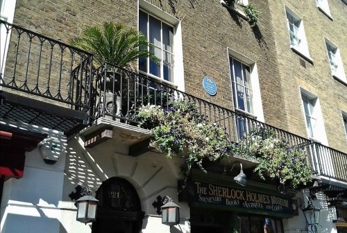
 The building that now has official claim to the “221B” address according to the London Post Office is a little further up the block, at what would ordinarily be about 239 Baker Street. It is the Sherlock Holmes Museum, and is housed in an 1815 townhouse whose exterior had the good fortune to actually look quite a bit like the residence described in the Holmes stories. The Sherlock Holmes Society of England got hold of it, meticulously recreated the interior as Doyle imagined it, stuffed it full of artifacts and memorabilia, and opened it to the public in 1990. It was still closed at seven on a Saturday morning, of course, so I walked on.
I doubled back south down Baker Street. I walked by what used to be, from late 1967 to summer 1968, the Beatles’ Apple Boutique retail store (i.e., tax shelter). Noted for its massive psychedelic mural that outraged their more conservative neighbors, the Boutique hemorrhaged money and was one the Fab Four’s few major missteps. The original building was torn down in 1974, and replaced with one that was quite similar (with the addition of a few windows.)


A block or so to the east was 20 Manchester Square, site of EMI House, business headquarters for the Beatles’ record label, and the building where the group peered over the edge of the interior balcony and down the stairwell for the cover of their first album in 1963. Theatrical photographer Angus McBean shot the picture, laying on his back on the lobby floor, sometime in February of ‘63.


Sadly, it was not worth even a short detour on my walk, because EMI House was torn down in 1999. Before its destruction, the balcony was reverently removed and installed in a place of honor at EMI’s sleek new headquarters several miles away in Hammersmith.
I turned east on London’s big shopping thoroughfare, Oxford Street. The city was finally coming to life as 7:30 approached. Construction crews got to work, and delivery trucks started unloading. Joggers, weekend workers, and early shoppers began moving up the streets and clustering around the bus stops. I noticed it was all young people. As they bustled to and fro, they vaped and chatted into cell phones (“mobiles,” as they call them over here, and every other word out of their mouths was “brilliant,” the most overused adjective among young Londoners, said reflexively, like a Californian uses “cool.”) Some of the more colorful denizens of London’s streets were having loud, animated conversations with no one. The sun peeked occasinally through the overcast, and the heat wave would continue.
I next headed south along Regent Street. Unlike the mainstream chain-store shopping along Oxford Street, the shops of Regent Street offered more upscale fare. The elegant buildings date from the 1890s to the 1920s. The street was originally completed in 1825, but none of the original structures remain.
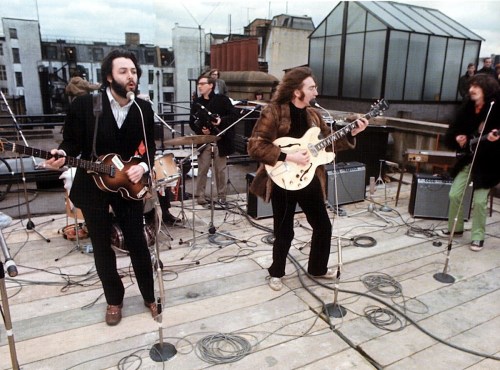
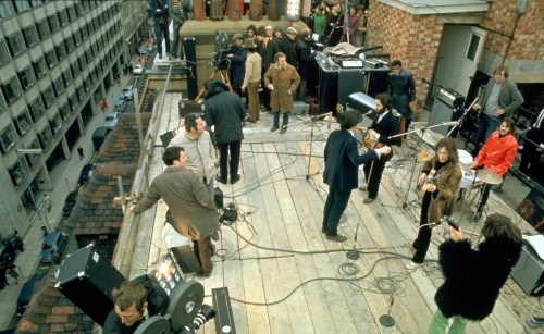
Just off Regent Street is Savile Row, the London garment district, home to some of the world’s best tailors, and former home of the Beatles self-owned management/production company, Apple Corps. 3 Savile Row is mostly known for its rooftop, which was the site of the final Beatles live performance on January 30, 1969, staged for cameras shooting what would eventually become the Let It Be documentary released in mid-1970.

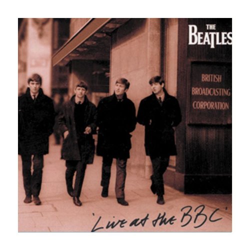
Following Regent Street around its gentle eastward curve into Piccadilly Circus, a massive traffic roundabout in the heart of London’s West End, I continued south. At 12 Regent Street there is a big office block known as Rex House. In the basement of Rex House, there was once a 400-seat movie theater called Paris Cinema, which opened in 1939. After WWII, it was bought by the British Broadcasting Corporation, who renamed it the BBC Paris Studios and converted it into a venue for recording radio broadcasts, mostly comedy shows in front of a live audience. In the 1960s, the space was also used to record special sessions by various pop groups exclusively for the BBC, including several recordings by the Beatles between November 1962 and July 1964.
A Dezo Hoffman photo of the Beatles entering the BBC Paris Studios on April 4, 1963 was used for the cover of the double-compilation album The Beatles Live at the BBC, which came out in 1995, the same year the BBC shut down the Paris Studio location in favor of more technically-advanced facilities elsewhere.


The old BBC Paris Studio is now an L.A. Fitness
 I was almost to Trafalgar Square, and my heart sank a little as I approached it from Pall Mall. There were two giant stages erected at either end of the square. Along the sides ran tall bleachers. A large line of mostly teenage girls and their mothers were already queuing for what the banners announced breathlessly as West End Live!, an open air revue featuring popular selections from recent stage musicals. “One weekend only!”
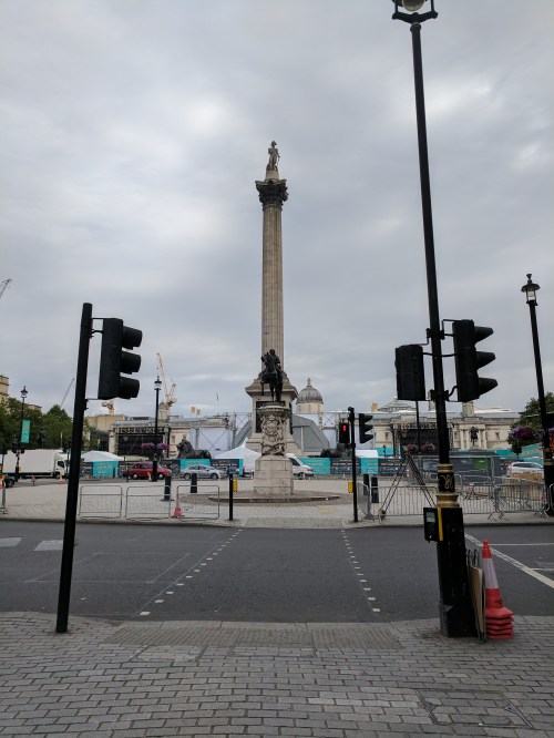
Trafalgar Square under seige by musical theater fans. Location of the original Charing Cross in the foreground.
To my horror, the giant lions guarding Nelson’s Column were totally hemmed in by tents and porta-potties. As I lined up to snap my somewhat deflating pic, I realized I was also right in front of the equestrian statue of the ill-fated Charles I. On the spot where the statue now stands was once an “Eleanor cross,” one of a group of twelve memorial crosses erected at intervals from London to Lincoln (in the far north of England) by Edward I in tribute to his late wife, Eleanor of Castile. One of these elaborate marble crosses would have been right in front of me had I stood there any time between 1294 and 1647, when the Puritan-controlled Parliament pulled it down during the English Civil War — the conflict that cost Charles I his head. A few years after the dust had settled and Charles II was firmly on the throne, he stuck a statue of his dad there as a well-deserved “fuck you” to the grim Puritans who had clamped down on everyone’s good time during their brief grip on London’s political reins.
The little area of London I was standing in was named for the Anglo-Saxon word for a  bend in the river — cierring — and the cross that once stood here: Charing Cross. It was once the junction of six major roads in and out of London, and is still considered the geographical center of city. All distances measured from London start at the location of the old Charing Cross. A Victorian-era recreation of the Eleanor cross now stands in front of the nearby Charing Cross train station (at right).
The hotel was not far from where I was. I went past St. Martin-in-the-Fields church, which has looked out over the area since 1726 (and built on a spot occupied by various churches since the Middle Ages), and past the National Gallery, still closed at this hour, its front lawn dotted with sleeping homeless, but on the short list for places to visit if we had time. (We ended up missing it.) A quick walk up Charing Cross Road and I was back the Radisson.
Not long after, we acquired our incredibly handy Oyster public transport cards, put about ten pounds on them, and hopped onto the London Underground heading for the northern suburbs. A sign on the platform warned me to “mind the gap” between the train car and platform when entering and exiting, and is a an example of the refined politeness of British signage. There are no orders to “Yield” on British roads, merely a reminder to “Give Way.” You don’t follow an “Exit” sign, you look for a “Way Out.” And my favorite, spotted later in Battersea — “No Suitable Turning Space In The Area Ahead.” Not just “no turning space,” but no “suitable” turning space. You probably could turn, technically, but it would be viewed as appalingly inappropriate behavior.
We arrived at Archway station, and trudged up Highgate Hill, which was a brutal reminder that despite my stick-like limbs, my center mass is quite tubby. I don’t know why they got rid of the cable car that once ran up the hill in 1909. Finally, huffing and puffing (except for Cam, who strolled up the hill like it was a carpeted hallway), we arrived in Highgate proper. The area was once the private hunting grounds of the Bishop of London in the Tudor era. It got its name from the gate built into the tall, deer-proof hedge surrounding the property.
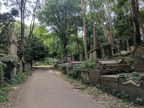
Highgate, until the end of the 1800s, was a separate hilltop village outside of the city of London, and it still retains a distinctive identity. It is the greenest place I’ve yet seen in a city that has a lot of greenery. Within the district of Highgate are the eastern edge of Hampstead Heath, Highgate Wood, Queen’s Wood, and Waterlow Park, which we crossed through to get to another large patch of greenery — Highgate Cemetery.
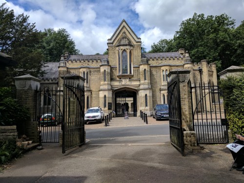
The gates of Highgate West, as seen from Highgate East
Back in the day, families buried their deceased loved ones in their local parish churchyard. Have you ever seen a churchyard? Not that big. Yes, London had a lot of churchyards (it seems like every corner in the city is occupied by an historic church), but it also had a lot of people. Eventually, more people than those little churchyards could handle. By the early 1800s, it appeared that all the churches in London were sinking into the ground. In reality, the ground around them was rising, as body after body after body were interred in these tiny areas, sometimes three or four deep and only a couple of feet below the surface. After a period of hard rain, human remains were often exposed.
Churchyards were also the only area where the working class of the inner city could enjoy a bit of nearby open space. (Most city “parks” were privately owned and behind locked gates.) Many an idyllic picnic was interrupted by tripping over a skull, or Fido retrieving a femur. These burial grounds were also breeding places for cholera and typhoid. Then there was the smell of decaying flesh, which hung thick in the air on windless summer days.
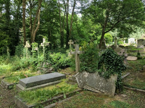
A few private companies stepped in to solve the “burial crisis” and make a little profit as well. They established spacious, well-landscaped “garden cemeteries” outside city limits. The 17-acre Highgate Cemetery was opened in 1839. This portion is now known as Highgate West. Another 19 acres was added in 1860, becoming Highgate East. The two sections are separated by the winding Swain’s Lane.
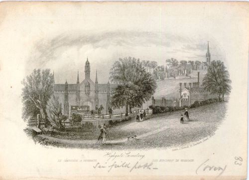
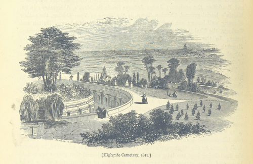
Highgate as it originally appeared. Note the now non-existent lawns and open spaces.
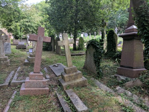
As space ran out in the mid-1900s, the company that managed the cemetery found it increasingly unprofitable. By 1969, they had given up on it, and nature took over. The elegant lawns, trimmed shrubs, and flower beds became overrun with gorse, hawthorn, foxwood, and countless other types of bramble. The once-stunning views of London down the hill became obscured by a thick canopy of oak, birch, and ash trees. The Victorian Gothic gravestones, Celtic crosses, obelisks, and angelic statuary began wearing away, sinking, listing, or falling over completely, creating a cock-eyed jumble. Often described as the “creepiest cemetery in London,” it is rumored to be the site of several hauntings, and even to to have a resident vampire. But on a sunny June day I didn’t get that vibe at all. It looks absolutely beautiful, actually, but it wasn’t the type of beauty the original planners had intended.
A charity called Friends of the Highgate Cemetery Trust eventually stepped in and took over management of the site. A nominal fee is charged to enter the cemetery.
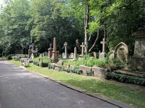
Highgate West is accessible only by guided tour. We duly bought our ticket for the 11:00 tour, and since our tour ticket included free access to wander Highgate East, we killed the intervening 45 minutes of so in the “newer” section. New burials are still allowed in both West and East to a limited extent, but there’s no guarantee you won’t be stuck under a footpath.
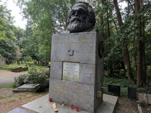
We visited the graves of Karl Marx (or maybe Santa Claus, hard to tell), and Douglas Adams. The Marx memorial has been the subject of controversy, and an attempt by some anti-Communist vandals to blow it up merely caused it to lean to the left in a great cosmic joke.
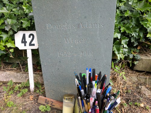
Adams, the creator of The Hitchhiker’s Guide to the Galaxy franchise and one of my favorite writers, was buried just off the path with a simple headstone and a bucket full of pens people had left in offering. I was disappointed that for once I was without one of my trusty Uni-Ball Vision Elite pens somewhere on my person, so I couldn’t pay my respects properly.
 An incredibly mangy fox trotted down the shady path for a while, several paces ahead of us. Weirdly, we passed two graves on different sides of the cemetery that both had a black-and-white cat sitting on them, staring intently at the headstone.
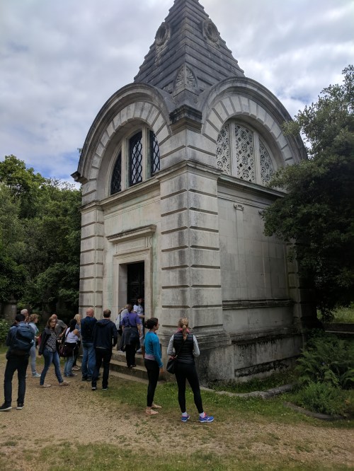
We headed to the West portion to begin our guided tour. (Both the Highgate Cemetery website and a large sign outside the gate warned us in bold letters that the grave of George Michael was strictly off-limits.) Our tour guide, Terry, was a cheerful Friends volunteer who was so Cockney, had Michael Caine overheard him, he would have thought, “Blimey, that bloke’s overdoin’ it a bit.”
Highgate West is a little more hilly and a little more overgrown than East, hence its limited public access. It was odd to think that most of the towering trees around us were less than 50 years old. As we passed by or through them, Terry regaled us with details about the Egyptian Gate, the Circle of Lebanon, and the catacombs.
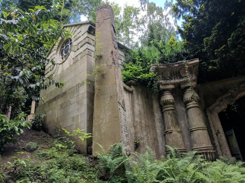
The entrance to the masoleum/crypt area of Highgate West is marked by the Egyptian Gate, reflective of the Victorian obsession with Ancient Egypt.
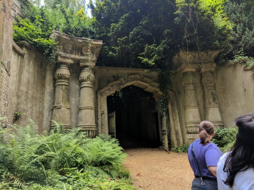
Passing through the Egyptian Gate, you go down the dark, dank Egyptian Avenue. The tombs inside this tunnel are home to the exremely rare orb weaver spider, so sensitive to light that even moonlight is too bright for them.
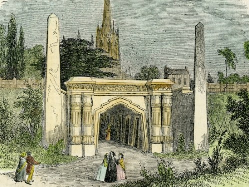
The Egyptian Gate as it originally appeared.
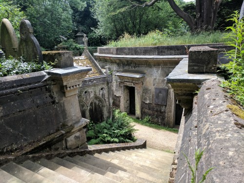
After emerging from the Egyptian Avenue, you step down into the ring of tombs known as the Circle of Lebanon.

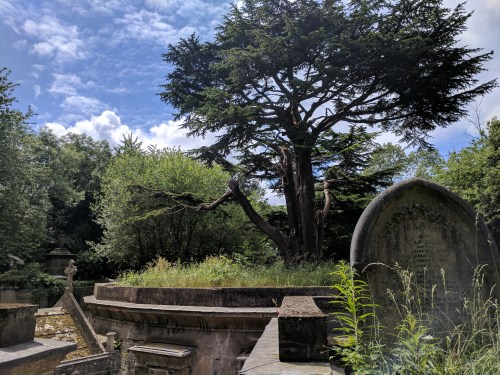
The weatherbeaten cedar tree that tops the Circle of Lebanon.
The Circle of Lebanon as it originally appeared.
The only other people our little tour group passed were other Friends volunteers, slowly but surely clearing the worst of the undergrowth. Terry pointed to some random, completely inaccessible spot and said that’s where the parents of Charles Dickens were buried, now totally covered by enough moss and bracken as to be invisible.

The understaffed brush-clearing volunteers might make it as far as Mr. and Mrs. Dickens’ graves by 2022 or ‘23.
Terry repeatedly assured us as he spun his stories that he wasn’t telling us “porkies,” which is old Cockney rhyming slang for mistruths. Rhyming slang originated as a kind of code among the street urchins of the East End. You take a word, and rhyme it with the final word of a separate two-word set that pair by association. Then you drop the second word you’ve rhymed with, and substitute the first for the original word. Follow? (“Porky pies” = “lies.” “Apples and pears” = “stairs.” So stairs would be called “apples.” “Wife” is “trouble,” after “trouble and strife.” The phone is the “dog.” I’ll leave you to figure that one out.) He also used one of my favorite old English expressions when he remarked that the cedar tree at the top of the Circle of Lebanon had taken some punishment from snow and wind. “Been in the wars,” is how he put it.
The grandest occupied masoleum in Highgate was built in 1878 by newspaper tycoon Julius Beer for his daughter Ada, who died at age 8.
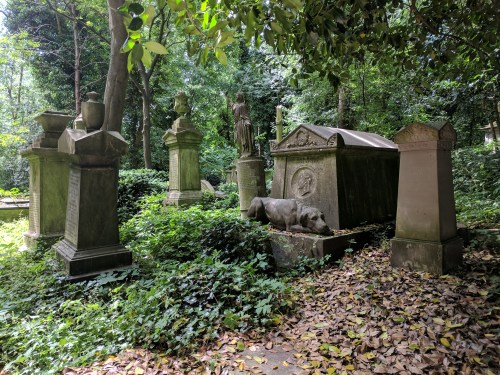
The tomb of Tom Sayers, guarded by an image of his mastiff dog, Lion. Sayers was a famous prize-figher, and his 1865 funeral was attended by 100,000 moruners, the largest crowd Highgate has ever seen.
After a fascinating hour or so, we bid farewell to Terry and headed up Swain’s Lane into Highgate for lunch. We settled into the outdoor patio area of a pub called The Flask. The Flask had occupied this spot since 1663 (the current building dates from 1767). Famous British highway robber Dick Turpin (1705-39) is said to have hidden from pursuers in The Flask’s stables. Like The Museum Tavern, The Flask has been taken over by a chain, in this case, Fuller’s Brewery. The menu was a little on the high-end side, making it more of a “gastropub.” For example, their Scotch egg (the greatest British invention, maybe second only to the Turing machine) was not content with using regular old sausage for its casing — it used Mexican chorizo, and came with a dill/cilantro dipping sauce. It was sublime.

There was another surprise on the menu. When I asked what type of pale ale they had on draft, the waitress proudly said they had Sierra Nevada, imported all the way from northern California, as if it were some kind of exotic treat, and not the brand I currently had twenty or so of sitting in the mini-fridge in my garage. I ordered one up, and had a little taste of home. (Much to the embarrassment of Shannon, who was a veteran traveler and big believer in the “when in Rome…” philosophy.)

Back on the tube and south across the river to Southwark to conclude our day at the Imperial War Museum.

The Imperial War Museum — which examines the British Empire’s role in various 20th century military conflicts — is housed in the building that used to be the Bethlem Royal Hospital. Founded over seven centuries ago and once located in a crumbling building in the north of London, Bethlem was an example of all the horrors associated with housing (not necessarily “caring for”) the mentally ill in centuries past. It’s where we get the term “bedlam.” A trip to Bethlem was not intended to be permanent. Most residents were turned loose after twelve months and given a special “bedlamite” license, allowing them to beg on the highways between towns. The hospital was also open to the public, so people could come gawk at the inmates as if it were a human zoo.
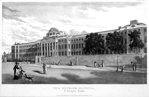
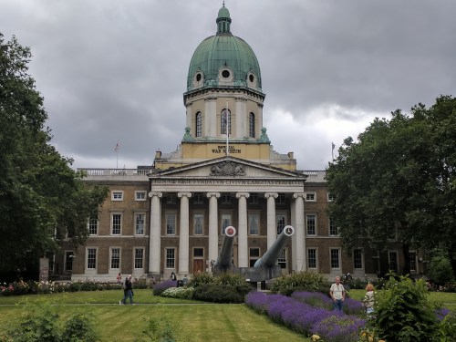
A new building was built for the hospital in 1815 (which had finally stopped selling admission tickets) in St. George’s Fields, Southwark, and the facility operated there until 1930. The massive wings were pulled down, leaving only the domed central portion, and making the dome itself a little out of proportion, like a ten-gallon hat perched on the roof. The Imperial War Museum moved in six years later. Nowadays, the old hospital section is only used for the museum’s administrative offices, and the exhibits are housed over five floors surrounding an airy atrium, which was added during a major expansion in 1986-89.
The front of the building is dominated by two WWII-era 15-inch naval guns, one from the HMS Ramillies and one from the HMS Resolution. When taking care of business, each of them could fire a one-ton shell twenty miles at a muzzle velocity of 2500 feet per second. They could do this every thirty seconds, until they ran out of one-ton shells.
As promised, every military action taken by the British Commonwealth is represented somewhere. The Suez Canal crisis, the Falklands War, and the fight against IRA terrorists all get their due attention. The museum focuses almost as much on how these conflicts affected civilians at home as it does on the combat itself. For such a major action of the 20th century, World War II seems to get short shrift. The Imperial War Museum’s most impressive areas are the World War I exhibit, which rambles around, trench-like, through the entire ground floor, and the section on the Holocaust, which covers the fourth floor and part of the third. Clearly inspired by the Holocaust Museum in Washington, D.C., this section is laid out like a scaled-down version of that institution, and has a similar emotional impact.
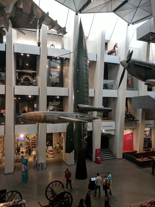
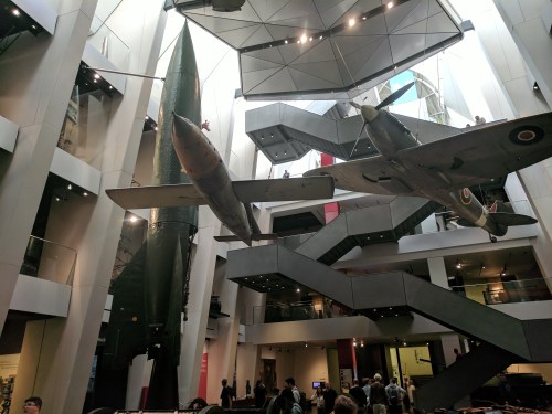
Vertical space dominated by the dreaded German V-2 rocket
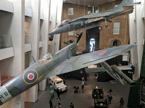

One of five casings made for the “Little Boy” atomic bomb dropped on Hiroshima.

A Japaense Zero fighter found rotting in the South Pacific jungle.


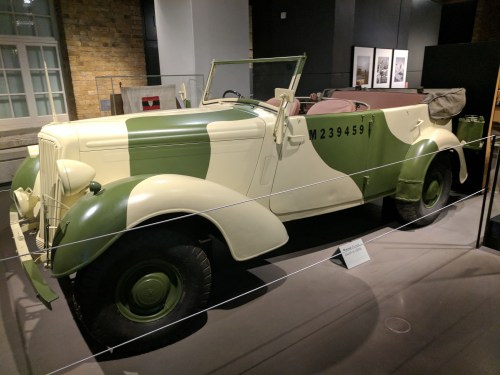
British general Bernard “Monty” Montgomery’s car

General Erwin “Desert Fox” Rommel’s map of North Africa, with his handwritten notations.
After picking up our luggage, we finally got to ride in one of the classic London black cabs as we headed toward our next temporary residence: an Airbnb in the residential district of Battersea. When we arrived, Shannon’s brother, Bret, and sister-in-law, Karen, had already arrived with their three kids, Jasmine, 8, Sammy, 6, and Maya, 3, and their nanny, Gema.
The original village of Battersea, on the south side of the Thames, was once centered around a riverside church called St. Mary’s, which was where poet William Blake got married, and where American Revolutionary War traitor Benedict Arnold is buried as a British hero. Battersea as we see it today is really the creation of the railroad age — no fewer than five lines rattled through the area by the end of the 1800s. It is one of the first examples of “urban sprawl.” Factories and warehouses began to line the Thames bank on the district’s north end, and block after block of terraced row houses sprung up in its southern portion, providing housing for local workers and — more and more — commuters to London.
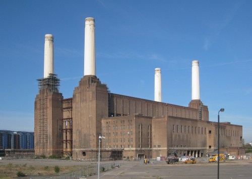
Battersea’s most visually-striking building, the Battersea Power Station, is more famous for a Pink Floyd album cover than the power generating it did from 1933 to 1983.
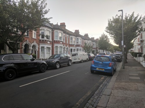
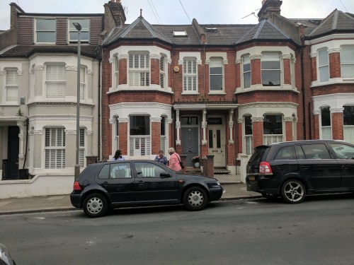
It was in one of these late-Victorian row houses (c.1890) just off one of the main Battersea thoroughfares, Northcote Road, that we found ourselves. Looking tiny and narrow from the outside, inside it stretched quite a ways back, and was stacked three-and-a-half floors high, including its basement rooms. Given a thorough modern interior makeover, it would prove a comfortable space over the next few days.
By the time we unpacked, we were ready for dinner, so we headed to a pizza place on the corner, Franco Manca.
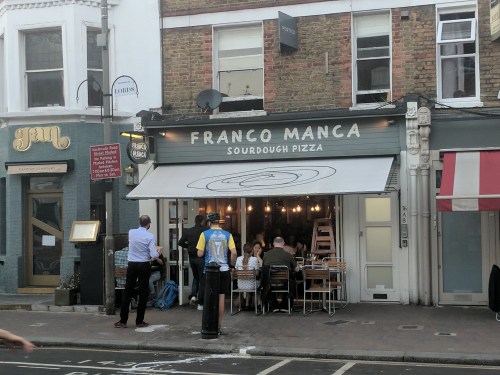
The sourdough Neapolitan pizza was excellent, the service was slow to the point of feeling totally ignored, and I noticed something that I noticed in the British Museum’s pizzeria that day before.
A Note to Our British Friends About Pizza Slicers:
They exist. They look like this:

Rather than slicing the pizza into easy-to-manage triangular wedges, in a lot of places in the British Isles, the 10-inch pies are served whole, and then hacked at and totally mangled with knives and forks as if it were the most natural thing in the world.
We have lots of pizza slicers over here. We can send you some.

Pingback: Mind the Gap: The Holy Bee’s Adventures in the U.K. (Part 2) | Holy Bee of Ephesus