It’s time to introduce our Fifth and Final Marx Brother, Zeppo.
Herbert Marx always felt like an afterthought. Born several years after his other siblings, he stayed home while they (and his mother) endlessly toured the country. Frenchie was also not the most hands-on parent, and too soft-hearted to be much of a disciplinarian. So it shouldn’t be surprising that Herbert became something of a juvenile delinquent, skipping school and roaming the streets of Chicago unsupervised, the way his brothers did in New York back at the turn of the century. Only instead of sneaking rides on streetcars and playing dice, Herbert was running with a genuine street gang, stealing cars and carrying a pistol.
When Minnie could spare him a thought, she despaired of his future. She felt the best way of saving him was to ease him into the family business as soon as possible. When they played Joliet in May of 1914, they were joined for a couple of performances by the adolescent Fifth Marx Brother, who in addition to being a heat-packing car thief, also had a passable “boy tenor” voice, and was quite happy to warble a few songs onstage when his mother asked. He also did a short tour of Michigan with the act in the summer of 1915. The chicken farm Minnie bought in 1917 to keep the older Brothers out of the draft had the added benefit of keeping her youngest off the mean streets…briefly.
It was during his sojourn on the farm that he finally earned his “o” nickname. Every Brother has his own story of where the name “Zeppo” came from, and none of them hold much water. The truth is, the older boys had been calling Herbert “Zip” for some time. Here’s why:
According to a story revealed many years later by Harpo’s son Bill, the label “Zip” came from a man suffering from microcephaly, and displayed at sideshows as a “freak” called Zip the Pinhead. His deformity included a deeply-receded forehead and a large, wedge-shaped nose that sloped straight into it, without the usual indentation between the eyes. Herbert also had a very distinctive nose bridge and slightly receding forehead. Nowhere near the point of deformity, but just different enough to be sensitive about as a young teen with self-esteem issues. And just the sort of thing that four much-older comedian siblings would delight in mercilessly teasing a little brother about. The taunting nickname “Zip” became “Zippo” to match his brothers’ names, and eventually evolved into “Zeppo.”
By the time he was seventeen, he had dropped out of school and was working as a mechanic for the Ford Motor Company (he demonstrated a remarkable aptitude for engineering and working with machinery from an early age). A steady job did not keep him out of Chicago pool halls and gambling dens. Like eldest brother Chico, Zeppo loved “action.” He had a head for numbers and a passionate love for playing cards and pursuing girls. “I’d have ended up in jail,” he confidently predicted. Minnie intervened to prevent that fate.
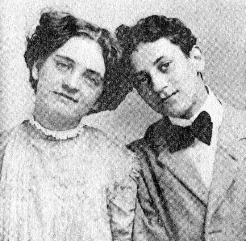
June 5, 1918…the phone rings in the Ford mechanic shop somewhere in Chicago. An insistent voice demands to speak to Zeppo. Zeppo is summoned, and wipes the grease off his hands, perhaps anticipating what is coming. “My mother called me…[and] said come home immediately,” remembered Zeppo. “I said, well I’m working. She says, well quit your job and come home immediately…And I said okay, so I came home…She says, your brother Gummo just joined the Army…you go and get packed and get on the train. Here’s the fare and go to Rockford, Illinois and join your brothers. You have to take Gummo’s place because I want the name of the Four Marx Brothers intact…So I acquiesced and joined the boys in Rockford, Illinois. I got right on, right on the stage. Didn’t know what the hell to do.”
Zeppo Marx, former auto mechanic and small-time Chicago hood, bravely faked his way through the last performances of Home Again ever staged (well, not quite — read on). “When I stepped out, Zeppo stepped in,” said Gummo. “I must say, though, that he was the only actor who ever had less talent than me.” The big question was what to do next.
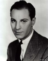
Zeppo on board, 1918
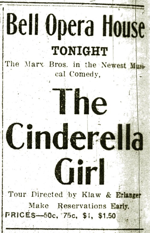
From the Chicago Daily Tribune, Sept. 22, 1918: “The Four Marx Brothers, residents of this city, propose to eschew vaudeville, in which they are eminent, and take up musical comedy. At Grand Rapids September 28 [the show actually opened in Benton Harbor on the 26th] they will begin a career in The Street Cinderella, whose words are by Jo Swerling, once a good reporter for The Tribune…”
They decided to make an attempt at a “real” musical comedy. They commissioned an eager young scribe named Jo Swerling to write them an original self-contained show with a genuine plot and real characters. Gus Kahn and Egbert van Alstyne would provide the songs. Uncle Al would direct. Ads began to appear in Michigan newspapers for The Street Cinderella — “Minnie Palmer presents…a new farce comedy in three acts…beautiful girls, beautiful music, beautiful love story…”
The title went back and forth between The Street Cinderella and The Cinderella Girl, and it seems they settled on the latter at the last minute.No one remembers the plot, something about a romance between two “street singers.” No one remembers the characters the Brothers were supposed to play (presumably variations on their already established personas). When the curtain rose and the overture began playing at the Bell Opera House in Benton Creek, Michigan on September 26, 1918, the Four Marx Brothers stared out at a half-filled house. Deliberately half-filled. In a sight that would become depressingly familiar just over a hundred years later, every other seat was empty. Every other row was empty. The audience all wore masks over their noses and mouths.
The Marx Brothers’ newest show — meant to lift them out of the vaudeville ghetto and into legitimate theater — opened the same week as the deadly Spanish influenza epidemic hit the Midwest.
There was another problem: “It was a terrible act and we realized we couldn’t play it successfully,” said Groucho. It limped through two performances. Both times, according to Marx biographer Kyle Crichton, the Brothers did not bother to finish the storyline, going into their familiar Home Again material instead. All future bookings of The Cinderella Girl were cancelled, and it was written off as an expensive mistake. By mid-October, the flu epidemic had closed most of the country’s theaters anyway. The only thing that was salvageable from the experience, according to Groucho, was that actor Ed Metcalfe (who had the thankless role of “the policeman” in Home Again and also appeared in Cinderella Girl) introduced him to the works of Gilbert and Sullivan around this time. Groucho became possibly the world’s biggest G&S fan, obsessively listening to their comic operas, and collecting their material and memorabilia for the rest of his life.
Chagrined, the Brothers trudged back into vaudeville, and got themselves booked for the truncated 1918-19 season on the Keith-Albee Circuit. They sat down with Uncle Al, made a few updates to the old Home Again material, threw in some of the better Cinderella songs (not wanting to waste what they had spent good money on), and called the “new” show ‘N’ Everything.
Betty Marx had joined the act’s chorus, probably to keep an eye on Chico. One night as she was exiting the stage after a big musical number, Harpo spontaneously stretched out a foot and tripped her. She was sent scooting across the stage on her stomach as the audience roared. After the curtain, she took her hurt feelings to her brother-in-law, who did not exude sympathy. “What the hell are you complaining about?” said Harpo, scrubbing off his make-up. “You got a laugh, didn’t you?” You had to be tough to be a Marx.
Zeppo practiced diligently to replicate Gummo’s old “whirlwind dance.” His partner was initially Gene Maddox. When she left the act, one of the chorus girls, Ruth Johnson (sometimes rendered as “Johnstone,” and billed as “Ruth Tyrell”) was randomly promoted to take her place. She and Zeppo began casually dating…but Groucho had his eye on her. He bided his time, then pounced, stealing the shapely, strawberry blonde, snub-nosed chorus girl away from his little brother. You had to be tough to be a Marx.
As Minnie “Palmer” Marx began expanding her vaudeville production empire, Leo took more direct control of the Brothers’ act.
In 1911, a new fad was reinventing the face of vaudeville — the tabloid musical, or “tab” as they were quickly dubbed by the trade papers. In the words of Robert S. Bader, tabs were “truncated versions of popular Broadway and touring shows, reduced by cutting much of the dialogue, removing non essential characters, and leaving the musical numbers and just enough of the plot to maintain some semblance of the original idea of the show.” The more respectable vaudeville houses began clamoring for shows consisting of a couple of classy tabs, rather than a low-rent, crazy-quilt collection of short, unrelated acts. And fewer acts on a bill meant fewer salaries had to be paid and more profit for the theaters. When the craze got too popular, Broadway producers began cracking down on copyright violations. Even with vaudeville companies legitimately paying for the material, demand outweighed supply. This led to the creation of more tabs featuring original material.
And that’s what put the light bulb on in Leo’s head when he and his erstwhile performing partner George Lee joined forces with the Three Marx Brothers in the late summer of 1912. Leo decided that the school act could be polished, tweaked, and refined into a tabloid musical. They could then hire a few supporting acts, and sell the whole thing as a self-owned, self-contained package.
In its new form, the two parts of Fun in Hi Skule (the classroom and the recital) would be condensed into the first act. A newly-minted second act (created with a little help from Uncle Al) would be more comedy and music in the form of a ten-year-class reunion in honor of the retirement of Julius’ teacher character, now named Mr. Herman Green. Arthur kept his Patsy Brannigan character. The dim-witted class disrupter of the first act had grown into the local garbage man by the second. (“Patsy Brannigan the garbage man is here.” “Tell him we don’t want any.” When and where this big laugh-getting line was first used is yet another element of the early days that is awash in contradictory stories.) He also continued to refine his costume, which was growing less Irish stooge and more tramp-like clown. But despite “Patsy” no longer being explicitly Irish, ethnic stereotypes were still firmly entrenched in the world of vaudeville. Leo became the Italian student, Tony Saroni. George Lee, with his bigger performance style and firmer command of Yiddishisms, took over the role of the Jewish student, now named Ignatz Levy. Milton dug the name “Hans Pumpernickel” out of retirement, and became the German student in a pageboy/”Hansel”-style wig. Paul Yale remained as his “nance” character, but toned down the more overt homosexual mannerisms and became more of a prissy “mama’s boy” (the audience would gasp, then crack up when Yale, in his knee pants and heavily-rouged cheeks, opened his mouth and sang in a deep, manly baritone.) The main support act was the dancing Harris Brothers. And the “schoolgirl” chorus had expanded to fifteen young women, still including the trouper Dot Davidson, who had been with them since the end of 1910, possibly due to her passionate attachment to Yale.
The schoolroom act still comprised the first half of the revised show. Julius is at the center, apparently delivering a harsh lecture to Dot Davidson, while the schoolgirl chorus on the left points and laughs. Arthur, on the right, is also getting in on shaming Davidson. New cast member Leo is in the background, bullying the Harris Brothers. In front of them is “sissy” Paul Yale and Milton as the updated version of “Hans Pumpernickel”
The whole shebang was titled Mr. Green’s Reception, and it was the first time the Four Marx Brothers shared a stage. It ran a full forty minutes, and the Marx Brothers touring company now included a stage carpenter and property manager in addition to its cast, supporting acts, and chorus line. The cast appeared in white-tie evening dress for the second act. As was the case with most mid-level vaudeville acts, they did not tour with musicians (apart from those in already in the cast), but carried sheet music for all of their numbers, arranged for anything from a four-piece to a full dance orchestra, depending on the size of the theater and its resident house band.
Mr. Green’s Reception started its run in Chicago on September 5, 1912, and was eagerly booked by the WVMA circuit for the entire 1912-1913 vaudeville season. The big-time beckoned, tantalizingly near. But they had yet to attain name recognition. They weren’t stars quite yet. They would come to town, get the audiences roaring (Leo’s piano-playing, Arthur’s ever-improving harp solos…and the Harris Brothers’ clogging…were all considered highlights), earn decent reviews in the local paper, and then were forgotten about as soon as the act left town. Not for much longer.
From the Burlington, Iowa Hawkeye, Dec. 20, 1912: “Judge W.S. Winthrow cut short his luncheon period yesterday to unite in marriage Mr. S. Paul [Yale] and Miss Margaret [Dot] Davidson, two young people who are playing at the Garrick Theatre this week. The thespians secured a marriage license at 11 o’clock and asked if they might see the judge…”
Time was of the essence, as Dot was six weeks pregnant. It was at that same Garrick Theater where the Brothers had several run-ins with a particularly nasty theater manager. (The story goes he paid the company’s salary in pennies. Hate to burst the anecdote bubble yet again, but this would have been pretty much impossible. Remember the size of the Marx Brothers’ company? And have you seen a few thousand dollars in pennies?) As their train pulled out of town, according to Marxian legend, Arthur stood on the back platform of the last car, shook his fist at the receding town, and yelled “You lousy sonofabitch, I hope your goddamn theater burns to the ground!” “The next day, it did,” Julius always loved to recall. “And that’s why we decided not to let Harpo talk.” (As with any legend, there’s a kernel of truth — Arthur may very well have cursed the theater as he left town, and the Garrick Theatre really did burn down, but not until two months later. And Arthur continued speaking onstage for at least another year-and-a-half.)
By the time the Garrick had been reduced to ashes in February of 1913, Mr. Green’s Reception was playing in South Bend, Indiana. South Bend was experiencing record low temperatures, and the St. Joseph River was choked with ice.
The Mr. Green’s Reception company, in costume — Julius as Mr. Green is in the back row with the girls. Milton, Leo, and Arthur are front and center. Paul Yale is on the far right, his arm around a Harris Brother, with George Lee on the far left. Looks like the other Harris Brother volunteered to take the picture
A scrapbook clipping from the local South Bend paper (name & date unknown): “Mr. [Arthur] Marx was on the bank of the stream in the rear of the Orpheum Theatre with others of the Orpheum troupe when one of the women…bet him 50 cents that he was afraid to take a swim. ‘I’ll bet you another 50 cents.’ ‘And I another,’ answered two others. Before taking the plunge, Mr. Marx said: ‘That’s a dollar and a half when I get out, ain’t it?’ He then dove from the ledge of ice, clothes, hat, and all. He came to the surface with chattering teeth, exclaiming, ‘It’s not so bad.’”
Jumping into icy rivers was only one way to pass the time. Stories of the Brothers’ affairs with the chorus girls that came and went from their show, and their necessarily brief dalliances with local women, fill their biographies and autobiographies and are at this point impossible to verify, but it seems sex on the road was very much part of their routine. Sometimes, when it came to the local whorehouses, it was almost too easy. “The girls used to come watch us at the theater,” said Julius. “And if they liked us, they’d send a note backstage inviting us over after the show.” Presumably, the services were discounted or maybe even gratis.
Raising a stein at the curtain call for Mr. Green’s Reception— l. to r. Paul Yale, Leo, Arthur, Julius, Milton, George Lee
The company also had the novel idea of forming a baseball team, and when not performing, rehearsing the house orchestra, or pursuing women, took on local college teams — and usually lost big. (For the curious: Catcher — Julius. First base — Paul Yale. Second base — George Harris. Shortstop — Arthur. Third base — Leo. Left field — Milton. Center field — stage carpenter Fred Browning. Right field — George Lee. Pitcher — Victor Harris.) The uniforms proudly had “MARX BROS.” printed across the chest.
Mr. Green’s Reception toured another full year, and exhaustion was beginning to set in by the spring of 1914. The grind of the road and the close quarters caused tempers to grow short. George Lee, whom many reviewers had indicated was the “principal comedian” of the act, and also their best singer, had already found another job as a solo act for the following season, and would be leaving the Marx Brothers company at the end of the tour. With only a couple of months left to go, Lee demanded a raise. Not seeing the sense of giving more money to someone who was just going to be taking off soon, the Brothers refused. “As the size of his head grew, he decided his salary should grow with it,” said Julius. Lee abruptly quit in early April of 1914. Paul Yale and Dot Davidson took the opportunity to leave the act at the same time. They formed their own song-and-dance duo, Yale & Davidson, and occasionally worked as a supporting act for the Brothers through 1916.
Mr. Green’s Reception company out of costume. Milton is top center, with Paul Yale to the right. Just below them is Julius. Arthur and George Lee kneel in the foreground. Leo is off to the left
The Brothers hired some replacements, and the company finished out the season, but the situation left Julius with a realization:
“For the first time in our career we realized we could succeed as an act without any outside help. We didn’t need any more extraneous singers, dancers, and feeble comedians. We were now a unit. We were the Marx Brothers…we had finally freed ourselves from always having some outsider along to put us over, and from then on we were able to steam on under our own power.”
And it was during those closing days of the final Mr. Green’s Reception tour that Something Momentous happened…
It was the very beginning of the Platinum Age of Comics. When the newspaper hit the front step, many adult readers would flip right to the “funny pages,” skipping the depressing headlines to enjoy the adventures of the Katzenjammer Kids, Maggie and Jiggs, Mutt and Jeff, and Krazy Kat. In 1904, artist Gus Mager created a series of comic strip characters called “monks,” after their vaguely monkey-like faces. All the monks had names ending in “o.” For a brief period, these characters featured in a strip called Sherlocko the Monk, in which the title character solved mysteries. Sherlock Holmes creator Sir Arthur Conan-Doyle threatened a lawsuit, and in 1913 the title of the strip was changed to Hawkshaw the Detective (and the characters redesigned to look a little more human). But the impact of “Sherlocko” and his fellow monks remained. Vaudeville and popular culture in general went through a fad of nicknames ending in “o.”
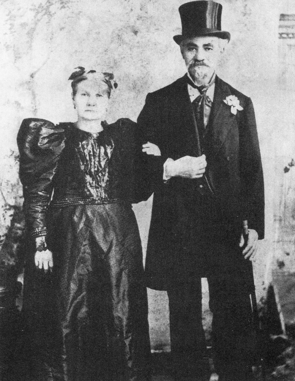
This is said to be the only picture in existence of all five brothers and their parents together. Outside the theater in Joilet, Illinois, April 30, 1914
The Brothers always agreed it happened in Galesburg, Illinois, which would make it mid-May of 1914. They were sharing a bill with a someone named Art Fisher. Over a round of backstage poker between shows, Fisher and the Brothers were idly discussing the “o” nickname phenomenon. As Fisher dealt the cards, he assigned each Brother an “o” name. “He named me Gummo,” said Milton, “because I had holes in my shoes and I’d wear rubbers, or gumshoes, over them even when it wasn’t raining.”
Arthur became “Harpo” for obvious reasons.
Leo became “Chicko,” because of his reputation for “chasing the chicks.” It was always intended to be pronounced as “Chick-o,” but at some point the “k” was dropped from the spelling, rendering it as “Chico” and resulting in many people pronouncing it “Cheek-o.” Although the Brothers used the original pronunciation, when people called him “Cheek-o,” the man himself never bothered to correct them. He happily answered to both.
There is some speculation that Julius’ new name — “Groucho” — may have come from the fact that he kept his cash in a “grouch bag,” which was a small drawstring pouch worn around the neck to prevent the petty theft that was a fact of life in a vaudeville touring company. But more likely, as even Julius admitted, it was because he was often in a surly mood and had a cynical overall attitude.
Art Fisher had made his impact on entertainment history, and promptly vanished. No researcher has ever been able to dig up exactly who he was or what became of him. (The blog From the Marxives has identified a vaudevillian named Art Fisher performing a “cowboy mimic” act, but he pretty much disappears from the record after 1912.)
Even though it was intended as a momentary card-game joke, the Brothers were delighted with their new names, and began using them among themselves immediately. It was pretty funny for an afternoon. Then the days stretched into weeks and months. They persisted in using the names. Friends and family shrugged and began calling them by those names as well (even Minnie, who did not seem too bitter that her sons enthusiastically ditched the names she gave them). It would be ten years before the Marx Brothers used their new names as their professional stage billing, but to themselves and everyone who knew them, they were now and forever Chico, Harpo, Groucho, and Gummo. And that’s who they’ll be in these essays from this point forward. (Family members tended to drop the “o”s — to relatives and spouses they were Grouch, Chick, Harp, and later, Zep. Gummo remained “Gummo” in all cases. I guess calling someone “Gum” just sounded too odd.)
As we saw in the previous entry, Julius Henry Marx had a passionate, all-consuming love for being onstage and entertaining an audience. His younger brother Milton most assuredly did not.
Milton, around the time he became a Nightingale
But Milton’s antipathy toward performing did not slow their mother, Minnie, down for one second. She was also consumed by a single-minded desire: making her sons famous. Julius was off to a good start. Now it was time to add another to the mix.
Acting in her new capacity as agent for her sons, Minnie struck up a personal friendship and professional relationship with Ned Wayburn, a well-known producer and choreographer who not only staged musical shows with fresh young performers, but also ran Wayburn’s Training School for the Stage (sometimes referred to as the “College of Vaudeville”), where ambitious but awkward stars-to-be could be receive instruction in singing, dancing, projection, and poise. Milton was immediately enrolled. How long he attended the classes is not remembered. How much good it did him is academic. In June of 1907, Milton and Julius (in matching white yachting suits) were on the road with a petite girl soprano in a pretty party dress named Mabel O’Donnell — a discovery of Wayburn’s — performing as Ned Wayburn’s Nightingales. Minnie accompanied the troupe as road manager. Mother-hen Minnie touring with her boys was a tradition that would continue long after O’Donnell had been forgotten. (Young Herbert was left under the loving but less-than-watchful care of Frenchie and Opie.)
A be-wigged Mabel O’Donnell, and her ardent suitor, Milton
Reviews were…mixed. “The young people in the act dress in white and sing with expression and some magnetism,” noted the New York Clipper. “Their voices are too immature to be measured by critical standards, and they evidently do not attempt to give any example of vocal ability.” Variety was a little kinder: “Two clean-cut, good looking boys and a little mite of a girl with a voice that seems about ten times too large for her make up a most pleasing singing trio. The voices blend well and are handled with judgment usually lacking in children.”Variety also noted that their white costumes needed to be sent to the cleaners.
By the end of the year, Ned Wayburn had over-extended himself. He had several expensive shows touring up and down the east coast that were returning negligible profits, so he was preparing to file for bankruptcy. As a result, he was not giving his Nightingales the attention that Minnie felt they deserved. She took over their management and bookings, took Wayburn’s name off the act (now they were “The Three Nightingales”) and, at some point in the spring of 1908, fired Mabel O’Donnell. According to Julius and Milton in later interviews, O’Donnell’s voice was a powerful instrument, but tended to wander off-key. She also, in Milton’s uncharitable memory, had a glass eye and had to wear a peek-a-boo wig that covered one side of her face, which hampered her constant lustful pursuit of Julius. In Julius’ even more uncharitable memory, she was “a fucking nuisance.” In O’Donnell’s defense, the few photographs in existence of her seem to depict a rather plain but perfectly normal-looking girl, and no review of their act ever mentioned off-key singing. (She definitely wore a wig, though.)
Lou Levy, a diminutive boy singer from Brooklyn a few years younger than the Marxes, became the third Nightingale, which may reveal the real reason O’Donnell was sent packing — an all-boy act could share a single room, saving money on accommodations.
This new version of The Three Nightingales did not sing a single note before they became The Four Nightingales. As always, stories about the reason for this expansion of the act are contradictory, but the most commonly accepted version is that the manager of the next venue where the Nightingales were booked — Henderson’s Music Hall in Coney Island — insisted he had hired a quartet, and a quartet is what had damn well better show up. No problem, decided Minnie. She would just put another son in the act. But even with three sons to choose from, realistic options were limited. Leo, now a talented “trick” pianist and the most obvious choice (even though, at twenty-one, he would be a little long in the tooth for a juvenile act), was counted out because he was actually working a semi-respectable job all the way over in Philly (more on that later). Herbert was…well, Herbert was seven. That left Adolph, who, at nineteen, had outgrown his childhood nickname of “Ahdie” — but wasn’t especially fond of the name “Adolph,” either.
Teenaged “Ahdie”
Adolph was not quite the black sheep (Frenchie and Minnie could never be ashamed of any of their boys), but he was the oddity in an already odd family. Leo had an amazing head for numbers and could mentally calculate as quick as lightning. Julius was a voracious bookworm, and loved literature and history. Adolph was the Brother who left school the earliest (around his second year of second grade), and struggled with basic literacy. He wandered around the city, hopping on and off streetcars one step ahead of the ticket-takers, and worked dozens of odd jobs that would last only a few weeks or even just a day or two before he was let go for being a screw-up. He had all of Leo’s irresponsibility, but none of his drive. He was a dreamer and a naif. He could play piano well enough that his most steady job was playing accompaniment to the short silent films still called “flickers” at the nickelodeon.
And of all the Brothers, he was the only one who couldn’t sing.
This would seemingly be the minimal requirement for joining a singing quartet, but didn’t seem to faze Minnie at all as she stalked into the nickelodeon one day and insisted her almost-adult son stop what he was doing and come with her immediately as she sized him up for a white suit.
The Four Nightingales make their debut. Adolph clutches Lou Levy by the shoulder. The three men on the right are unidentified— Coney Island, June 1908
Adolph Marx — later known to the world as the silent comic genius Harpo Marx — made his professional stage debut on Coney Island on June 1, 1908 as part of The Four Nightingales. He was silent at that moment, too, having been instructed to lip-synch his part of “Darling Nelly Gray.” He had to be literally shoved onstage. “As I caught my balance, the thought sizzled in my mind. You’re not a boy anymore. You’re a man. Don’t let them know you’re scared,” Adolph recalled. “I came to a halt beside Lou Levy. And there They were. A sea of mocking, hostile faces across the footlights…With my first look at my first audience, I reverted to being a boy again. I wet my pants. It was probably the most wretched debut in show business.”
Business card
As is generally the case with a good Marx Brothers story, this may be exaggerated or totally fictional. (Julius remembers Adolph shitting his pants, so take it all with a grain of salt.) If Adolph’s little accident really happened, then the audience didn’t notice. The Four Nightingales were a success at Henderson’s Music Hall, and played there a full week. Then the road beckoned, and the boys (and ever-present Minnie) hit the circuit. York, PA…Lima, OH…Tampa, FL…Wheeling, WV…Richmond, IN…the road went on and on as 1908 turned to 1909. Adolph developed a passable enough singing voice to “growl” the bass parts. At the same time, Julius recalled that as he and Milton reached the end of their teens, their formerly sweet singing voices had begun to coarsen. Lou Levy had to carry the primary musical load as lead vocalist.
Ladies and gentlemen…the Four Nightingales: Milton, Lou Levy, Julius, and Adolph
Although The Four Nightingales’ show was essentially a musical act, comedy had been a part of it from the very beginning, when Julius would do a little between-song patter, often in a comic German accent (in imitation of Uncle Al.) An early review in a New Jersey paper stated that “Julius and Milton Marks [sic]…are not only good singers but clever comedians, too.” Not everyone was so appreciative. “[They] are wasting a good deal of valuable time in the exploitation of ineffectual comedy and dialogue,” read a later review. “The greater part of it could be dropped altogether, and the precious moments thus saved devoted to more singing.” (Evidently this reviewer did not share Julius’ disdain for their voices.) If the boys even read these reviews, it didn’t put them off their new direction. More and more comedy began creeping in, until Julius had developed his first full-blown comic character — “Hans Pumpernickel,” the German butcher boy. He ditched his white suit in favor of a grocer’s apron, a blonde wig (one of Minnie’s cast-offs), blacked-out teeth, and a basket of rubber frankfurters. His star turn was the comedic German song “Ist das Nicht Ein Schnitzelbank?”
From a theater manager’s report: “Four boys, three of them work straight, one eccentric. One of them is a good soloist and their quartet work is acceptable.”
Top to bottom: Julius, Adolph, Milton, Lou Levy
The very first Marx Brothers comedy sketch, circa 1908, “wasn’t built around much of an idea,” Julius said. “I pretended I was a German comedian. All comedians using German accents were called ‘Dutch comics.’ The accent came easily to me. We lived in Yorkville, a German neighborhood, my uncle, Al Shean, was a Dutch comic, and we were surrounded by breweries… The plot consisted of me as a butcher boy delivering wieners, asking Adolph and Milton (who were dressed as yachtsmen) how to get to Mrs. Schmidt’s house. While Milton pointed me in one direction, Adolph stole the wieners.”
The Marx Brothers, at the peak of their powers and over the course of their best Broadway shows and Hollywood films (to most fans, that’s roughly a single decade, 1925 to 1935) were an unstoppable juggernaut that essentially invented modern comedy, or maybe post-modern comedy. (Buster Keaton might share that honor, but he existed in his own peculiar silent bubble — the Marx Brothers loudly ran amok in society.)
Some have called their style anarchic. Some have said they are surreal (Salvador Dali was a big fan). Revolutionary. Ahead of their time. Anti-establishment antiheroes. They ended up as all of these things when viewed backwards through the lens of pop culture history, but they wouldn’t have called themselves any of those things at the time. They always said they were only trying to entertain. It just came out that way. And as Marx scholar Noah Diamond says, “They were never angry. They broke the rules just for the sheer joy of breaking the rules. I don’t know that they really had an agenda.”
As I put it in my one-shot Zeppo essay several years back, “the Marx Brothers were three Great Comedians — Groucho, with his cigar, painted-on mustache, and endless flow of wisecracks, insults and non-sequiturs, Harpo, the gifted silent clown who communicated through exaggerated facial expressions and horn-honking, Chico, the piano-playing sharpie with the inexplicable Italian accent — and one leftover.” (Poor Zeppo.)
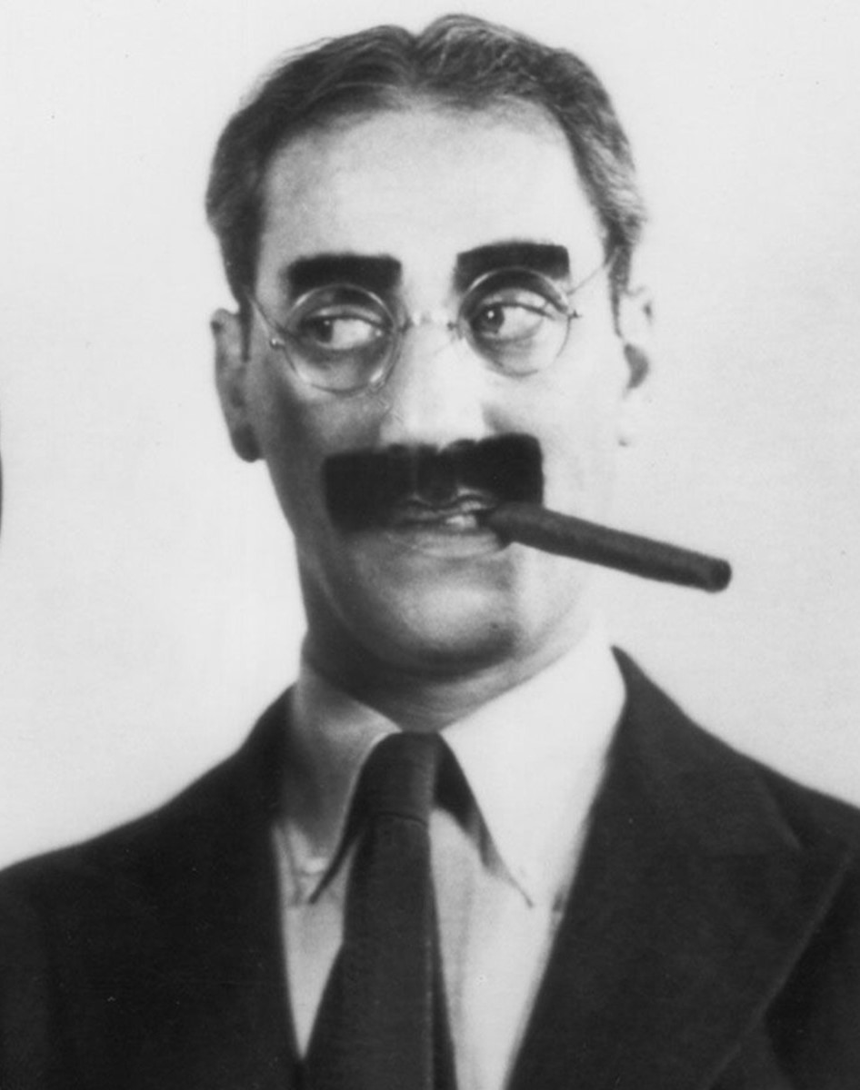
Groucho (Julius)
For being one of the most famous and successful comedy teams in history, they were certainly the strangest. Those bizarre costumes. The fact that they worked best not as a full team, but in ones and twos (Groucho and Chico, Chico and Harpo, Groucho playing off a clueless victim of his rapier wit). The fact that one Brother was entirely unnecessary, and left the team part way through their film career with no effect whatsoever.
You can be strange, you can break the rules, you can tear down the walls of what’s accepted, but you don’t become a comedy legend unless you bring the goods. You have to be funny, and the Marx Brothers were certainly that. As proof, I submit my several years’ experience as an instructor of cinema studies…at the middle-school level. Talk about a tough crowd. I often did a semester on comedy, and always included a few of the best Marx Brothers movies. After a brief bit of skeptical silence as they adjusted to the creaky old black-and-white antiquity of what they were seeing, they would start to laugh. Yes, even the most jaded, TikTok-sated middle schooler will succumb to the charms of the Marx Brothers, if that middle schooler has at least a modicum of a sense of humor (most of them do).
Harpo (Adolph/Arthur)
In this series of essays, my plan is to explore the Marx Brothers’ entire career, but with particular emphasis on their early years and later years (hence the subtitle of “rise and fall.”) Of course, I will be touching on the classic movies that made them legends, but so many others have done that so many times (and so much better), that I feel like adding too much to that particular pile would be superfluous. The Brothers’ career peak may well be the shortest portion here. And I’ll try to avoid the most well-worn stories. Still, this will be the longest sustained piece of writing on a single topic that I’ve ever done, except for “This Used To Be My Playground” Parts 1-24, which were written piecemeal over eight years. (This still might beat that series on actual word count.) So if you’re not into the Marx Brothers, or don’t want to learn about the Marx Brothers, then I’m sorry for what’s going to be happening here for the next year or so. (Yes, it’s that long, and the site only updates once a month. I’d like to go faster, but I have a job, a life, computer games to play, golf to watch, etc.).
Chico (Leonard)
The problem with pursuing a straightforward examination of the Brothers’ lives and careers is that mundane facts are almost totally obscured by myth and apocrypha — mostly spun by the Brothers themselves. They were showmen, born and bred, and never let the truth get in the way of a good story. In their old age, both Groucho and Harpo wrote autobiographies that were chock full of exaggerations, mistaken memories, and outright fabrications, many of which were taken as gospel by fans and journalists of the time. It took a later generation of scholars to peel away the patina of legend and piece together as much of the real story as they could. But misinformation still proliferates, especially on the internet. As much as I can, I will use the most up-to-date, reliably researched sources. (The Holy Bee as amateur armchair researcher is greatly indebted to the legwork of these professional authors, and a full source list will be provided after the final entry of this series.) I will do my level best to get the history right, without relying on Marxian Tall Tales, and if that means there will be fewer funny stories that are only half-true (or less), then so be it. It’ll make for a slightly less entertaining read, but I’ll be able to sleep at night. (And so will you, after reading one of these essays!)
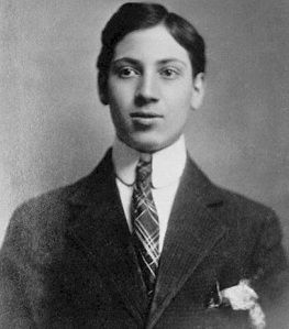
Zeppo (Herbert)
The title of this series comes from the working title of author Joe Adamson’s seminal work on the Marxes, Groucho, Harpo, Chico, and Sometimes Zeppo. (Evidently, Simon & Schuster editor Michael Korda hated cutesy, esoteric, or wordplay-based titles. Makes it fair game for the Holy Bee to swipe.)
So this will be, in a description I’ve used in the past, your typical Holy Bee mishmash. Part biography, part cultural history, part critical analysis, part rambling and musing.
Here we go…
The region known as Alsace has always been a victim of geographical tug-of-war. Hugging the western bank of the Rhine River, the area has been regarded at various times as the easternmost territory of France or the westernmost territory of Germany. In October of 1859, Alsace was firmly under the control of France, and in a Jewish commune known as Mertzwiller, Simon Marx was born to another Simon Marx (possibly spelled “Marrix”), an illiterate peddler and suspected bigamist who may have been married illegally to two women at the same time. Before the boy was twelve, the events of the Franco-Prussian War annexed Alsace on behalf of the new Imperial State of Germany — the Second Reich — and young Simon went from being French to being German overnight.
In a similar vein, before the Franco-Prussian War, the little seashore town of Dornum, just east of the Dutch border, was considered to be in the independent Kingdom of Prussia. After the Franco-Prussian War, it was considered to be in the newly consolidated German Empire. It was there, in the waning days of the old kingdom, that Miene Schoenberg was born in November of 1864 to distinctly un-orthodox Jewish parents.
Miene’s parents were Lafe and Fanny Schoenberg, who traveled through northern Germany and the Low Countries performing as a ventriloquist/magician and a singing harpist, respectively. Lafe had a reputation as a wily, philandering charmer, always on the lookout for a pretty girl or easy money, traits he would pass on to at least a few of his grandsons. The 1851 marriage of the rascally Lafe and the more proper Fanny was objected to by her parents — and had been scandalously preceded by the 1850 birth of their eldest daughter, Schontje. Schontje was turned over to Lafe’s parents to raise, and for whatever reason the Lafe/Fanny union was not blessed with any more children until 1858 — then they came very close together. In addition to Schontje, there was daughter Sara, who emigrated to New York well ahead of the rest of the family in 1872, daughters Celine (about whom nothing is known) and Jette (died at age three), and at least a few others who didn’t survive infancy. All we need to note for the future are daughter Hanchen (b. 1862), daughter Miene, son Abraham (b. 1868) and son Heinemann (b. 1873).
Fanny and Lafe, 1876, just before immigrating. Hanchen is between them, Abraham is in front of Fanny, and Heinemann is on Lafe’s lap. The fair-haired Meine is on the right.
Looking for greater opportunities, the Schoenbergs came to the melting pot of New York City between 1877 and 1879, and began the process of assimilation among the crowds of fellow immigrants in the Lower East Side. Lafe became “Louis” (although he never mastered English), Hanchen became “Hannah,” Meine became “Minnie,” and the boys, Abraham and Heinemann, became “Al Shean” and “Henry (‘Harry’) Shean.” (Fanny stayed Fanny.) Fifteen-year-old Minnie took a job in a sweatshop, assembling fur coats.
We don’t know if Schontje or Celine made the trip. If they did, it is likely they are partly responsible for the flood of “Schoenberg cousins” the Brothers remember going in and out of their household at all hours. We know that Sara married a Gustave Heymann, and had a bunch of little Heymanns roughly the same age as the Brothers.
Fanny and Lafe, 1880s
Simon Marx made his way to New York in 1880, and was taken in and apprenticed by an older cousin who worked as a tailor. He shed the name “Simon” and became “Sam,” but — although he considered himself German — he went by the nickname of “Frenchie” for the rest of his days. He never mentioned nor gave much thought to his parents and a multitude of siblings and half-siblings he had left behind in the Old Country. (“Frenchie” or “Frenchy”? Looking through all the sources, it seems to be a 50-50 split. I’ll go with Harpo’s spelling from his autobiography.)
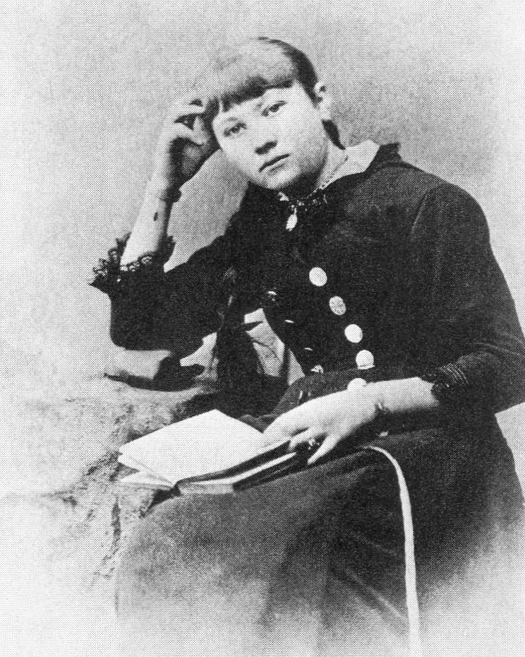
Minnie, at around sixteen years old
By late 1884 Frenchie was barely scraping by as a tailor. But there were other opportunities for a handsome, dapper, and gentlemanly young Alsatian — especially one who was a decent dancer. He picked up extra money moonlighting as an instructor at a dance hall, and that’s where he met the bright, vivacious Minnie, who had moved on from the sweatshop and was now selling straw hats. Romance blossomed, and Sam “Frenchie” Marx, 25, married Minnie Schoenberg, 20, on January 18, 1885. They bounced from apartment to apartment (always moving further uptown — away from the teeming, roughshod Lower East Side), and began to produce their remarkable offspring.
Frenchie Marx
The first Marx brother never got to be a “Marx Brother” at all. Manfred Marx, born in January 1886, was dead by July, a victim of acute “enterocolitis” (inflammation of the digestive tract) and “asthenia” (overall weakness), brought on by either influenza or tuberculosis. Whatever bacteria or virus was at fault, Manfred became another statistic in the annals of urban 19th-century infant mortality. His parents were devastated, but in true immigrant spirit, they persevered — and all their subsequent children lived to see old age.
After poor lost “Mannie” came Leonard, born on March 22, 1887. Then came Adolph on November 23, 1888. The middle child, Julius Henry, was born on October 2, 1890. Little brother Milton arrived on October 21, 1892. (He was another sickly one — Minnie watched him like a hawk.) The “surprise baby,” Herbert, was born on February 25, 1901.
We know them as Chico, Harpo, Groucho, Gummo, and Zeppo.
Although the family always had its eyes on the future, Manfred’s death was not without reverberations that would echo for years. Minnie became incredibly protective. “Sam can cough all night, and I never hear him,” she once said. “But if one of my boys coughs just once, I’m wide awake.” And the first child born after Manfred — Leonard — was undoubtedly his mother’s favorite, spoiled and cosseted unabashedly. All the boys were born with fine blonde hair (and Minnie was known to have mixed peroxide with their shampoo) — except Julius, who sported woolly black locks from the get-go. That, and the slight cast to his left eye, always made him feel like a little bit of an outsider. Minnie referred to him as der Eifersuchtihe, “the jealous one.” His brothers’ hair eventually darkened in adolescence, but for Julius, the damage was already done.
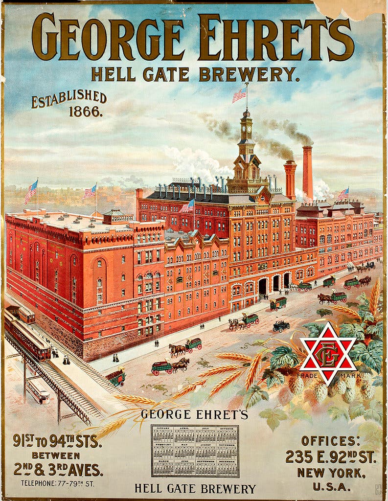
The dominant Yorkville landmark was the massive Hell Gate Brewery. The Brothers’ grandfather taught them to tell time by looking out of their window towards the brewery’s clock tower
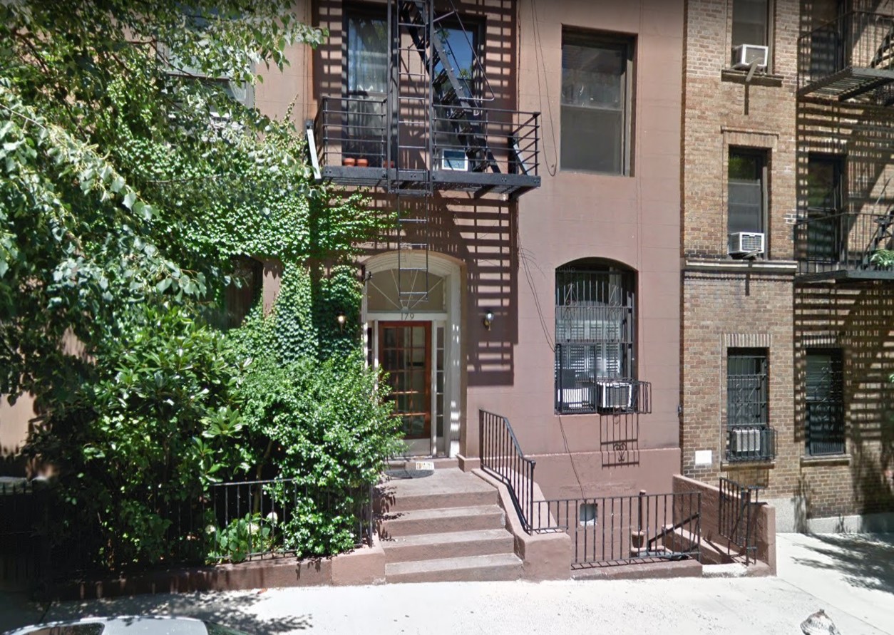
Every Marx Brother has a story about what a terrible tailor their father was (he supposedly refused to use a tape measure, preferring to guess his customers’ measurements), and also liked to spin tales about their poverty and life in the tenements. The reality was a little different. Yes, Frenchie preferred cooking and playing pinochle to cutting cloth, but he must have been earning something. By 1895, the family had settled into the top floor of a comfortable four-story brownstone at 179 East 93rd Street in the respectable German neighborhood of Yorkville — hardly a tenement. They stayed there for almost fifteen years, a far cry from the days of fleeing angry landlords in the Lower East Side when rent came due. The Marx family was solidly lower-middle class.
Which isn’t to say the apartment wasn’t very, very crowded.
Let’s take a look at the occupants of this address, circa 1900…
The stoop of the Marx family’s building as it appears today
The occupants of three rooms on one floor of 179 East 93rd Street included Frenchie, who was more likely to be found frying short ribs and cabbage or playing cards than plying his trade. (He didn’t have a shop. His big cutting table and scraps of fabric dominated the dining area during work hours, and were put away when it was time for dinner and/or a round of cards, which came earlier and earlier in the day as he got older.) There was Louis and Fanny (now “Opie” and “Omie” to the grandsons). There was thirteen-year-old Leo and eleven-year-old “Ahdie” — towheaded troublemakers who at the time could pass as twins, and were already showing a proclivity for prowling the neighborhood looking for action. There was nine-year-old “Julie,” somewhat sour and serious, usually to be found with a book in whatever private corner he could claim, or keeping an eye on seven-year-old Milton, who was frail and small for his age. Presiding over all of this was Minnie Marx, pregnant (or very soon to be) with Herbert, and beginning to concoct the dream of putting her precocious boys on the stage. (None of the Brothers bothered with school beyond their bar mitzvah, and their attendance was pretty spotty before that.)
And according to the Brothers’ collective memories, another constant presence was a Marx Sister — Pauline (“Polly”), aged sixteen. Actually, Polly was the daughter of Minnie’s sister Hannah, born in 1884 when Hannah was between husbands, and unofficially adopted by Frenchie and Minnie to keep things respectable. (For what it’s worth, Polly was listed in the 1900 census as residing with her mother and stepfather, but who knows what the actual situation was.)
The Marxes occupied the top floor
A total of eight people — and that’s just the baseline. It seems that Polly was a semi-permanent fixture, and Aunt Hannah and her second husband Uncle Julius were there so often they might as well have been residents. Plus there was an endless stream of Schoenberg cousins, family friends, Frenchie’s customers, and pinochle players trooping up and down the three flights of stairs at number 179. And somewhere among the clutter, human and otherwise, they managed to find room for Omie’s old harp and a second hand upright piano. (One of Julius’ favorite reading spots was draped over the back of the piano.)
The story goes that Minnie was for some reason convinced Uncle Julius was sitting on secret riches, and named her middle child after him in hopes of a future inheritance. The question mark in the story is that Hannah and Julius Schickler did not marry until two years after Julius Marx was born. But who knows, maybe the couple had been “courting” for a couple of years.
Julius and Adolph in front of 179 East 93rd Street, around 1901-02
The loss of Omie Fanny in 1901 was balanced by the arrival of baby Herbert, but gradually the fourth floor got some breathing room. Polly married young, to the nearest non-related male (one of Frenchie’s card-playing cronies, actually) and got the hell out of there as soon as she could. Teenaged Leo and Ahdie were spending less and less time under the family roof, out until all hours doing who-knows.
Julius was a touring vaudeville singer by the end of 1905. And Julius most assuredly did not get an inheritance from his eponymous uncle when he finally shuffled off sometime in the 1920s. Uncle Julius’ entire estate, grouched his nephew in his colorful autobiography, consisted of “a nine-ball he stole from a pool hall, his liver pills, and a celluloid dickey.” Plus, he died owing Frenchie eighty-four dollars.
I was fully recovered from the previous day’s ailments, but Shannon’s injured toe was paying the price for the long J.K. Rowling walk. She would opt out of this morning’s activity — a cross-country hike to the coastal town of North Berwick, about two miles away.
Unlike in the Cotswolds, there was no detailed hiking map. We knew the general direction, but it would be mostly guesswork. No grey skies or fog this morning, we were back into California temperatures. I was already running with sweat with Fenton Tower still in sight behind us. A few twists and turns along seemingly endless vistas of barley fields brought us to a long gravel driveway leading to a ranch-style property with several outbuildings. We headed hesitantly up it, and were soon overtaken by a silver Mercedes kicking up plumes of dust behind it. The tinted window rolled down, and Bret recognized the driver as the person with whom he discussed arrangements at Fenton Tower when we first arrived (the rest of us were busy scouting out rooms). It turned out he actually owns Fenton Tower. And the ranch we were now on. And everything currently visible to the naked eye. He gave us a few pointers for the remainder of the walk.
“I hope we won’t be trespassing on anyone’s property,” Karen said.
“Nah,” said Mr. Fenton (I didn’t catch his real name) with a wave of his hand. “Everything is mine until the town limits. Have a nice walk.” He roared off up the drive.
We did have to hop a barbed wire fence with uncertain footing on the other side, but the rest of the hike passed uneventfully.
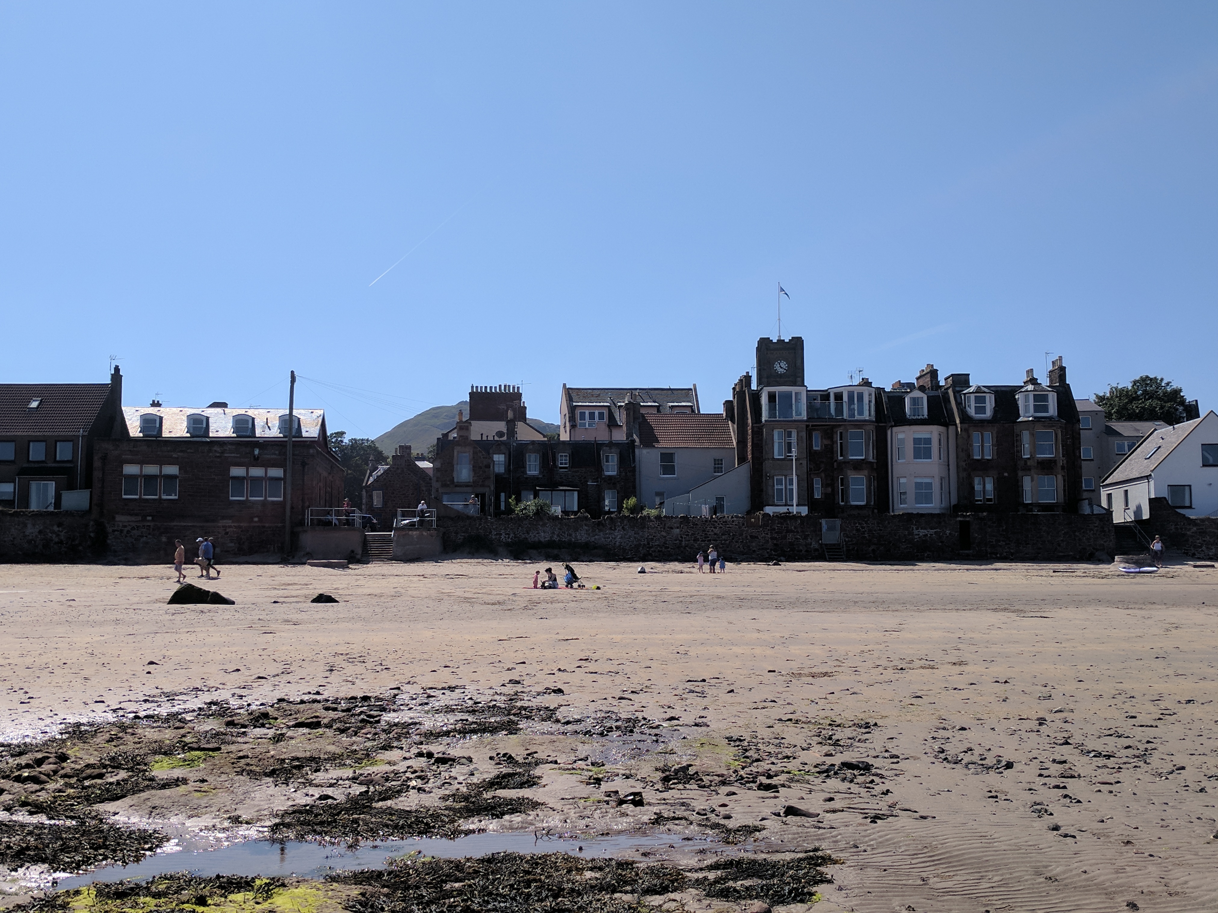
North Berwick was originally established as a ferry port, shuttling passengers across the Forth of Firth to St. Andrews or Kirkcaldy as long ago as the 1100s. A series of witch trials were held on Berwick Green in the 1590s. Nowadays, the small seaside town caters to vacationers, and especially golfers attracted to the many historic Scottish links courses that dot the area.
We nosed around the town, and clambered out onto the rocky cliffs near the little harbor. Other rock islets further offshore serve as a habitat for a variety of seabirds, such as puffins and gannets. On the North Berwick beach, a crowd of young swimmers paddled around a safe shallow area enclosed by a rock wall. The water was a suspiciously cloudy pale yellow color and wouldn’t be my choice for a refreshing dip, but to each their own.
News reports were calling today the hottest day in Scotland since 1990. We had a trattoria-style lunch at the Zitto Italian Wine Bar. Some of us decided to hike back at that point. Sheila, Karen, and the kids wanted to explore the town shops some more, and would return via taxi.
North Berwick Law, rising 600 feet above sea level. Once topped by an Iron Age fort, the modern day summit is crowned with a whale’s jawbone. A little too ambitious for today’s walk.
By the time we returned to Fenton Tower, my clothes were wringing wet with perspiration. Restored by a cool shower and fresh garments, I was ready for that afternoon’s big activity — touring the Glenkinchie single malt Scotch distillery just south of the village of Pencaitland.
Glenkinchie distillery workers, 1920s
The same building seen in the photo above
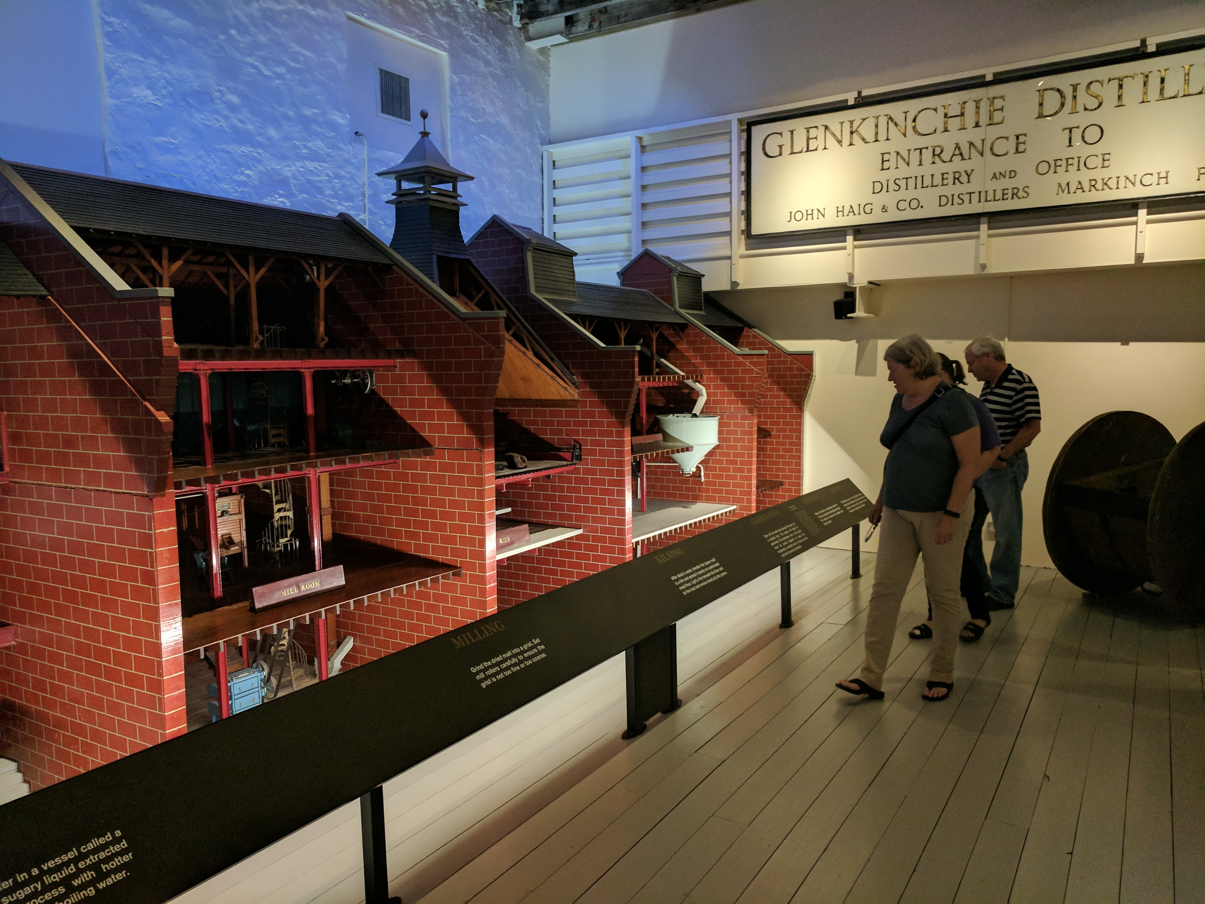
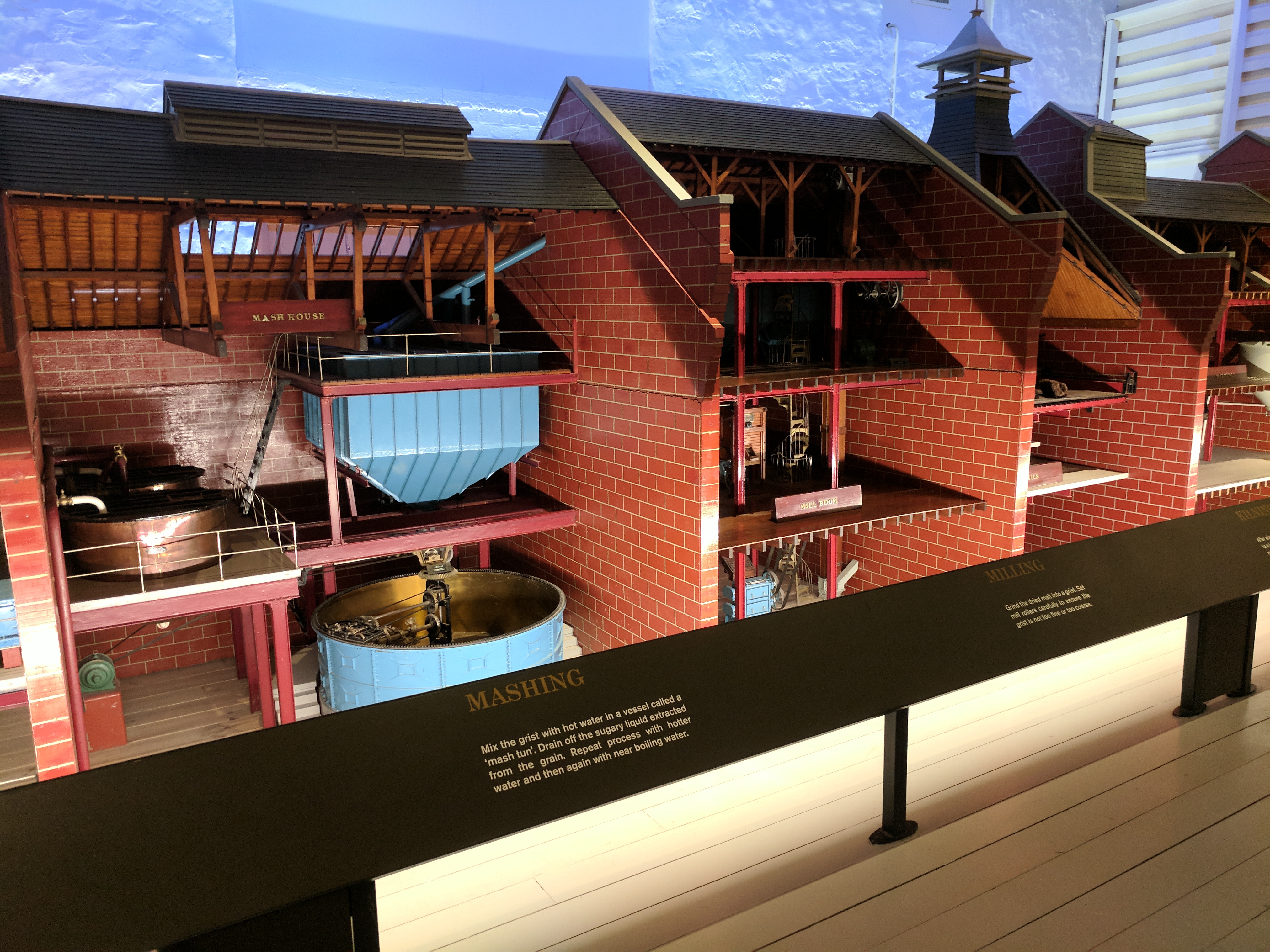
One of only six distilleries in the Lowlands, Glenkinchie was established in 1837. Although they stopped malting their own grain in 1969, and recently outsourced their aging cellars, it was still a fascinating look at an insanely complex process that I could barely wrap my head around. Since I didn’t carry my notebook around, and was mostly anticipating the tasting at the end, most of the technical details I am unable to report back to you with any degree of accuracy.
Our guide, Kay, walked us through the various rooms in the distillery (some of which were searingly hot on a day like today) and explained the process and the history of the company in her warm Scottish burr.
The old malting floors have been converted to museum space, including a massive scale model of the entire distilling process.
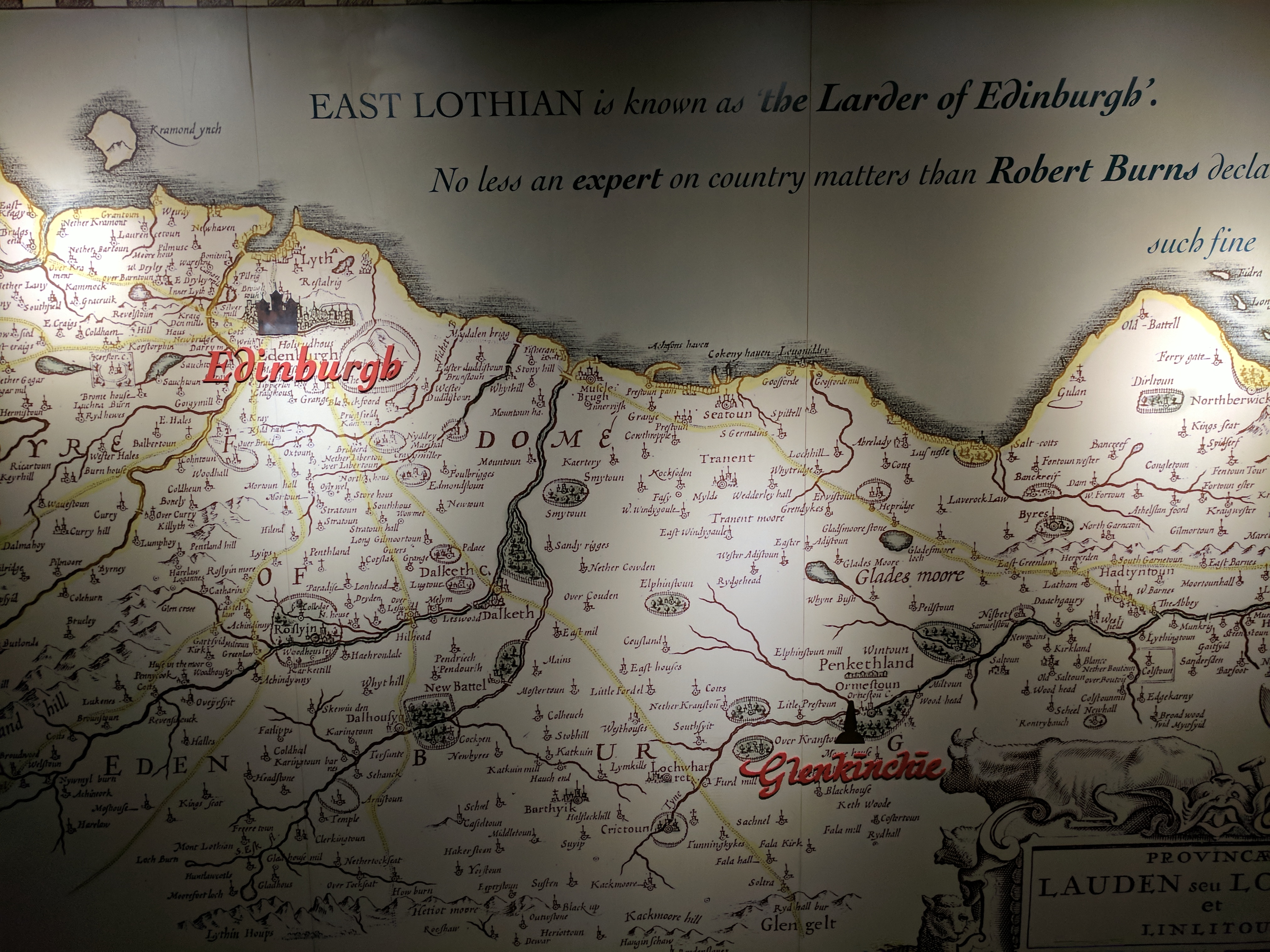
One wall of the Glenkinchie museum was dominated by a vintage map of the East Lothian region
Map detail — note “Northberwick,” the Law, and “Fentoun Tour”
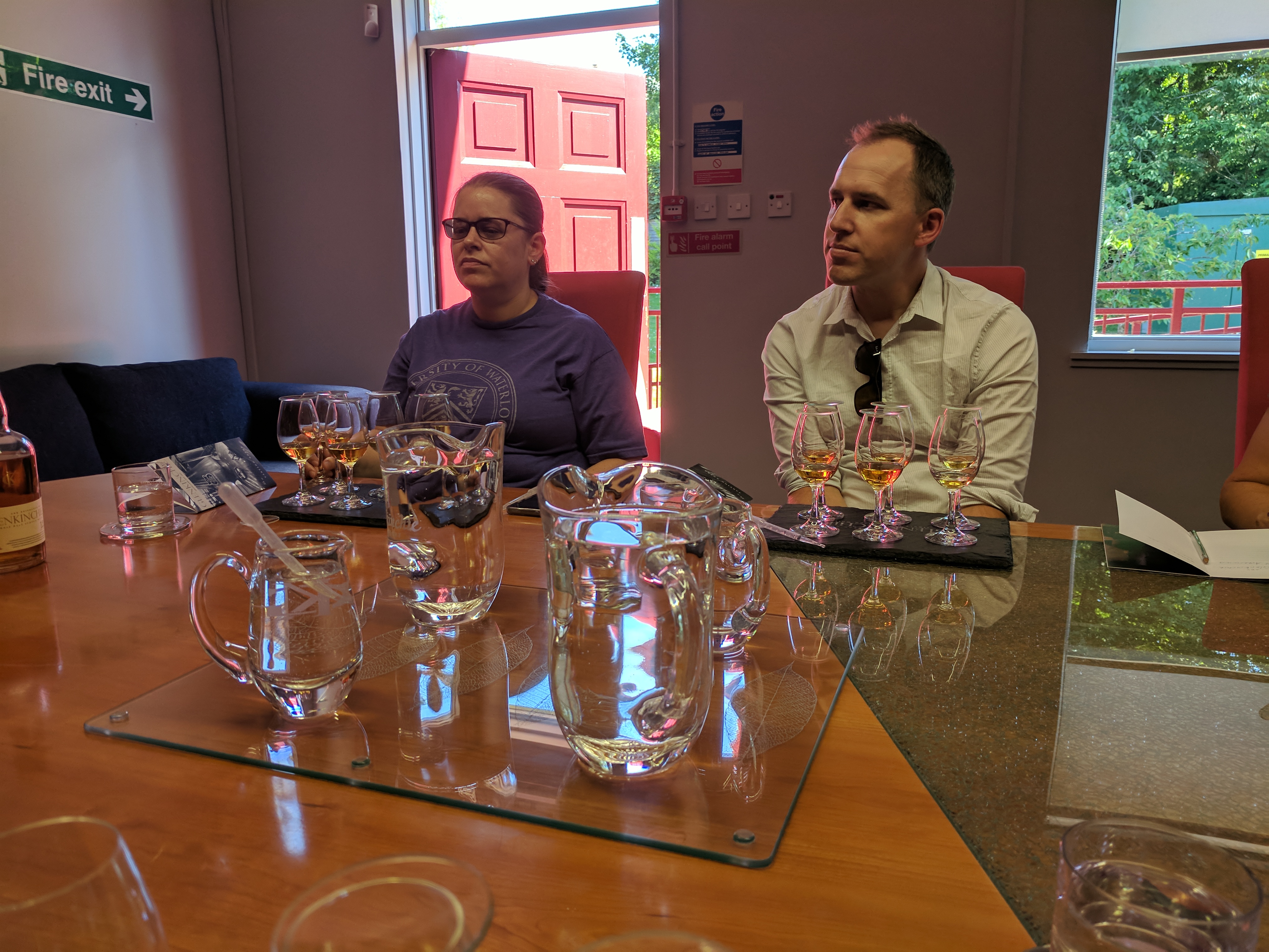
We ended up in the tasting room with pens, notepads, eyedroppers of water, and six glasses in front of each of us, each glass with a splash of Scotch. Five varieties were from Glenkinchie, the sixth was a smokier peat-flavored Scotch from another distillery for purposes of comparison. (Glenkinchie specializes in very smooth, non-peaty flavors, perfect for a Scotch newbie.) We noted color, body, nose, taste, and finish. No one liked the peaty Scotch (except me, I liked it just fine), but we all agreed #2 and #5 were the best.
Going to Scotch school with Kay
#5 was, naturally, the most expensive Scotch Glenkinchie offered, at several hundred dollars a bottle. #2 was a nice, mid-priced option. Bret bought us all a bottle as we exited, slightly woozy, through the gift shop.
For our final night in Fenton Tower, the kitchen staff outdid themselves with a three-course dinner. After dinner, we watched Monty Python and the Holy Grail in anticipation of our visit to Doune Castle in the morning.Continue reading →
The bulk of Sunday morning was taken up by an eight-mile loop hike through the Cotswolds countryside. The previous day we had purchased a walking map, “North Cotswold Classic Walks (Revised Edition)” (not revised enough, as it turned out).
It was a small party that set out after breakfast — Shannon and myself, her parents, and Bret & Sammy. I was put in charge of the “laminated, waterproof, and tear-resistant” map. The only way the map would get wet on this day was by me sweating on it. Clear skies and temperatures in the mid-eighties again. Having done it a couple of times before, we covered the first leg from Lower Slaughter to Upper Slaughter with ease. Then we headed into the open country to the north. The challenge here was the narrow country roads’ almost non-existent shoulders, forcing the intrepid hiker to thread a needle between occasional traffic and thick hedgerows. Luckily this scenario was somewhat rare, and most of the hike was on public right-of-way trails through meadows, farmland, and wooded areas. A red fox — in considerably better condition than the flea-bitten specimen we saw skulking in Highgate Cemetery — scampered down a sloping orchard into the brush that lined the River Eye.
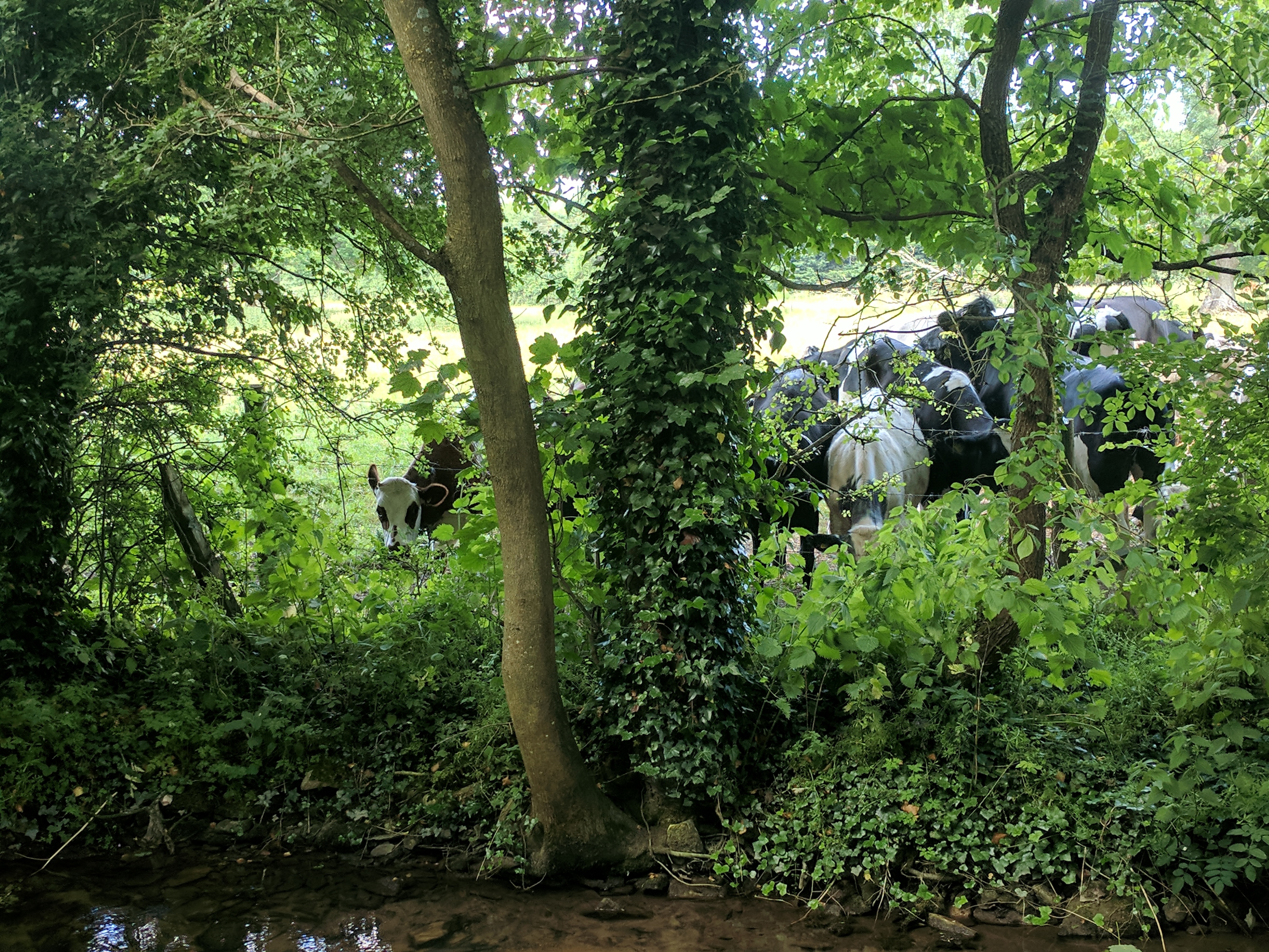
We were just shy of the halfway point when my navigational skills were put to the test for the first time. Our map instructions stated “6. Turn L, walk beside road to x-roads, and turn R along a wide grassy kerb to first metal gate (between stone walls) on your L. Follow farm tracks between stone walls to old barn. Through wooden gate following W/M sign.” The first bit was no problem. It was a delight to have a wide grassy anything along the side of a road to walk on. The first metal gate appeared in due course, we went through it…and nothing on the other side matched the map’s descriptions. No “farm tracks,” but a paved asphalt driveway. No “old barn,” no “wooden gate.” The whole property had been thoroughly upgraded. We took turns peering at the map and pointing at random things, trying to decide if we were in the right place. Did the Navigator screw up, or was the map incorrect? Our shufflings and mutterings drew the attention of the occupants of the property, who glanced at us over their yard fence, and seemed used to seeing confused hikers. We eventually made an educated guess as to direction, and scooted down a steep incline to a little grassy ravine chock-full of cows. According to writer Bill Bryson, several hikers in Britain have been killed by cows over the years. I kept this nugget of information to myself, as the cows showed no more interest in us than the property owners did a few moments ago.
Scrambling up the other side of the ravine, we encountered a way marker that matched the map, and we continued with confidence. There was another slight detour when one of the access gates was blocked, due to that particular pasture being occupied by a couple of sharp-horned steers.
The path grew damper and the shade more frequent as we began to follow the track of a disused railway along a wooded hillside path. When we came to a fork, there was a group of obviously new semi-detached bungalows where the map promised open fields…so I took the wrong fork, thinking the map couldn’t be wrong twice in a row. The sense of going the wrong way grew until I called the group to a halt, and took a chance at us doubling back the way we came. It’s a good thing I did, or we may have ended up in Wales looking at the Irish Sea. We picked our way around the new housing, and sure enough, the proper trail continued.
Overgrown tunnel under the disused railway
Upon our arrival back at River Cottage around 1:00, Shannon really wanted to experience the traditional English Sunday lunch of roast beef and Yorkshire pudding. She and a few others headed for the Slaughters restaurant, and I settled in to my hidden den to watch the England v. Panama World Cup game, lunching on crackers, prosciutto, and Peroni. England gave Panama a sound 6-0 drubbing. Post-lunch, Shannon, her mom, and two nieces went horseback riding.
A leisurely afternoon stretched into an equally leisurely evening. I took a hot and criminally long shower, followed by an attempt to completely drain the Irish whiskey bottle so there would be one less thing to pack onto the minibus in the morning. Thoughts turned to dinner as the horseback-riding party returned. Options being limited, we wandered over to the Slaughters once more. Our fluttering waiter had world’s most hard-to-trace accent. Sheila finally pinpointed it as belonging to “Franc,” the fluttering wedding planner played by Martin Short in Father of the Bride.
The next morning we regretfully bade farewell to the wonderful River Cottage. Our new minibus driver seemed to be a carbon copy of our previous minibus driver, John. Silver-haired, stocky, but with a military bearing. Despite his cheery, Northern-accented gregariousness, I never caught his name, and before long, we were so chummy it would be embarrassing to ask. He simply became “Not-John” in my mind.
We were heading for Scotland, and decided to break the drive into two days. After a few hours heading north, passing exits for Birmingham, Manchester, and Liverpool, we stopped at a nondescript roadside service area for a nondescript Burger King lunch. As I pulled a Peroni from the bus’s cooler, Not-John spoke of the day’s World Cup match. He was actively rooting against the Argentinians, still bitter about spending his 19th birthday fighting 1982’s Falklands War. After another hour-and-a-half or so, we were among the green crags and sparkling waters of England’s famous Lake District. We were in the north now, where the pace was a little slower and the people more relaxed. “Lovely” replaced “brilliant” as the one-word expression of approval.
The Lake District
Located entirely in the rustic county of Cumbria, the Lake District is the land of William Wordsworth and Beatrix Potter. If you think the Cotswolds are aesthetically pleasing, the Lake District doubles down. Home of 21 freshwater lakes (almost none of which are actually called lakes — they’re “tarns,” “waters,” or “meres”) and the highest elevations in England, the Lake District receives 12 million visitors per year.
We reached our destination, the Forest Side Hotel in Grasmere, by two that afternoon. William Wordsworth used the locale of what would one day be the hotel as a setting for his narrative poem “Michael”
The property was indeed a sheep farm in Wordsworth’s day. The current building was built as a “gentleman’s residence” for one Stephen Heelis in 1853. It remained as a private residence until the 1930s when it became the “Cooperative Holidays Association,” offering organized holiday activities for working-class youths. It was refurbished into a luxury hotel in the late 1990s.
We chose it for our stop en route to Scotland due to its attached restaurant boasting Michelin-star status. “Inspired by the Cumbrian countryside,” the restaurant offered dishes such as venison pastrami with smoked juniper yogurt, West Coast langoustine with asparagus, North Atlantic cod, oyster, and tarragon salsa, and several others that do not crop up on a typical menu. All vegetables are grown in the Forest Side’s own extensive gardens.
The Forest Side gardens
The porter who brought our bags to our room was the first person to absolutely stump me with the thickness of his Cumbrian accent. My ears are normally very good at parsing the various British dialects, but all I could get from this fellow was “‘ow nit omsby onna rike?” or something of the sort. I could tell it was a question, and luckily, by his gestures, I understood he was asking if I wanted the luggage on the bed, so I didn’t have to embarrass us both by asking him to repeat himself. After a short walk and a nap in our room (complete with a bathroom bigger than my first apartment), Shannon and I met the rest of the party in the lounge for cocktails at six-thirty. The bartender, Michael, was on his summer break from university, and made one of the Forest Side’s signature cocktails, the name and ingredients for which are now lost as I did not jot them down. Whiskey-based, it was one of the best cocktails I’ve had. Old-fashioned-like, but with a touch of more tropical fruitiness. When Michael handed it over to me, I thanked him in the proper northern English way — “cheers” — and received the proper northern English response — “that’s all right, then.”
Dinner was at seven, followed by another round of cocktails on the veranda. The sky finally began to darken around ten, and the mosquitoes forced us inside, but we were sad that the Forest Side was to be a one-night-only experience.
Up and out, with Not-John behind the wheel, by nine-thirty the next morning. We trundled through the furthest northern reaches of England, and scraps of ancient masonry began appearing along the roadside. We had reached Hadrian’s Wall.
Traditionally regarded as the boundary between England and Scotland, Hadrian’s Wall actually lies entirely within England. It extends about 80 miles across one of the narrowest points on the island of Great Britain, from the Tyne estuary in the east to Solway Firth in the west. Construction began in AD 122 on the orders of Roman Emperor Hadrian to manage and protect Roman holdings in the southern half of Britain. Historians now believe the wall may have purposes in addition to fending off Pictish barbarians, such as controlling the flow of goods and making sure customs were paid. Built into the wall were small “milecastle” fortifications every (Roman) mile or so, and larger forts every five miles. Although Roman influence extended far beyond the wall, it represented the demarcation line between civilization and wilderness. Continue reading →
Today was the first low-key day of the trip. No rushing around to squeeze in as much stuff as possible like we did in London. I slept late enough to actually be a little hungry upon awakening, so I augmented my coffee with a couple of rashers of bacon, and toasted “bloomer” bread with rich, fatty English butter.
There may be no better place in the world for a walk than the Cotswolds. By late morning, we were on one of the many footpaths that criss-cross the woods and pastures surrounding Lower Slaughter, Upper Slaughter, and the larger village of Bourton-on-the-Water. (“Slaughter” comes not from the ultimate fate of many of the area’s sheep, but from “slough,” meaning “wet land.”) We crossed the River Eye (which takes about five steps on a footbridge — the scale of what earns the name “river” is a little smaller over here), noting the trout idling lazily just beneath the surface, and the duck families paddling to and fro. The only thing that could make everything ever more like a children’s storybook setting would be a bunny rabbit. As if on cue, one hopped out from behind a hedge. It was almost sickening how perfect the scene was.
Just beyond the village, our leisurely progress was observed by a herd of curious cows, and two horses wandered over to the fence line to say hello. These horses seemed absolutely delighted to see us and have their noses stroked. Shannon, our group’s true horse aficionado, reached under the jaw of one of them to scratch its ear on the far side. The horse actually leaned into her and closed its eyes in bliss. I have a feeling it would have rolled over to have its belly scratched if we were on the other side of the fence.
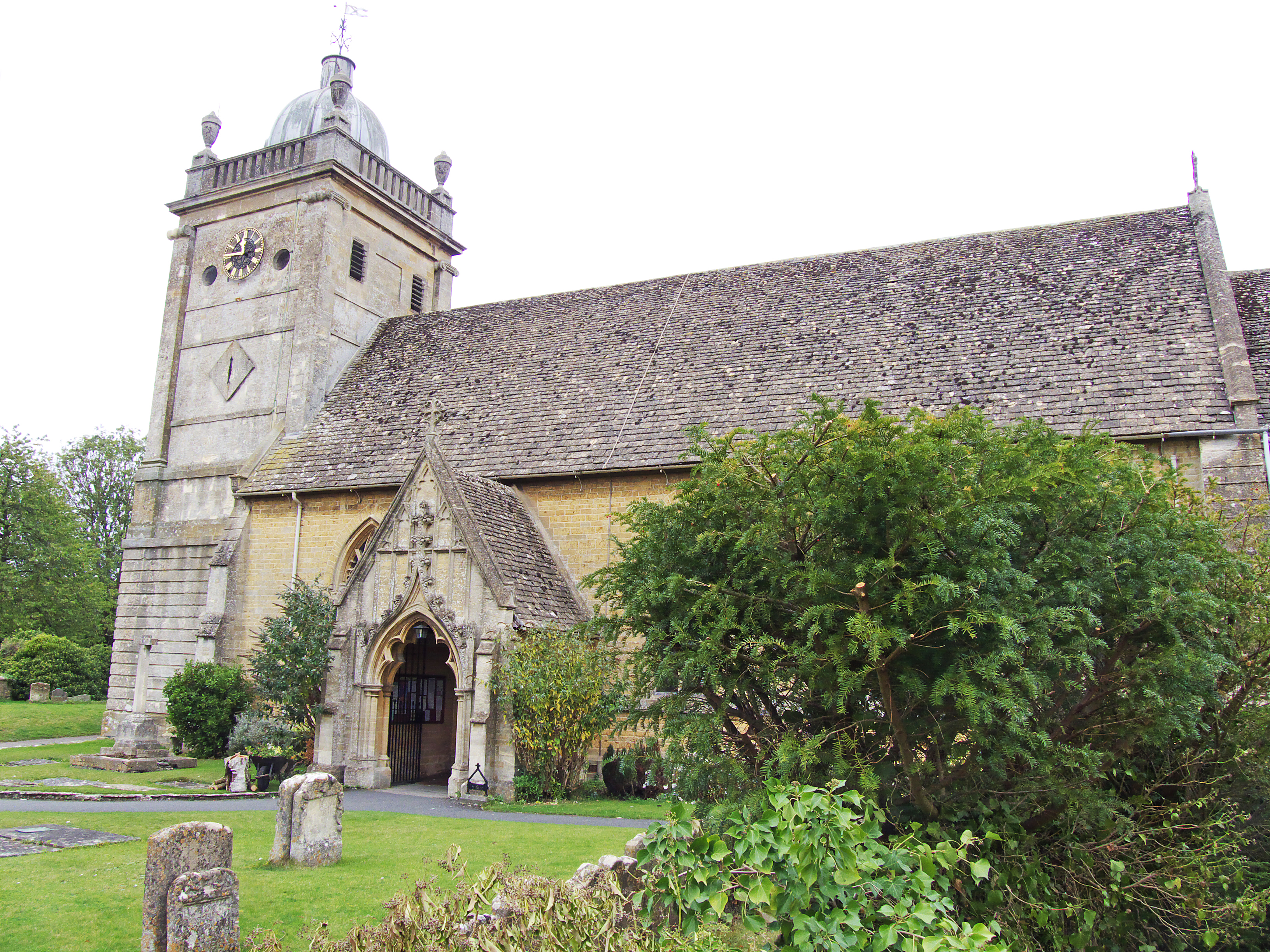
The footpath passed by the parish church of St. Lawrence. The interior chancel was preserved from the old Norman church that once stood here back in the 14th century, but the rest of the building dates from 1784. The churchyard was the usual jumble of slender, tilted headstones, and the practice of burying randomly connected family members not only in the same plot but the same grave was very much in evidence. And it seems that tombstone engravers got paid by the word. “Here is interred the mortal remains of Harold Wyckham-Pigg, Esq., parish deacon and beloved husband, father, brother, cousin, and humble servant of the Lord, called home from his earthly toils in his sixty-sixth year of life, Monday the twenty-third of June, eighteen hundred and thirty-six, anno domini. Also, Mrs. Margaret Wyckham-Pigg, beloved daughter-in-law of same, wife of Peter Wyckham-Pigg, solicitor, passed from this life on…etc. etc.” Each line in a different font, like the annoying co-worker who tapes up signs in the office break room.
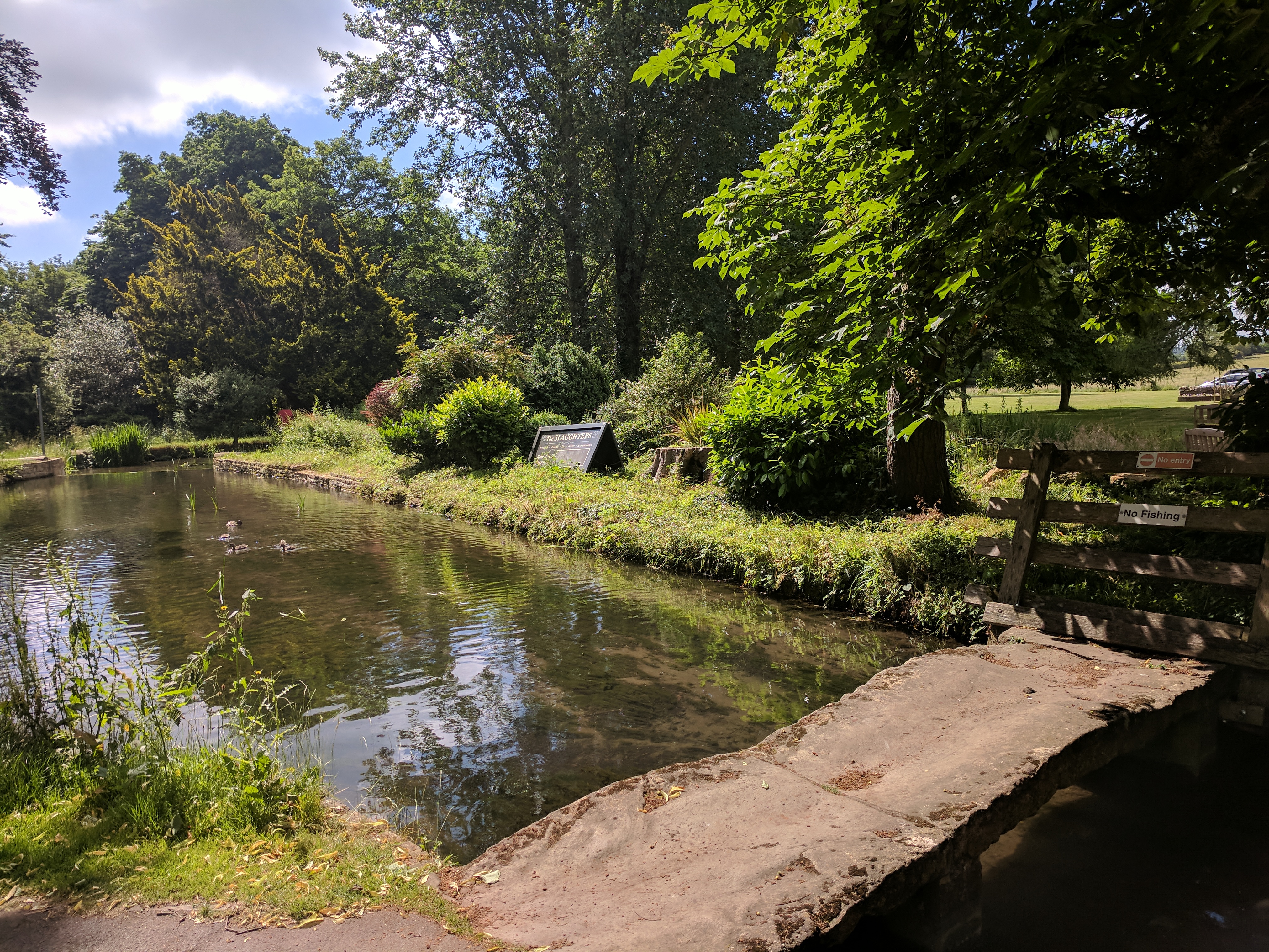
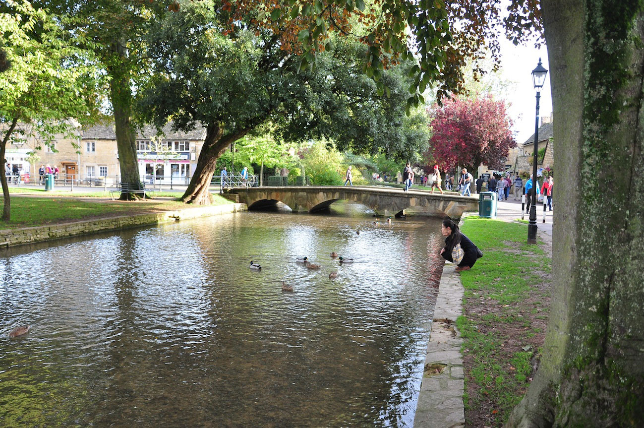
We reached Bourton-on-the-Water just in time to start looking for a place to have lunch. Bourton is often referred to as the “Venice of the Cotswolds” due to the five arched bridges that span the River Windrush as it flows through the center of town. The distinctive yellow limestone buildings that give Cotswold villages their quaint character line the stone channel that carries the river. Like much of the Cotswolds, Bourton-on-the-Water shows evidence of continual habitation since prehistoric times and its name reflects a heavy Saxon influence. “Burgh” meaning camp, and “ton” meaning estate, enclosure, or village. So Bourton is the “village beside the camp.” (On the water.) The camp may have been the remains of an old Roman camp, as Roman-era coins and pottery have been found nearby.
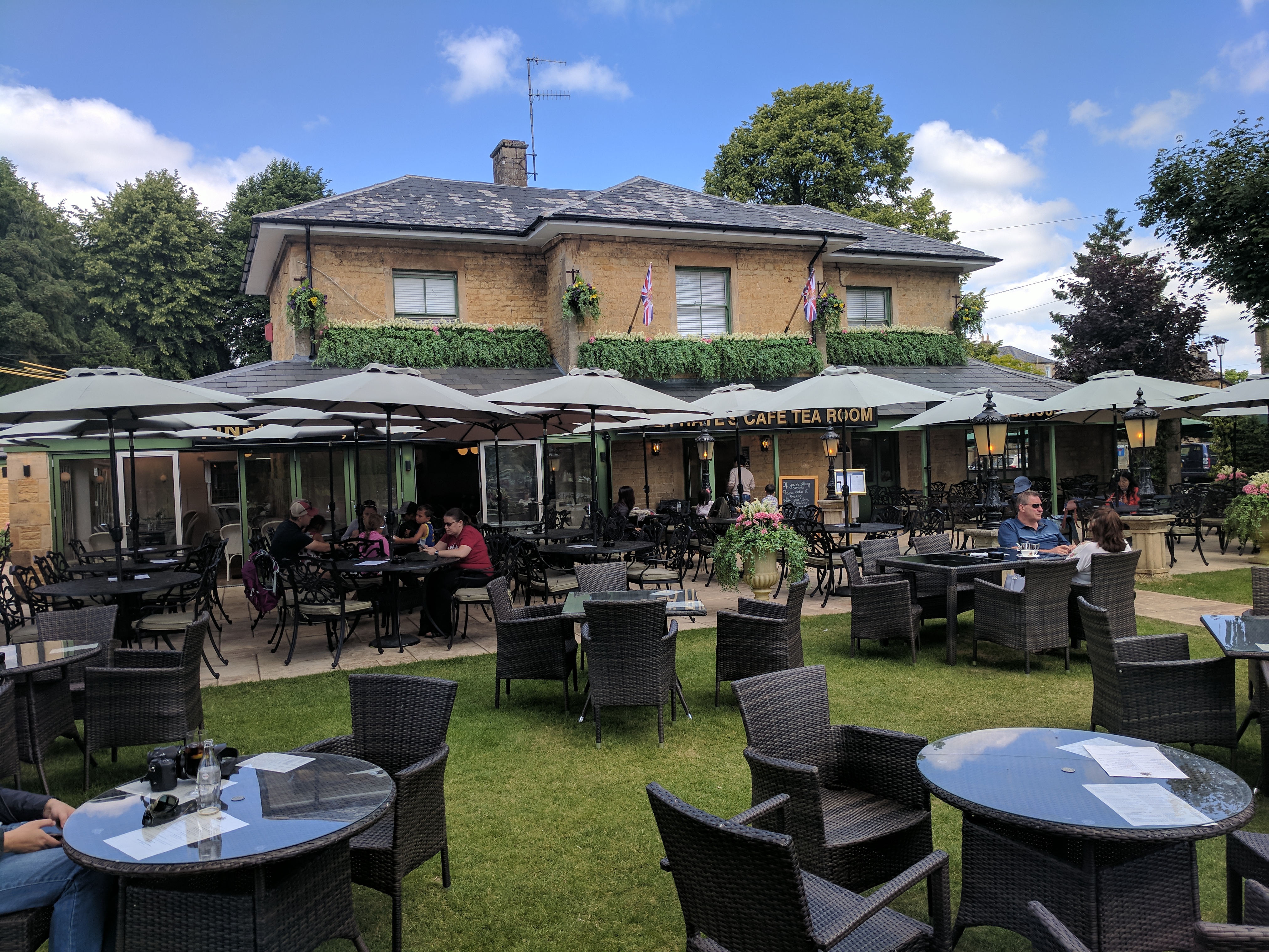
Our choice for lunch was De La Haye’s Cafe Tea Room, where I indulged in what might be my favorite traditional British dish, bangers and mash. The tiny bit of green onion in the mashed potatoes was a brilliant touch. Just across the street from the cafe was Bourton’s war memorial, listing names of the village’s young men lost in World War I and II. Even the smallest village we visited had one of these, a reminder of what a toll these conflicts took on every corner of Britain.
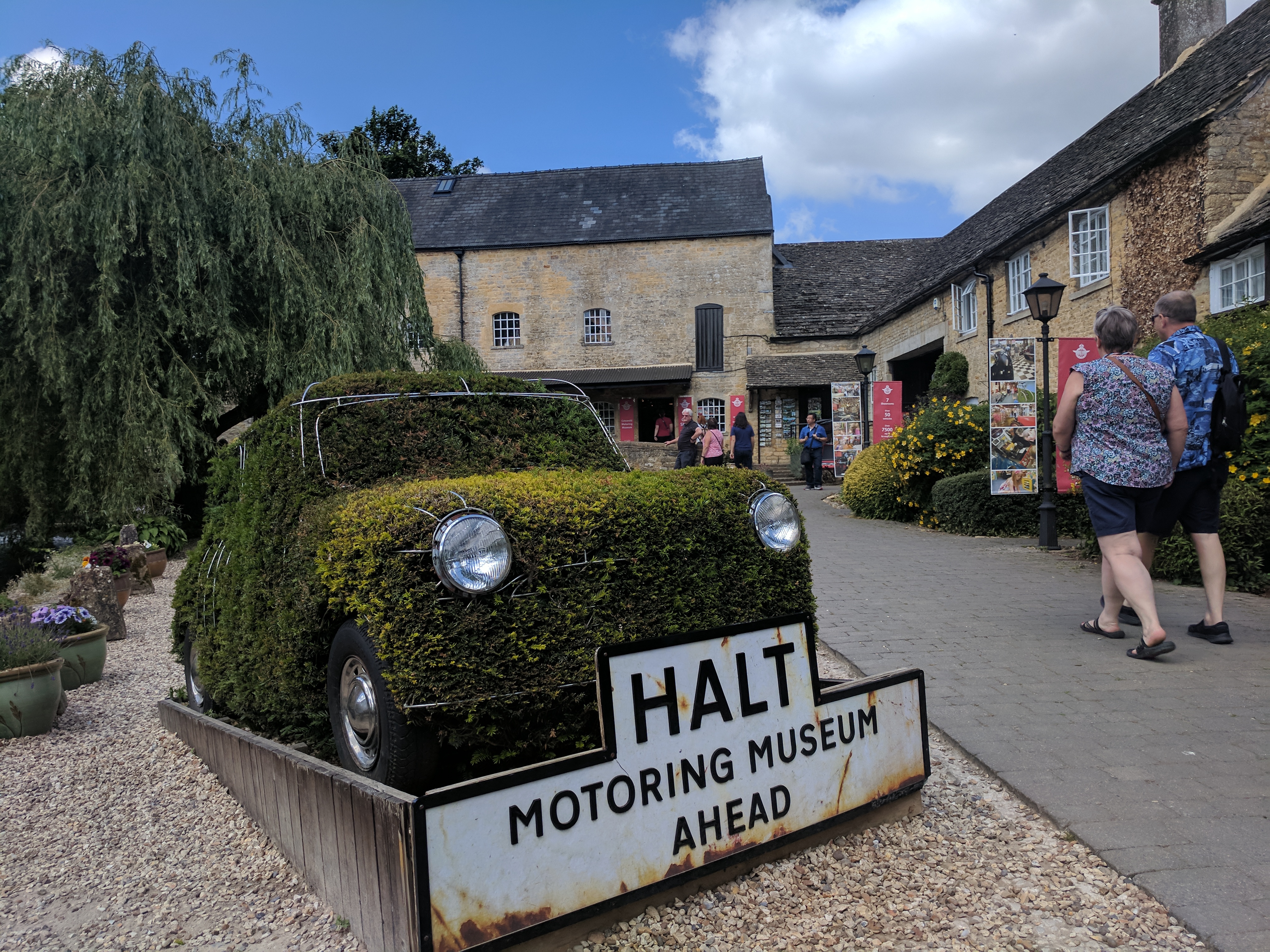
After lunch, some of our party went to the Motoring Museum (“Bourton’s #1 Tourist Attraction”) next door, and a few of us (myself included) wandered back to River Cottage to while away the afternoon reading, dozing, and watching World Cup (Iceland v. Nigeria).
Not even a reach-in.
My father-in-law and brother-in-law are both super-busy-type businessmen, and a two-and-a-half week sojourn overseas was only possible for them thanks to modern technology. Most late afternoons they would have their ever-present laptops open and tabbed up with memos, spreadsheets, and schematics that I could never presume to come close to understanding, while I, as a teacher on summer break, filled my time making ice and peering into the cupboards for more crackers.
River Cottage living room.
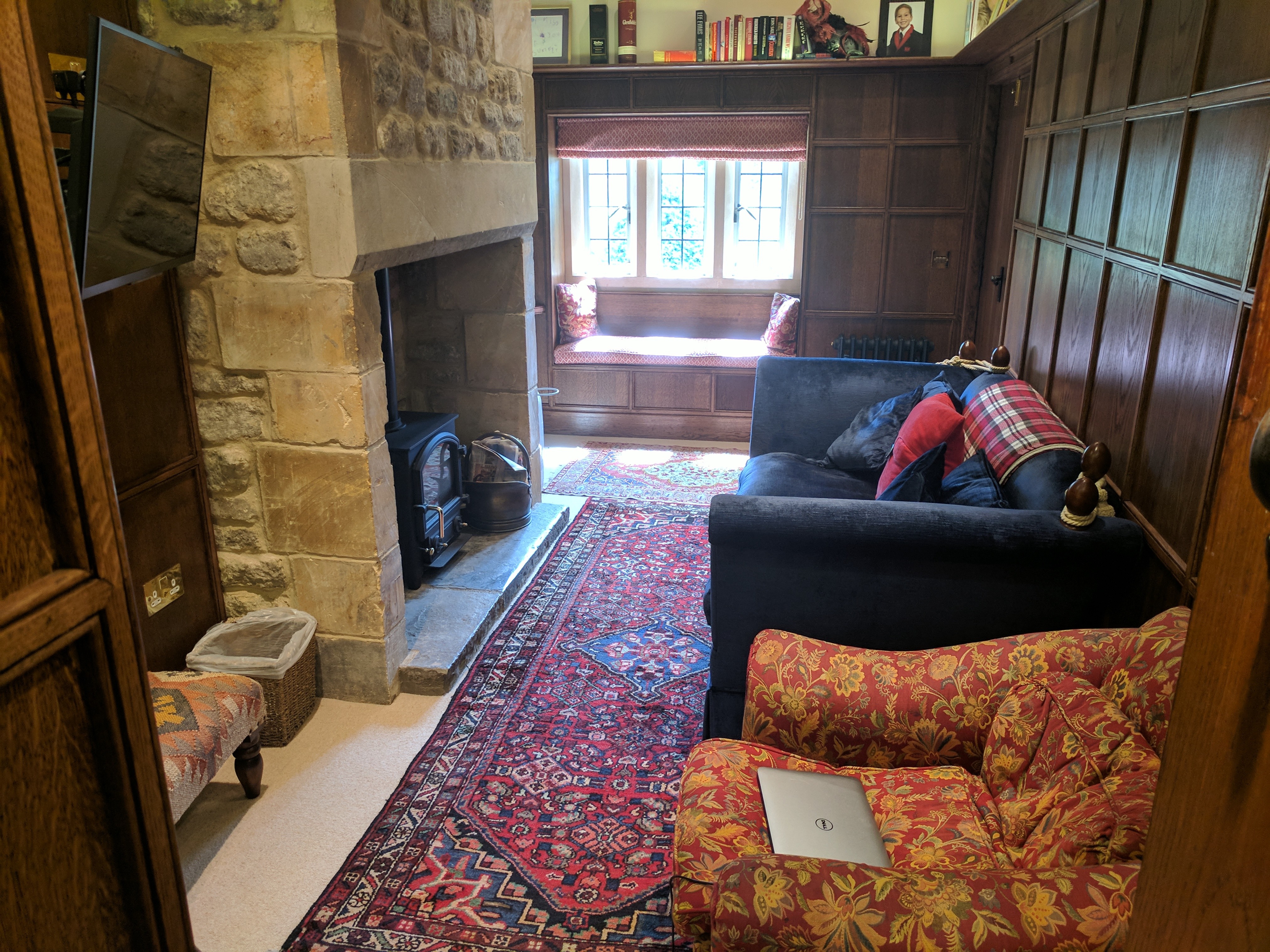
Because I had so much extra time to stake out our lodgings, I commandeered the best room in River Cottage for myself. Behind a small, nondescript wooden door off the kitchen — it looked like it led to a closet or pantry — was a tiny, perfect, wood-paneled study with a low, exposed-beam ceiling, the world’s softest armchair, and a flat-screen TV mounted next to the stone fireplace. This was where I would spend the next few evenings finishing my Nelson biography, sipping whiskey with painstakingly harvested ice, writing up the notes that are the basis for what you’re reading right now, and ignoring accusations of being anti-social. The only downside was the window was right on the heavily-traveled footpath through the village center. On one memorable occasion a Japanese tourist cupped his hands and stared directly into the window, only to find me, drink in hand, staring right back. I raised my glass in friendly salutation, but he seemed terrified and scampered off. I don’t know what he was expecting to see.
Recessed door to my hideway.
Introvert’s paradise.
River Cottage back garden and sunroom.
Dinner that evening was at Lords of the Manor, just outside Upper Slaughter. We took a different footpath in a different direction, passing by Lower Slaughter’s historic Old Mill, through sun-dappled woods, and sheep pastures where the sheep barely bothered to get out of our way.
Sheep pasture selfie, on the way to Lords of the Manor.
Located in the lower floors of a manor house dating from 1649, Lords of the Manor recently lost its Michelin star due to a change in chefs, but I have no doubt it will soon earn it back. The 19th-century Witts family once occupied the house and grounds, and were the “lords” referred to in the restaurant’s name, and their manor was Upper Slaughter and its surrounding lands. The manor house sits on eight acres of gardens and lawns.Continue reading →
We were leaving London today and heading northwest for a stay in the Cotswolds. There was some talk early in the planning stages of the trip of renting a few cars and driving ourselves around the sceptered isle. However, the whole everything-on-the-other-side aspect of traffic and steering wheels would have undoubtedly resulted in getting lost/separated, damaged vehicles and property, possible injuries, and harsh accusations of incompetence from local drivers and pedestrians. So we decided the safest bet was to rent a van that could transport the eleven of us and hire a local driver. Pricey as it may seem on the surface, we figured we were saving money on foreign lawsuits in the long run.
Our driver, Sebastian, sported a look best described as “Russian mob,” but seemed friendly enough as he loaded our approximately 11,000 pieces of luggage while dragging on his ever-present cigarette.
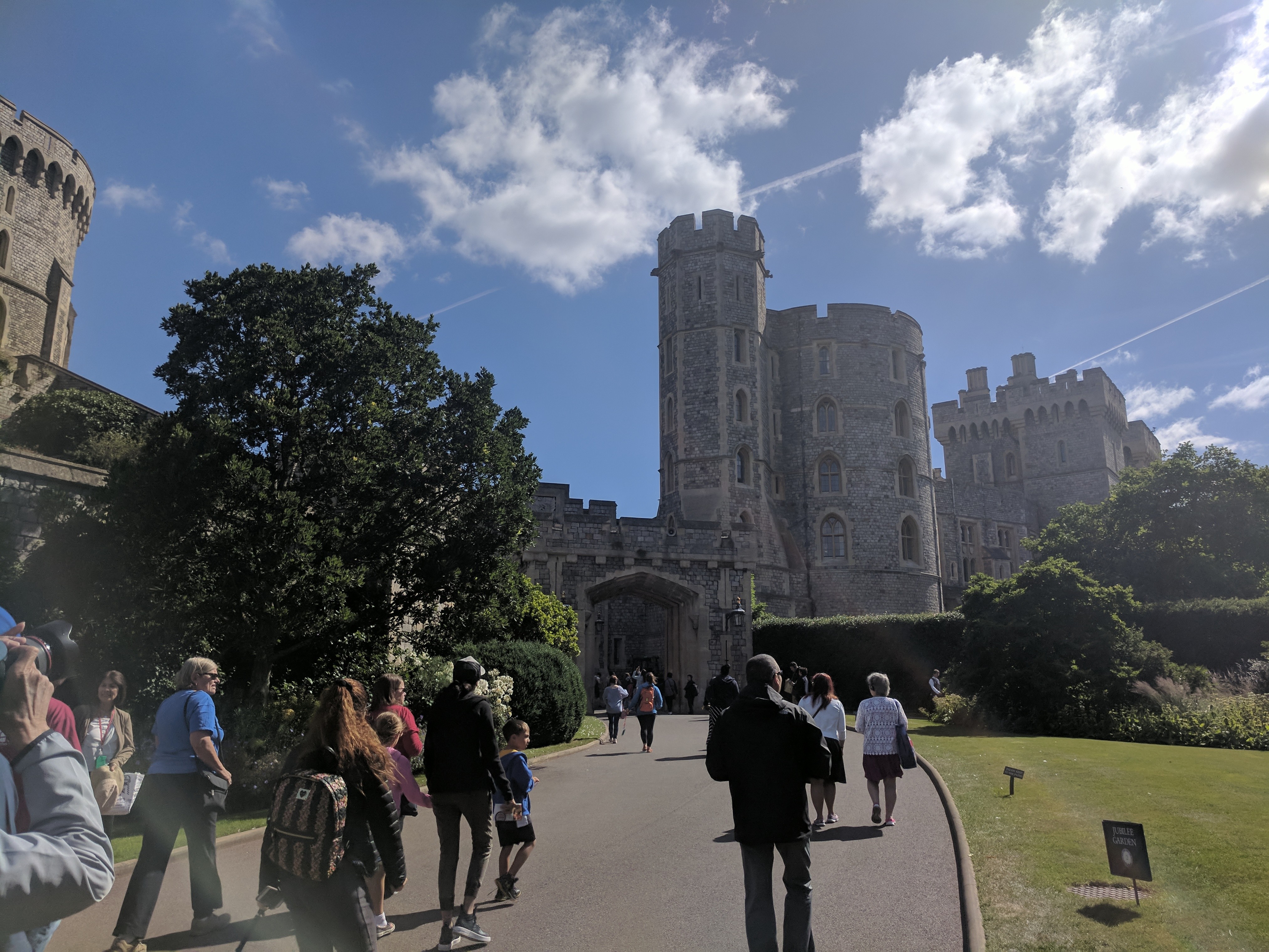
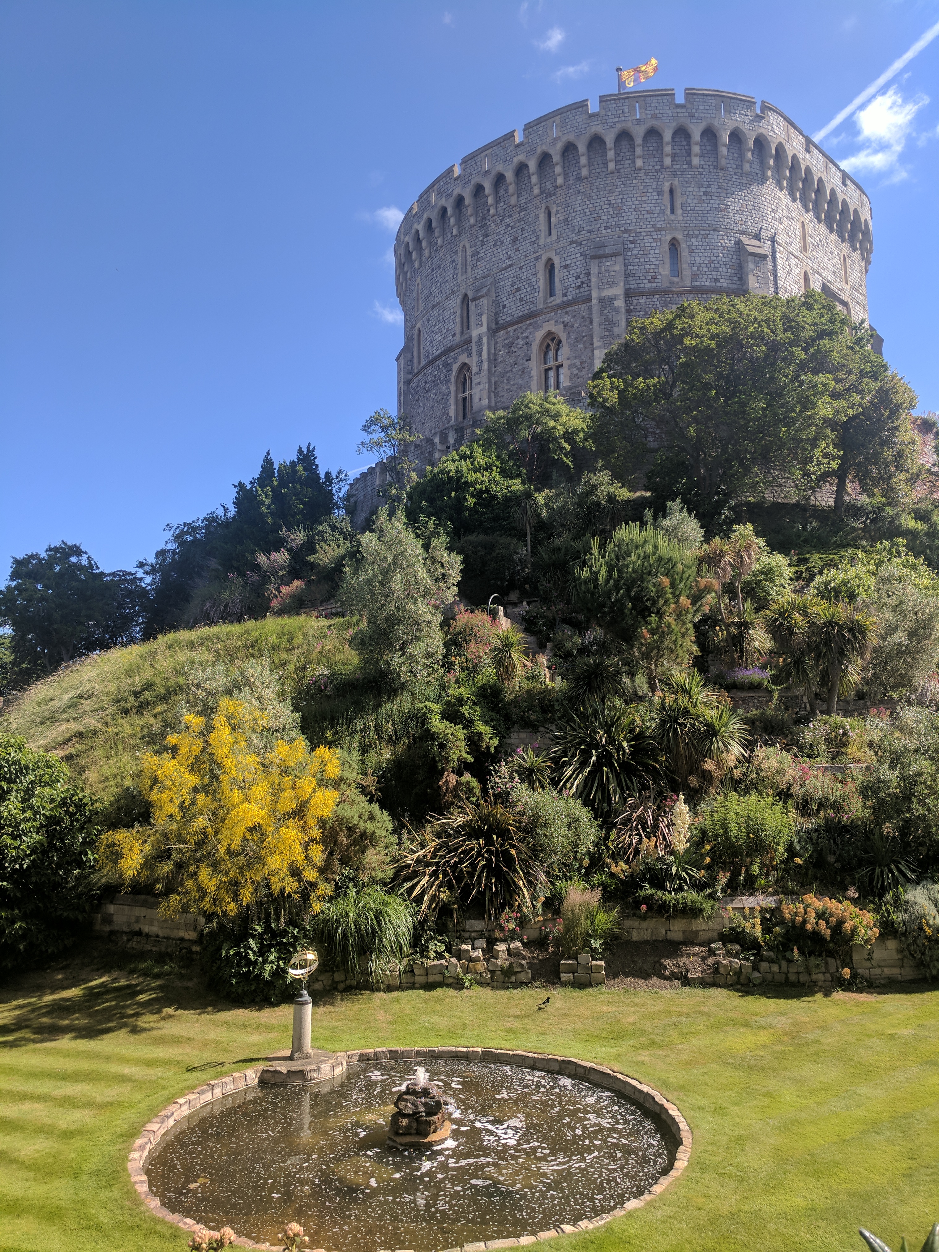
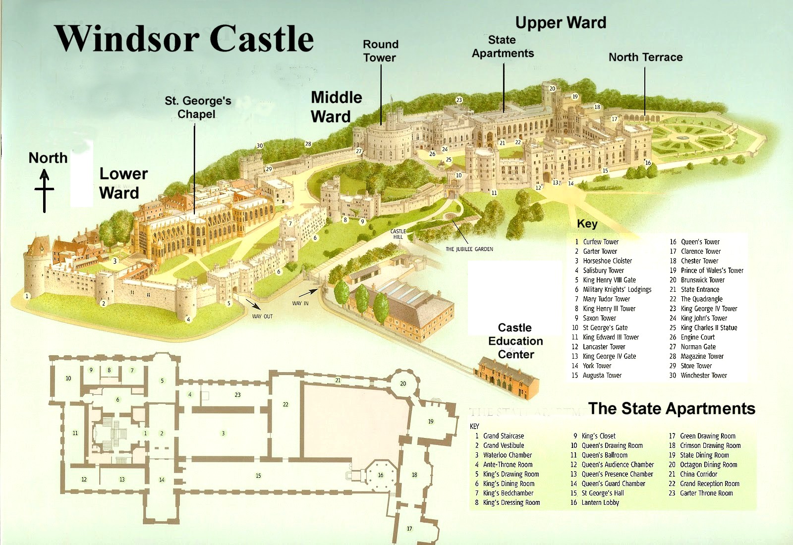
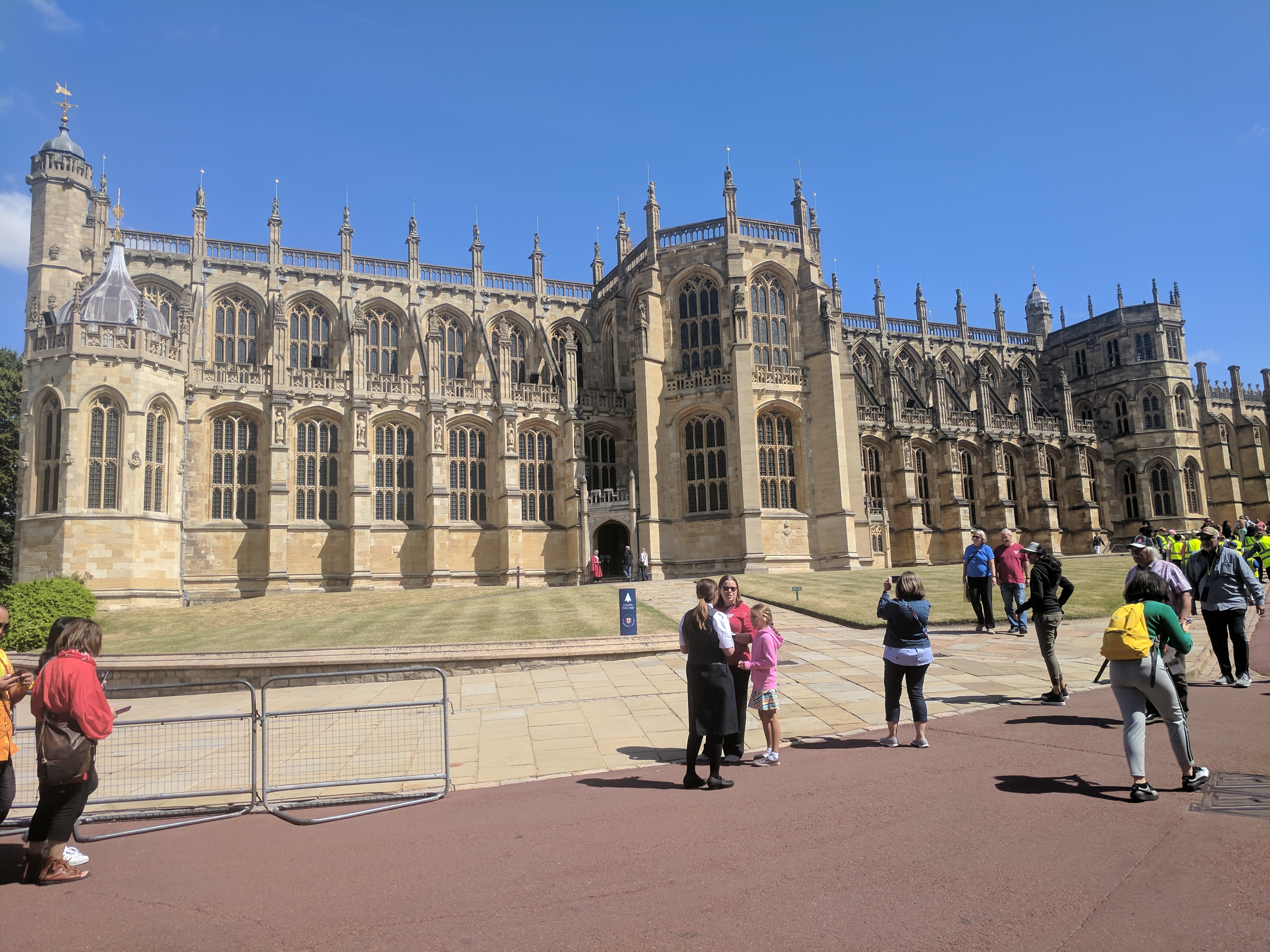
There were two sightseeing stops on the way, and the first one came after traveling west for less than an hour: Windsor Castle, which had been much in the news due to the royal wedding of Prince Harry and Meghan Markle taking place there about four weeks previously.
Windsor is the largest occupied castle in the world, and the oldest in continual use. Like the Tower of London, Windsor Castle was begun by William the Conqueror in the late 1000s as one of a series of defensive forts ringing London and its environs. It was a wooden keep at first, replaced with stone by William’s immediate successors. The reign of Henry II (1154-89) saw extensive upgrades. Work was continued by Henry’s bumbling youngest son, King John, who holed up in Windsor Castle when his own nobles revolted against him. This resulted in him signing the Magna Carta in 1215, which, in theory, was the first set of limitations placed on monarchical power by a monarch’s subjects. (Future monarchs felt free to ignore it for the next several centuries.)
The reign of Edward III (1327-77), who was born at Windsor, saw the most notable expansions and improvements to Windsor Castle since its original construction, although it didn’t go smoothly. The Black Plague wiped out much of the labor force, and the series of dynastic conflicts known as the Hundred Years’ War diverted funds and manpower. The result, however, was impressive — Windsor became the largest and most comfortable of the royal residences, and was “the most expensive secular building project of the entire Middle Ages in England.”
Later in Windsor history, King George III went famously insane, as portrayed on stage and film, and spent the last twenty years of his life raving away deep within the castle, sporting a Howard Hughesian long white beard. Queen Victoria’s beloved consort, Prince Albert, died in the castle’s Blue Room in 1861, and the grieving royal widow insisted on the room being kept just as it was when he was alive, right down to the servants changing the linens and keeping the water pitcher full.
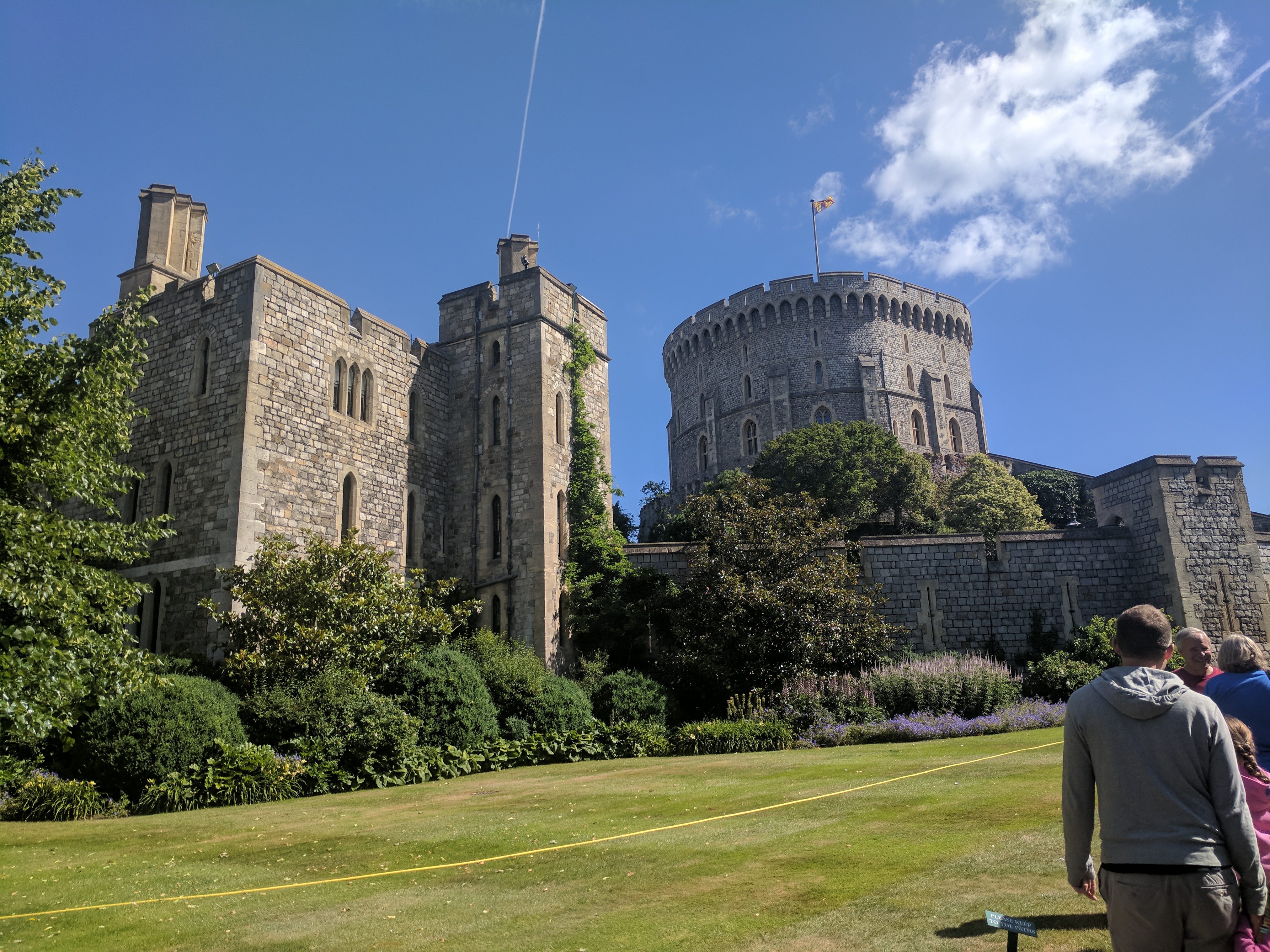
Windsor had become a popular royal “second residence” away from London for its heavy defenses when needed, its luxurious apartments, and its extensive grounds stretching through a beautiful woodland setting. The rambling expansiveness and general footprint of the castle was established at this point, but the towering battlements and turrets now visible for miles around date from extensive rebuilding during the 18th and 19th centuries.
The day was mostly clear, with a refreshingly crisp breeze blowing away memories of humid London. As we walked up the path toward the castle, we spotted the Queen’s royal standard fluttering above the Round Tower, meaning the monarch was in residence, although it was highly unlikely we would bump into her. Everyone knows about her preference for Windsor over Buckingham, and she was still lingering there a month after her grandson’s big wedding.
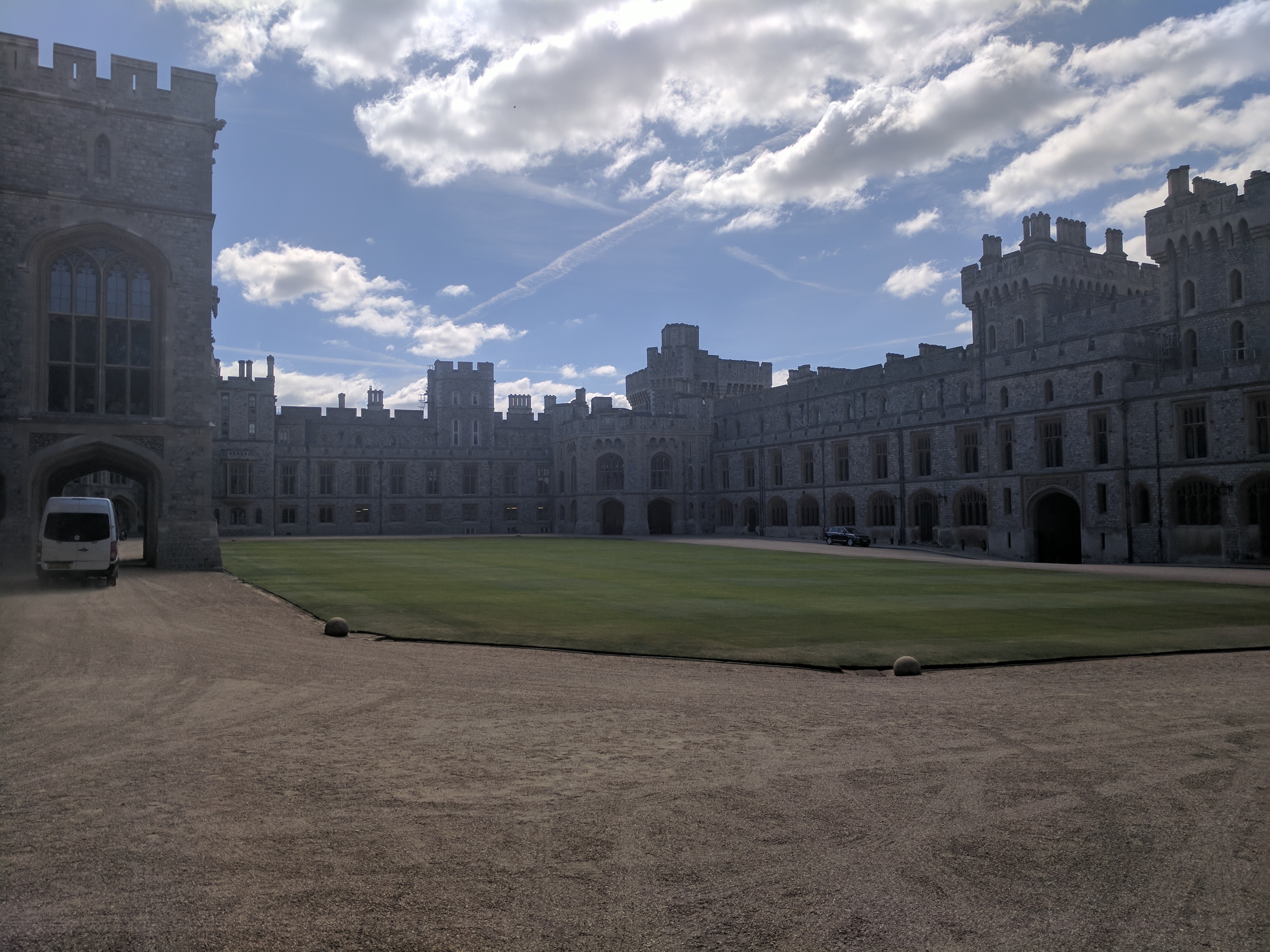
We made our way around the Round Tower to the north terrace and entrance to the State Apartments, which were open to the public, but no photography was allowed. The State Apartments are mostly Georgian/Victorian in origin, and were severely damaged in a 1992 fire. Most of the furniture and artwork was saved, but the rooms themselves required extensive restoration, which was mostly completed within a year. (One of Windsor’s most popular features, Queen Mary’s Doll House, was closed the day we were there, along with St. George’s Hall and Waterloo Chamber.)
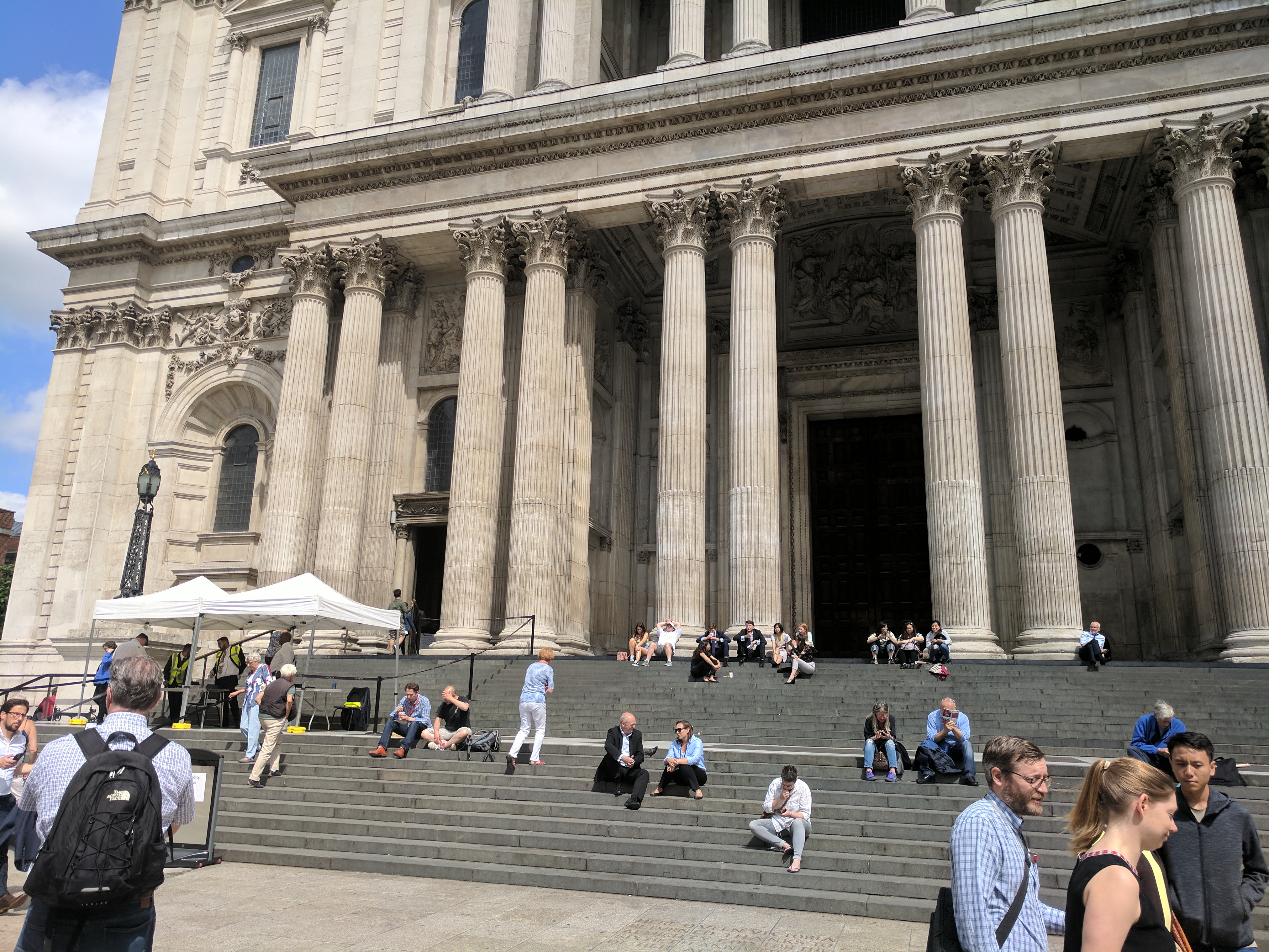
The State Apartments are entered through the arched Grand Staircase, overlooked by a marble statue of George VI, the current monarch’s father and the stammering hero of The King’s Speech. The statue was flanked by an impressive collection of weapons and armor. The Grand Vestibule beyond is also kind of a military mini-museum. On display is the fatal bullet dug out of Admiral Nelson. (The coat it passed through is in the National Maritime Museum, remember?) We then passed through suites of rooms dedicated for the use of the king, and a separate suite for the queen.
Every room in the State Apartments has a different architectural style — Classical, Gothic, Rococo, etc. — although they are so lavishly wallpapered or damasked and hung with dozens of works of art I couldn’t really notice the differing details of the actual construction. As the name implies, these rooms were once living quarters, but living quarters designed for use during state business, so they retained an element of “publicness.” People were coming and going all the time, even in the “King’s Bedchamber.” (In the time of Henry VIII, visitors were warned against leaving their dirty dishes “upon the King’s bed, for fear of hurting the King’s rich counterpoints.”) The royal family’s truly private living quarters were — and still are — elsewhere in the castle.
We then headed down the path into the Lower Ward to St. George’s Chapel, the primary burial place for the royal family once Westminster Abbey was full to bursting. The late-Gothic chapel’s construction was begun in 1475, and completed in 1528. St. George is the patron saint of England, despite the fact that he was a third century Greek-born Roman soldier who never saw England (he spent much of his life in what is now Turkey), and he never certainly never slew a dragon (dragons aren’t real).
St. George’s Chapel, Windsor Castle.
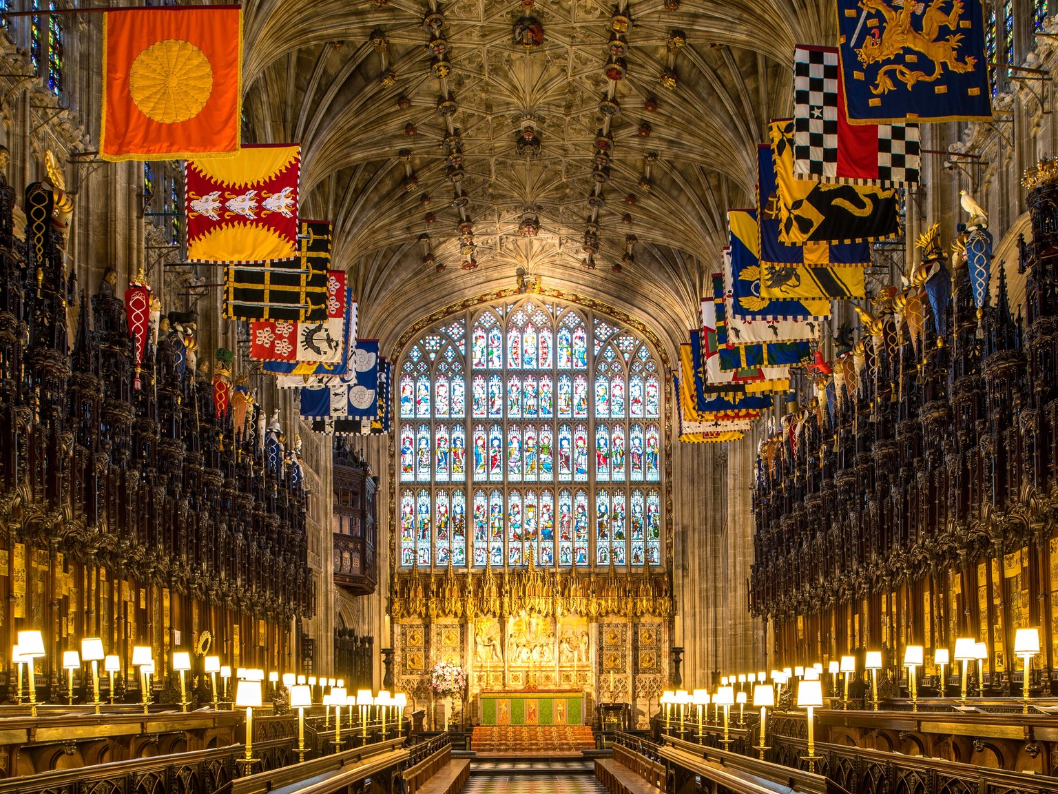
The interior is very reminiscent of Westminster Abbey, although on a much smaller scale. There is one stained glass window from the medieval era, the rest is Victorian. The wooden seats of the quire are English oak, originally felled in the nearby forest. The 75-foot high vaulted ceiling is lined with colorful heraldic banners. In the floor of the quire is the tomb of Henry VIII.
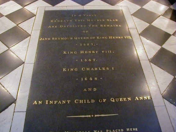
As his weight skyrocketed and his health declined, Henry VIII planned an elaborate exterior mausoleum for himself and his already-dead (of natural causes) favorite wife Jane Seymour on Windsor’s grounds. Once he expired, his remains were placed in a temporary vault in the floor of St. George’s Chapel. Since his overbearing regal presence was no longer around the crack the whip, no one was really motivated to complete (or even begin, really) the mausoleum, and the temporary vault became permanent. The vault was cracked open a hundred years later, and the body of executed Charles I — his head sewn back on — was plopped in the vault on top of Henry and Jane. A stillborn infant of Queen Anne was tossed in for good measure fifty years after that. The vault in the quire became a kind of macabre utility drawer.
Elsewhere in the chapel, you can pay your respects to George III, our old foe from the Revolution. He is also entombed in the floor, in a spot highly susceptible to Americans dancing a little patriotic jig. (A shame, really. Apart from the bad timing of being king in 1776, and the later mental illness, George III was one Britain’s more capable and sensible monarchs. He was laughed at behind his back by his courtiers for remaining faithful to his wife and not taking one or more mistresses.)
Queen Victoria and Prince Albert are buried in a large mausoleum on the adjacent (and much more private) Frogmore Estate grounds.
The newest addition to the St. George’s interior is the George VI Memorial Chapel, completed in 1969 in honor of the king who had died seventeen years earlier. George VI’s remains were moved here, and he is buried alongside his wife, Elizabeth (the “Queen Mother” who died in 2002 at the age of 101), and his daughter, Princess Margaret. Space is reserved for the current queen and her consort, Prince Philip.
One of the most attractive features of Windsor Castle is the one that we didn’t have time to explore — the 5000 acres of Windsor Great Park to the south of the castle. Full of ancient oaks, deer, and rambling paths and creeks, this expanse of broadleaf woodland is connected to the castle by the Long Walk. The only interruption to the idyll is jets coming in for a landing at Heathrow Airport, which is practically in Windsor’s backyard.
The Long Walk leading from Windsor Great Park to the castle.
After our illuminating trip through the world of the Royal Society, we were ready for lunch. We chose the restaurant located on the ground floor of the Grand Hotel, within sight (“a mere 77 paces”) of Trafalgar Square. Built in the 1880s, it was once the Hotel Victoria. Seven floors, five hundred rooms, electric lights…and four bathrooms (it was the 1880s, after all.) Its ballroom was one of the biggest in London, and an elegant billiard room filled the basement. It all ended with World War II. In 1940, the Ministry of Defense took over the hotel, and it became one of the many nerve centers of the British war effort. Primitive computers filled what was once the restaurant. The ballroom became a lecture hall, where military experts and intelligence officers briefed civil defense workers. After the war, the old Hotel Victoria was a musty shell of its former self, still owned by the government but underused and in bad shape. After finally being sold, it returned to the hospitality business in 2010, reopening as the Grand at Trafalgar Square.
The Grand’s restaurant, known as Boyds Grill & Wine Bar, was lit by vintage chandeliers from 1914, and the original marble and onyx walls were once again in evidence, having been covered over during the war years. After a starting course of duck wings, Shannon had the sea trout, I had the cottage pie, and Cam had their “hot dog of the week,” which I regretted not getting myself. We don’t keep hot dogs in the house because they’re fundamentally disgusting — the processed-scrap, bottom-feeders of the lunch meat world, not even fit to be categorized as a “sausage.”
Yes, they serve hot dogs.
But goddamn, do I love a grilled hot dog. I once made a vow to myself to never turn down the opportunity to have a hot dog outside of the house, be it a ballgame, barbecue, or gourmet restaurant. I broke that vow today, and was a little remorseful as I saw Cam devour his southwestern-themed dog, covered in cheese and hot sauce. The cottage pie was fine, though.
After lunch, Cam and I were the only ones really interested in seeing the Churchill War Rooms. Shan and her parents hopped a bus to head back to the Airbnb for an afternoon of rest and reading. We would meet again that evening in London’s East End for another walking tour, this time dedicated to the crimes of Jack the Ripper. Cam and I struck out on foot towards Whitehall.
We turned southwest at Trafalgar Square, passed under the 1912 structure known as the Admiralty Arch and began walking down the Mall, which, if we followed it all the way, would lead us to Buckingham Palace. We turned left on Horse Guards Road instead, heading towards the Churchill War Rooms, and found ourselves in the sector of London known as Whitehall.
The Admiralty Arch, gateway to Whitehall
Whitehall was named for Whitehall Palace, which once occupied this entire area. The old Palace of Westminster, since 1049 the seat of the English monarchy, was viewed with increasing royal disfavor by the early Tudor era. With its cold medieval feel and immense echoing hall, Westminster Palace was an outdated relic. It was being used more and more for meetings of Parliament, anyway. A hundred yards downriver was York House, owned by Henry VIII’s discredited advisor Cardinal Wolsey. Once Wolsey had fallen from favor in 1530, Henry swiped the mansion for himself, renamed it White Hall, and turned it into a rambling, 1500-room edifice with luxurious private apartments for both king and whoever his queen happened to be at the moment. No more would the king’s court live and work communally in a drafty, stone-floored “great hall.” Now there would be smaller, plusher rooms. The king would meet people in a “presence chamber.” Business would be conducted mostly behind closed doors.
Whitehall Palace. The Banqueting Hall is on the left.
The era of Whitehall Palace came to an end in 1698, with its near-total destruction by fire. The official royal household moved on to St. James’s Palace. The only structure of Whitehall left to see today is its Banqueting House.
The Banqueting House today.
The street called Whitehall is now home to most of the administrative offices of the British government. The home and offices of the Prime Minister, Downing Street, is a side street off of Whitehall. The term “Whitehall” is often used as shorthand for the entire British government (or at least its foreign policy arm), much as “Wall Street” represents the American financial world.
Underneath the Treasury Building, not far from Downing Street, is a set of bomb-proof basement rooms from which World War II Prime Minister Winston Churchill directed the course of Britain’s role in the conflict. In various forms, these subterranean bunkers, including a Cabinet Room and a Map Room, have been open to the public since 1984. After an expansion to include Churchill’s private quarters and a major 2005 remodel, the Churchill War Rooms (now operating under the auspices of the Imperial War Museum) saw a surge in popularity. So much so that when Cam and I approached them, our hearts sank to see the size of the line. Near the beginning of the line, an official-looking portly gentleman in a vest and holding a shade umbrella kept repeating the mantra of “Two-hour wait at this point, ladies and gentlemen, two-hour wait. Two-hour wait at this point, ladies and gentlemen, two-hour wait…”
We bailed, and decided on the spur of the moment to make the obligatory Beatles fan pilgrimage to Abbey Road in the upscale neighborhood of St. John’s Wood.
The abbey the road was named for was the Kilburn Priory, a small community of nuns that existed from 1134 to 1536, nothing of which remains except some chunks of masonry and an old well.
Behind its graffiti-covered outer walls, the front of Abbey Road Studios looks like the 1831 Georgian townhouse it once was. When the Gramophone Company acquired the property in 1929, it built its recording facility on top of what was once a very extensive back garden. The townhouse facade has always been used as administrative offices only. The Gramophone Company merged with a few others to form Electric and Musical Industries, Ltd. (EMI).
One of EMI’s subsidiary record labels, Parlophone, signed a promising young band from Liverpool in the summer of 1962, and they spent almost all of their remarkable recording career within the confines of what was then called simply “EMI Recording Studios.” The facility has three recording spaces — massive Studio One, designed for large orchestras, mid-sized Studio Two, and the little Studio Three. The Beatles made use of all of them at one point or another, but their home base was Studio Two. The early puppy-love singles which rocketed them to fame, the twin masterpieces Rubber Soul and Revolver, the psychedelic epic Sgt Pepper’s Lonely Hearts Club Band, the fragmented but no-less-epic The Beatles (“White Album”), and almost everything else — all cooked up in that one building, mostly in that one room.
Going over the Hard Day’s Night screenplay while recording “And I Love Her,” Studio Two, February 1964.
Studio Two, Abbey Road.
Their Get Back project, an attempt to perform a live concert of all-new material in January 1969, did not go well. Internal tension between the band members, and collective boredom with the whole Beatles thing, was at its height*. The desultory run-throughs of the new songs were shot by a documentary crew (at Twickenham Film Studios) and the songs were duly put on tape under the supervision of Glyn Johns (at their self-owned Apple Studios, not at Abbey Road). The “concert” ended up being a brief lunch-hour performance from the roof of their Apple office on Savile Row. Iconic as it is now, the rooftop show seemed anti-climactic back then. Apart from the title single which came out that spring, the Get Back project was temporarily shelved.
There actually wasn’t a clear division between the end of the Get Back sessions and the beginning of what came to be Abbey Road. As late as April 1969, they recorded things like “Oh! Darling” and “Something” under the impression they were for the completion of the earlier project. When it became clear the Get Back project was a fizzle (for now), the Beatles decided put their differences aside, summon their long-time producer George Martin, and craft one more well-polished studio gem as a proper cap to their career. Over the summer of ‘69, the walls of Studio Two were witness to the creation of “Come Together,” “Octopus’s Garden,” “Here Comes The Sun,” “Golden Slumbers,” “Because,” and several others that formed the sonic tapestry of their final project**, including the aptly titled “The End.” The resulting album is a lot of people’s favorite — it’s filled with good energy, more close three-part harmonies than any of their recordings in years, and tinged with the perfect amount of elegiac, end-of-the-ride sadness. (Despite this, the ever-mercurial Beatles did briefly entertain plans for a follow-up album, with a democratic track listing of four Lennon songs, four McCartney songs, four Harrison songs — and two for Ringo if he wanted — but business/managerial disputes sunk the idea, and ultimately the band.)
2.5 million people take a peek at the crown jewels every year. The line leading into the Tower of London’s Waterloo Block for viewing them wrapped around the east side of the White Tower, but the wait wasn’t over when we finally entered the building. Disneyland-like, the line continued to wind back and forth once we entered the building, with large video screens showing scenes from various coronations in an attempt to help the time pass as the queue shuffled along. Fairly quickly, it must be said.
The reason the line moved quickly was revealed when we finally entered the crown jewels display area — visitors hopped on an airport-style moving sidewalk and were moved past the collection at a pretty speedy clip. No lingering was possible, and no photos allowed.
The collection known as the “crown jewels” is made up of 140 individual pieces — crowns, scepters, orbs, swords, robes, maces, trumpets, plates, and other items, most of them symbolically representative of some element of the British monarch’s reign. Several of them are used in the coronation ceremony at Westminster Abbey. Some of them are worn by the newly-crowned monarch in the ceremony, some are handed to him/her, some are simply shown to him/her, who then kind of solemnly nods at them in an approving manner and they’re placed somewhere nearby.
The original crown jewels, from the time of Edward the Confessor, were mostly lost when King John’s caravan attempted to cross the tidal estuary known as the Wash in 1216. They mistimed their crossing, and high tide rolled in and claimed several wagons, including the treasure wagon. The next set of crown jewels was physically destroyed on the orders of Oliver Cromwell, who had toppled the monarchy and installed himself as “Lord Protector” in 1653. The crown jewels, he said, were symbols of the “detestable rule of kings.” Cromwell’s rule as essentially a military dictator was pretty detestable itself, and when the monarchy was restored in 1660, the new king, Charles II, ordered a replacement set of crown jewels to be crafted. The collection has been growing ever since, with the latest addition being a set of bracelets made for Elizabeth II’s coronation in 1953.
The most important accessories of the coronation: St. Edward’s Crown, the Sovereign’s Orb (topped with a cross, symbolizing God’s dominion over earth), the Sword of Offering, the Sovereign’s Dove Sceptre (symbolizing the monarch’s position as head of the Church of England), and the Sovereign’s Cross Sceptre (symolizing the monarch’s position as head of state). To the left is the hollow golden eagle called the Ampulla, which contains the holy oil which will anoint the new monarch. The anointing is done with the Coronation Spoon, the oldest surviving item in the crown jewel collection. Dating from the late 1100s, it was hidden when the rest of the jewels were destroyed.
The centerpiece of the collection is the St. Edward’s Crown, made of 22-carat gold and encrusted with over 400 jewels. This is the crown placed on the head of the monarch at the moment of coronation, but it isn’t worn for very long — weighing in at five pounds, it is said to be incredibly uncomfortable. For most of the coronation ceremony, and for all other state occasions, the monarch wears the similar, but lighter, Imperial State Crown.
After being whisked by the crown jewels so fast we could feel the breeze in our hair, we were deposited outside the Waterloo Block, and concluded our visit to the Tower of London. Our little family trio broke off from the main group again, leaving them to do something more kid-friendly. We headed up toward the Tower Hill tube station to see the oldest thing in London.
The Romans founded London in the first century A.D., and inhabited the city for almost 400 years. By the second century, it was enclosed by a protective wall. London had all the features of a major Roman settlement — a forum, an amphitheater, public baths, a large fort for its garrison of soldiers. All now long gone, or deep under the modern city. But a few fragments remain, mostly uncovered by Nazi bombs in World War II, or by digging foundations for new construction. The most noticeable of these fragments are some sections of the old wall, which once ran for 2.5 miles and defined the original shape of the city.
The section near the Tower is one of the largest. Buildings used to back up against both sides, but they were torn down in the early 1900s, revealing this portion for the first time in centuries. The first nine feet or so (up to the top row of red tiling) is Roman, everything above that was added during the Middle Ages.
Perimeter of the London walls.
We continued eastward from Tower Hill in search of a suitable place for lunch. We soon found ourselves at St. Katharine Docks, named after the medieval hospital that once occupied the site.
St. Katharine Docks, 1800s.
The docks were used for commercial shipping purposes from 1828 to 1968, then sold to developers. Today it is an upscale shopping and dining area, surrounding a small yachting marina.
We chose Bravas Tapas, which specialized in the Spanish Basque style of dining indicated by its name — multiple small dishes of finger food shared around the table. We sat outdoors on the water, and picked two dishes each, including brava potatoes, piquillo-wrapped prawns, bacon-wrapped quail, and roasted Iberian pork belly. Even including some of the fancier places we found ourselves in, it was some of the best food I had on the whole trip.
The prawns
The quail
The pork belly
We hopped a bus to St. Paul’s cathedral.
Cam on the bus to St. Paul’s
St. Paul’s, along with the Palace of Westminster and the Tower Bridge, is one of the three iconic sights of London. It occupies Ludgate Hill, the highest point within the old city walls (a dizzying 58 feet above sea level). It is possible that the Romans built a temple to the goddess Diana on this spot, but it was long gone by the time Christianity permanently came to England in the early Middle Ages. Various cathedrals occupied the hilltop since the 600s. The Normans constructed the edifice known as “Old St. Paul’s” beginning in 1087. Like its successor, Old St. Paul’s dominated the skyline, with a spire reaching almost 500 feet above the ground. After Henry VIII broke with the Catholic Church and established the Church of England, St. Paul’s became the “mother church” of the new religion.
Old St. Paul’s
The old cathedral was decaying by 1666, and there was already hesitant talk of pulling it down and starting fresh. The Great Fire made the decision easy for them. Good old Sir Christopher Wren designed the New St. Paul’s, replacing its spire with a dome, which was completed in 1708.
New St. Paul’s
The other reason, besides the Fire, that the face of the City of London is so new is that central London was a primary target of German bombs in the Blitz of 1940-41, which wiped out much of the city that had been re-built after the Fire. St. Paul’s took a couple of direct hits, but its thanks to its immense bulk, it survived, and it became a symbol of English fortitude in the face of Nazi aggression.
We approached the steps of the great cathedral, and I suddenly remembered that the steps of St. Paul’s were the site of the “Feed the Birds” song from Mary Poppins, featuring Jane Darwell’s silent performance as the Bird Lady, selling bread crumbs for “tuppence [two pennies] a bag” to people who wanted to feed the pigeons that swarmed the area. Darwell was an Oscar-winner (for her performance as Ma Joad in 1940’s The Grapes of Wrath) brought out of retirement at age 84 by her admirer Walt Disney for this tiny part. It was only on a recent re-watch of the film that it dawned on me that the song was actually a metaphor for giving to charity. I always thought it was about feeding a bunch of filthy pigeons. I looked around and saw only a handful of pigeons. I checked the St. Paul’s website later, and there’s a notice at the bottom warning people against feeding the pigeons. I guess that could be a metaphor, too.
My own charitable spirit was stretched to the breaking point when I saw it would cost us £18 each to enter the cathedral. Instead, I took a couple of pictures (we were too close to capture the massive dome properly), and headed up Little Britain Street, through Postman’s Park, to arrive at the Museum of London.
The Museum of London, appropriately located at the address of 150 London Wall, is dedicated to examining the history of the city, from the Stone Age to present day. It is the largest urban history collection in the world. Its modern-looking (for 1976 — it looks a little funky today) building was constructed in the 1970s on the gutted bombsite that was notable for having received the heaviest concentration of falling ordinance during World War II. The museum was great in a different way from the glorious jumble of the British Museum — it was streamlined and logically ordered in a chronological fashion. The British Museum demands the visitor dig deep, the Museum of London is set up in a way that the casual I’ve-just-got-an-hour visitor can have an enriching experience, as well as those who like to linger longer.
Although I had only briefly glimpsed the Monument to the Great Fire that morning, it had stayed in the back of my mind, and I lingered longest in the War, Plague, and Fire gallery. As mentioned in the previous entry, most Londoners believed the fire to have been deliberately set in the bakery by Catholics as an act of religious terrorism. This belief was further fueled by the confession of a man named Robert Hubert, a Frenchman who claimed to be Catholic and working with a gang of Catholic insurrectionists. Despite changing his rambling, disjointed story several times, and despite testimony from everyone who knew him that he was a lifelong Protestant, well…a confession was a confession, and he was hung before the year was out. Not long after the Monument went up, a smaller plaque, now on display at the museum, was placed on the exact spot where the bakery once stood:
“Here by the permission of Heaven, Hell broke loose upon this Protestant city from the malicious hearts of barbarous Papists, by the hand of their agent Hubert, who confessed…”
The plaque was finally removed in the 1700s, not due to a change of heart or because the truth was established, but because the crowds stopping to read it were blocking traffic.Continue reading →