[NOTE: This piece was ported over from a much-older website, and some of the formatting and photo sizes aren’t presented as originally intended. As soon as I hire a quality control staff, these errors will be corrected.]
I certainly have no regrets about leaving Marysville – my home of two years – behind in favor of the relatively cosmopolitan Sacramento (insert snickers from San Franciscans here), but I do owe Marysville a little bit of respect for its history. It was already a bustling city when California gained statehood in 1850, 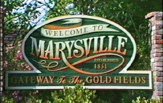 although little remains to be seen of its original character. This is due primarily to two undisputable facts: 1) The pioneers and a couple of generations after them seemed unable to prevent themselves from burning things to the ground every few years. In Marysville, this tendency stuck around well into the 1950s, long after fire departments had been invented. Maybe it’s something in the water. 2) City planners in the 1960s and 70s seemed to get some kind of perverse kick out of replacing handsome, vintage buildings with buildings that looked like giant cinder-block shoeboxes. I understand that it’s sometimes too expensive to restore old buildings and they have to go, but it’s unfortunate so many of them went at a time when the Hideously Ugly school of architectural design was in vogue. (If you can find one example of a nice-looking building designed and built between 1961 and 1979, e-mail it to me and I’ll send you a prize.)
Anyway, most of you who know me personally know that I like history, and I particularly like to observe how things change, subtly or radically, over time. It’s why I chose to include the “This Used To Be…” series of photos in my 90’s Playlist series. I was also inspired by a series of books called Then & Now which juxtapose vintage pictures with those taken at the same place in modern times. I decided I could do the same thing based on the pictures in Images of America: Marysville by Tammy L. Hopkins and Henry Delamere. So I headed out with my camera and a copy of the book to document the changes that Marysville has gone through. It sometimes took some hardcore squinting at the old photos, and a little guesswork, but I think I matched things up okay. My photos don’t look too great for the simple reason that I’m a shitty photographer with cheap equipment, and also because occasionally time or guesswork failed me when I was on site in Marysville (I took a few shots of the wrong side of the street), so I used images captured from Google Street View instead.
So, with your patient indulgence, allow The Holy Bee of Ephesus to present MARYSVILLE: THEN & NOW.
First of all, a map to orient any of you unfamiliar with the town.

Most of the historic stuff we’ll be seeing is in the rectangular area bounded by E St. to the west, B St. to the east, Ellis Lake to the north, and 1st St. to the south. There are some exceptions, but that’s pretty much it. Over the Feather River to the west is Marysville’s “twin” city of Yuba City, which is much bigger and fancies itself more sophisticated. I lived off of 14th Street, on the north side of Ellis Lake (outside the map’s top boundary.)
Excuse me while I go into full historian mode for a moment (picture me lighting a pipe and brushing the lint off one of my suede elbow patches).
In 1842, California was still part of Mexico, albeit a part in which no one but American settlers had any interest in residing. The Mexican government gave huge land grants to anyone who could fog a mirror, and much of it ended up in the grip of California grand poobah and somewhat lunkheaded businessman John Sutter. Sutter leased some of his approximately one kajillion acres of northern California land to Prussian immigrant Theodor Cordua, who established an adobe trading post at the convergence of the Yuba and Feather Rivers. As the bemused Maidu Indians looked on, munching their acorn paste, Cordua presumably shouted something to them like “Hey, can you give me a hand with this crate?” and by 1849, all the slower Indians in the area were “employed” as laborers by Cordua and his business partners. The rest had understa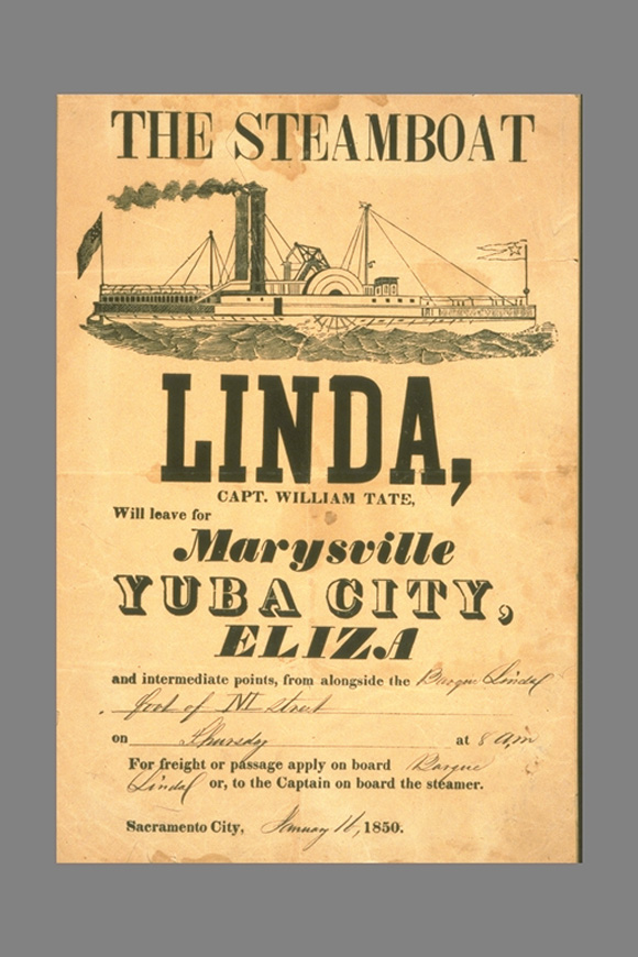 ndably scattered. (The term “Yuba,” which was applied to the river and general surroundings came from either a small band or sub-tribe of these Native Americans, or a variation on the Spanish word for “grape” — uva. Take your pick.)
Cordua gave his settlement the name of “New Mecklenburg,” but his more sensible neighbors decided that was a blazingly stupid name, and took to calling it Cordua’s Ranch, or simply “The Plaza.” When the Gold Rush hit, it became an important way station for people traveling to the ore-rich Sierra Nevada foothills, which began a few miles to the east. A few of the bigger steamboats coming up from the Bay Area began making New Mecklenburg a stop. (The first steamboat to navigate the Yuba River was the Linda, whose name lives on in a scuzzy little meth town just south of Marysville.)
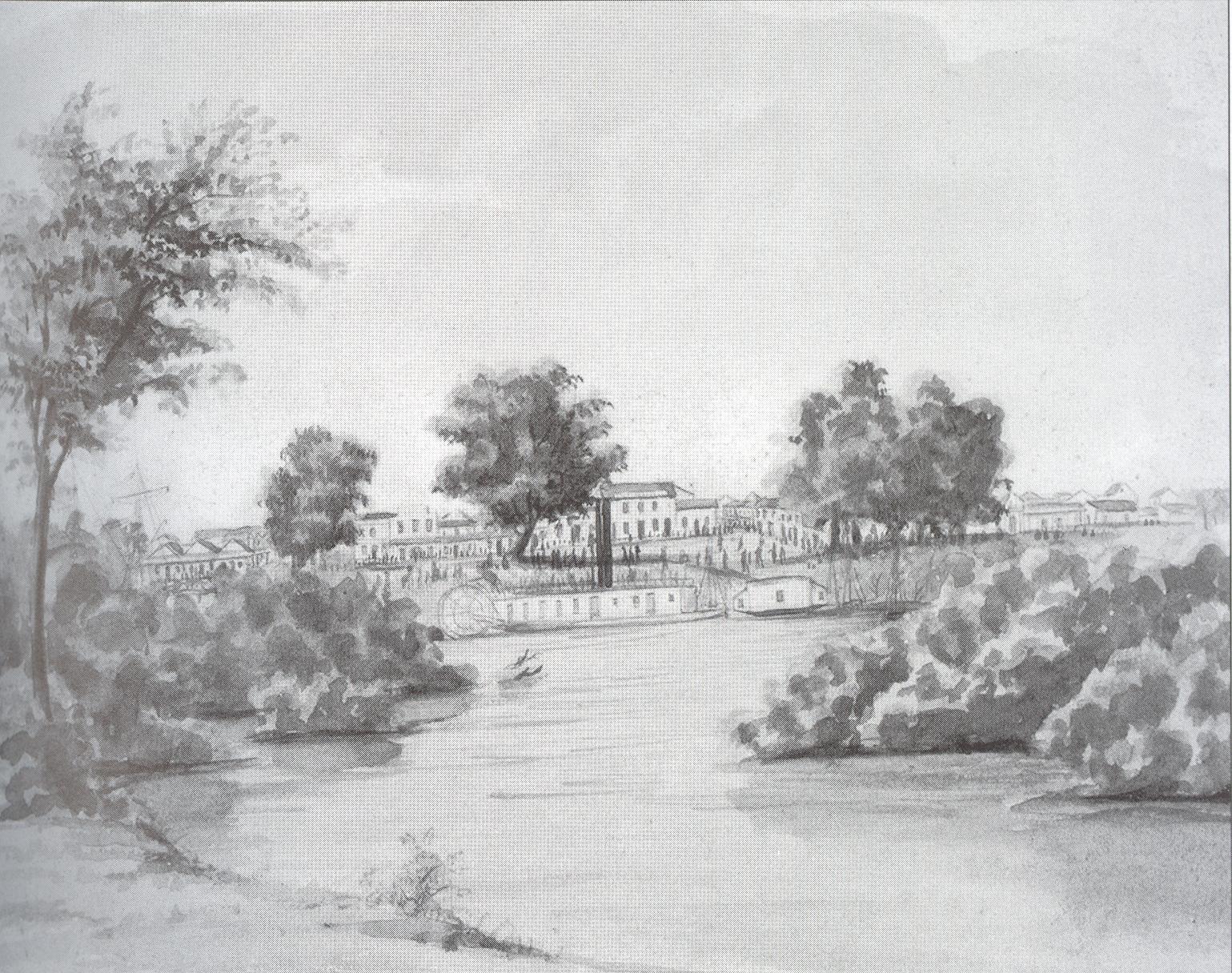 A watercolor of how “The Plaza” once looked
 The general area of “The Plaza” nowadays, buried deep under the Yuba River levee I’m standing on to take the picture.
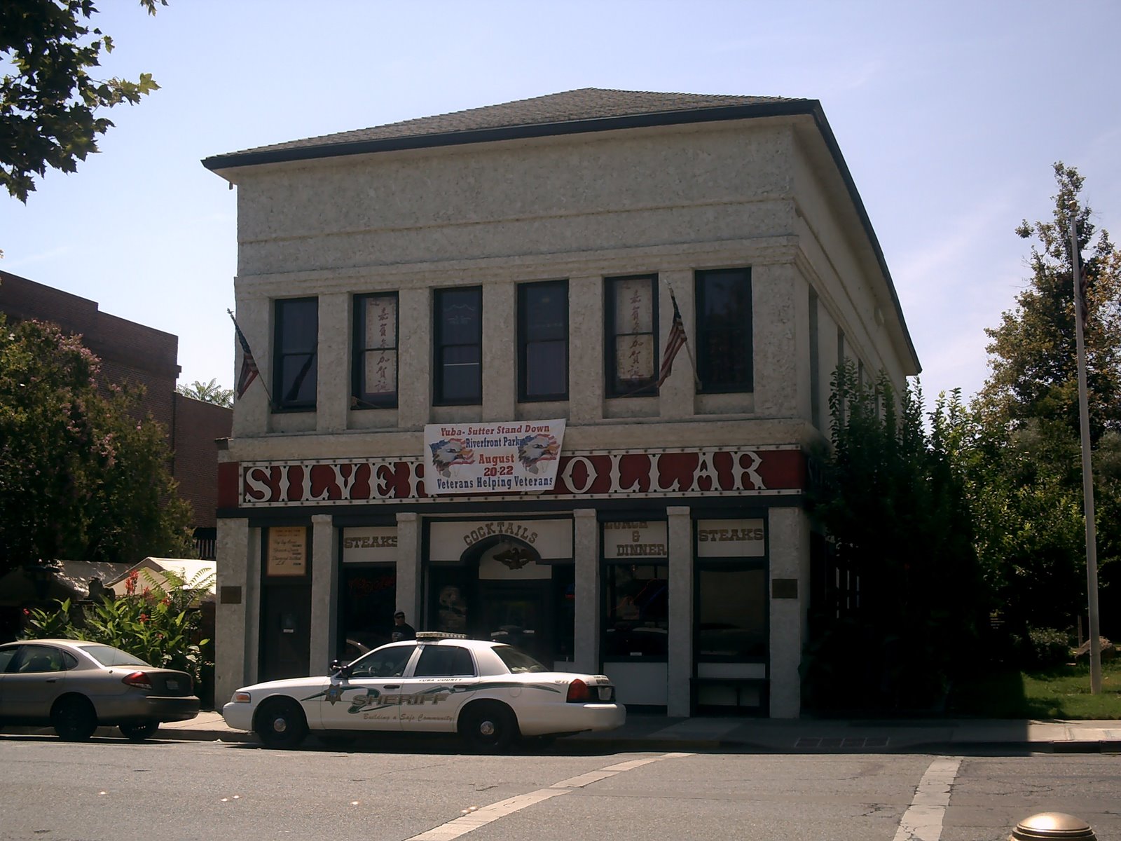 It was decided that the Silver Dollar Saloon on 1st St. (my favorite Marysville watering hole when I have to choose one – sheriff’s car optional), which backs up to the levee, is the presently standing structure that’s as near as possible to the old Cordua place, so that’s where they chose to stick the “New Mecklenburg” historical plaque.
Cordua sold off big chunks of his holdings to various speculators, but much of it went to a French immigrant named Charles Covillaud, who was rolling in profits from the early days of the Gold Rush. Everyone was making money hand over fist. (Except for the Chinese immigrants who poured into Marysville by the wagonful, and established a mini-Chinatown around 1st and C Streets. The Chinese referred to Marysville as “Sam Fow,” or “Third City” as it was the third city they came to after passing through San Francisco and Sacramento.) Covillaud then sold portions of his holdings to professional adventurers Jose Ramirez of Chile and John Sampson of Britain (by way of Chile) for another tidy profit. It was that kind of time. Frenzied buying, selling, subdividing. Entrepreneurs, soldiers-of-fortune, and various miscreants flocking in from everywhere, everything coated with a fine layer of gold dust. Craziness.
The portion of land Covillaud cannily kept for himself is what became the city of Marysville proper. He named it after his wife, Mary Murphy, who was a Donner Party survivor (and thus, a suspected cannibal, which never seems to get mentioned.) Much was made of this, though I don’t see why. In the mid-1800’s, if you survived one gruesome life-threatening event, another was waiting in line almost immediately. Sure enough, ol’ Mary checked out at age 36.
 A woodcut depicting the earliest days of what was by now called “Marysville.” It could be depicting Professor Harelip Jenkins and His Magical Dancing Bananas for all I can see, as these fucking woodcuts are impossible to look at without getting a migraine. But, y’know, they’re historical and all, so they must be important.
There seemed to be no limit to what Marysville could accomplish. It was the seventh (or possibly eighth) incorporated city in the new state of California, and there was talk of it even becoming the state capital. Developers began selling it as the “New York of the Pacific.” Imposing brick structures replaced the adobe huts and canvas tents. Greatness was in their grasp.
Then the dumb bastards went and burned it all down within a year.

Upon rebuilding, the citizens of Marysville soon discovered that their settlement was just as susceptible to flooding as any other town in the central valley of California. Californians loved building permanent settlements on floodplains, because that’s where the best farming is. But listen to the word: floodplains. See what it does there? The word is its own definition. Floodplains have a tendency to flood. It’s not that the Hardy Pioneers weren’t aware of the situation, but they seemed not to care, relying on engineering (bypasses and levees) to solve the issue. Difficult as it is to envision now, the earliest descriptions of Marysville describe it as being situated on bluffs above the Yuba River, so at first it seemed like flooding wouldn’t be a problem at all. Marysvillians could enjoy a sense of smug superiority, being literally above it all.
Then the place started flooding anyway.
It gradually dawned on the smarter ones that hydraulic mining upriver was increasing the sediment load and, thus, raising the level of the riverbed. The bluffs were disappearing. In 1875, a team of engineers put together an intricate series of levees designed to protect the town and its precious commerce. When they finished up, wiped their brows and had a look around, they realized they had entirely hemmed in the city with levees. It would forever be confined to its 1875 borders.
Adding insult to injury, the increased sediment in the riverbed caused the big paddle-wheeled riverboats to be unable to navigate as far north as Marysville. Sacramento got all of its business. Marysville as a major shipping port with the potential to be the “New York of the Pacific” was no more. So, Marysville population circa 1853: about 10,000. Population circa 2009: just under 12,000. For most of its existence, Marysville has been a slightly bitter, kind of backward little town that had all of its hope to be something better snuffed out over 130 years ago.
OK, let’s make with the photos before I put you all to sleep…Click on the pics for a more close-up look.
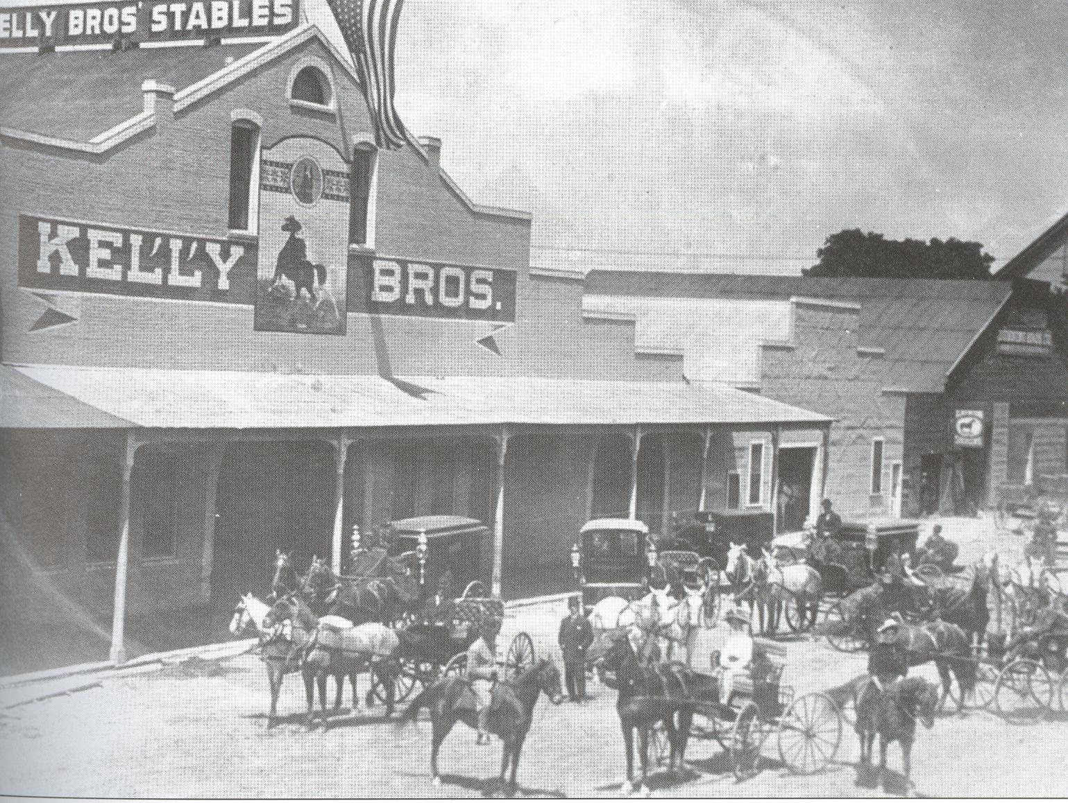 A touch of Marysville’s original Wild West flavor can be seen in this photo of Kelly Brothers’ Stables on E Street
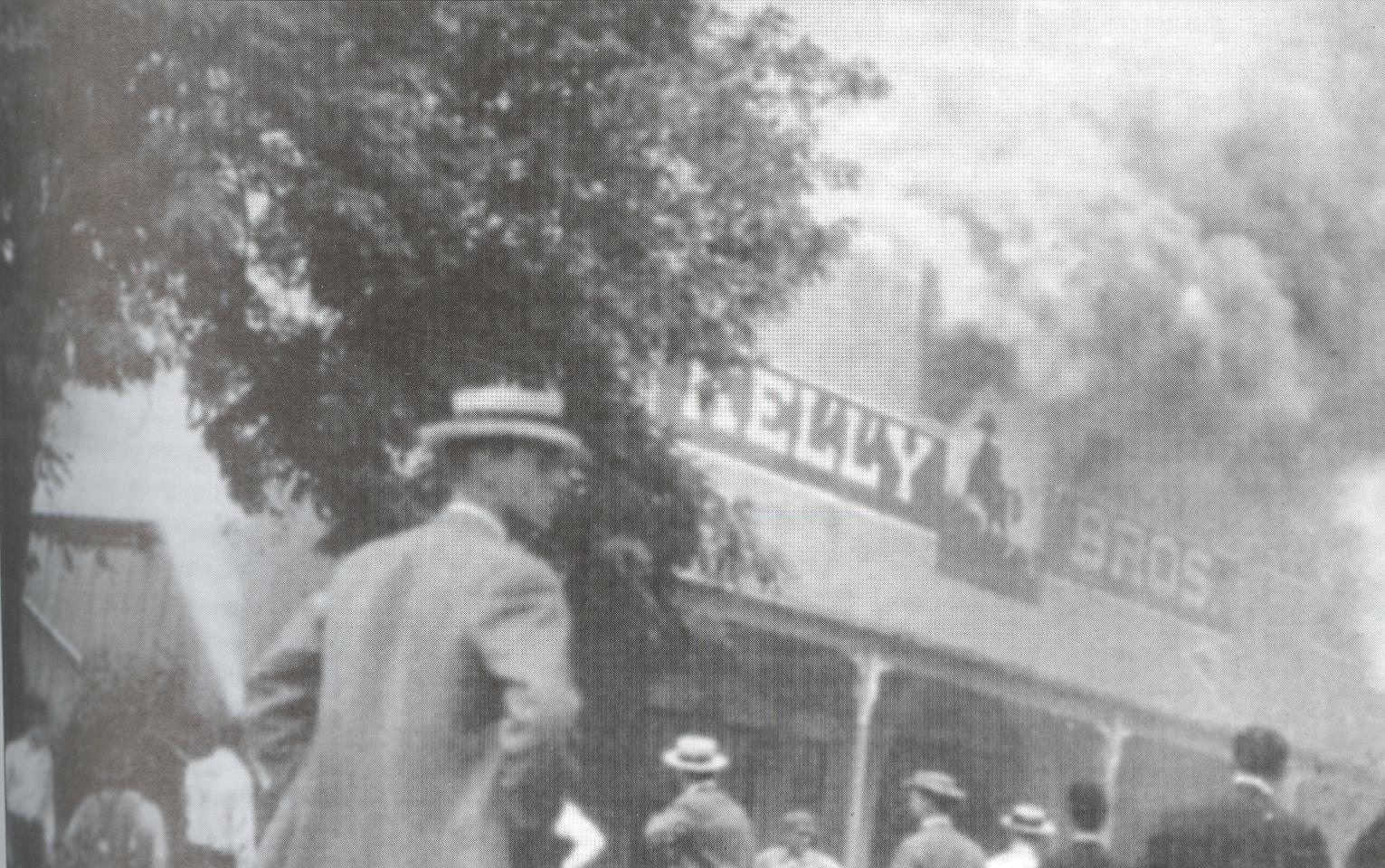 It burned down in 1915. (Note the man in the foreground being conspicuously unhelpful, for fear his snazzy straw boater might blow away.) The Kelly Brothers also ran an undertaking business on D Street.
 As rootin’ and tootin’ as it tries to be, the Java Detour that today sits at the same location just doesn’t cut it.
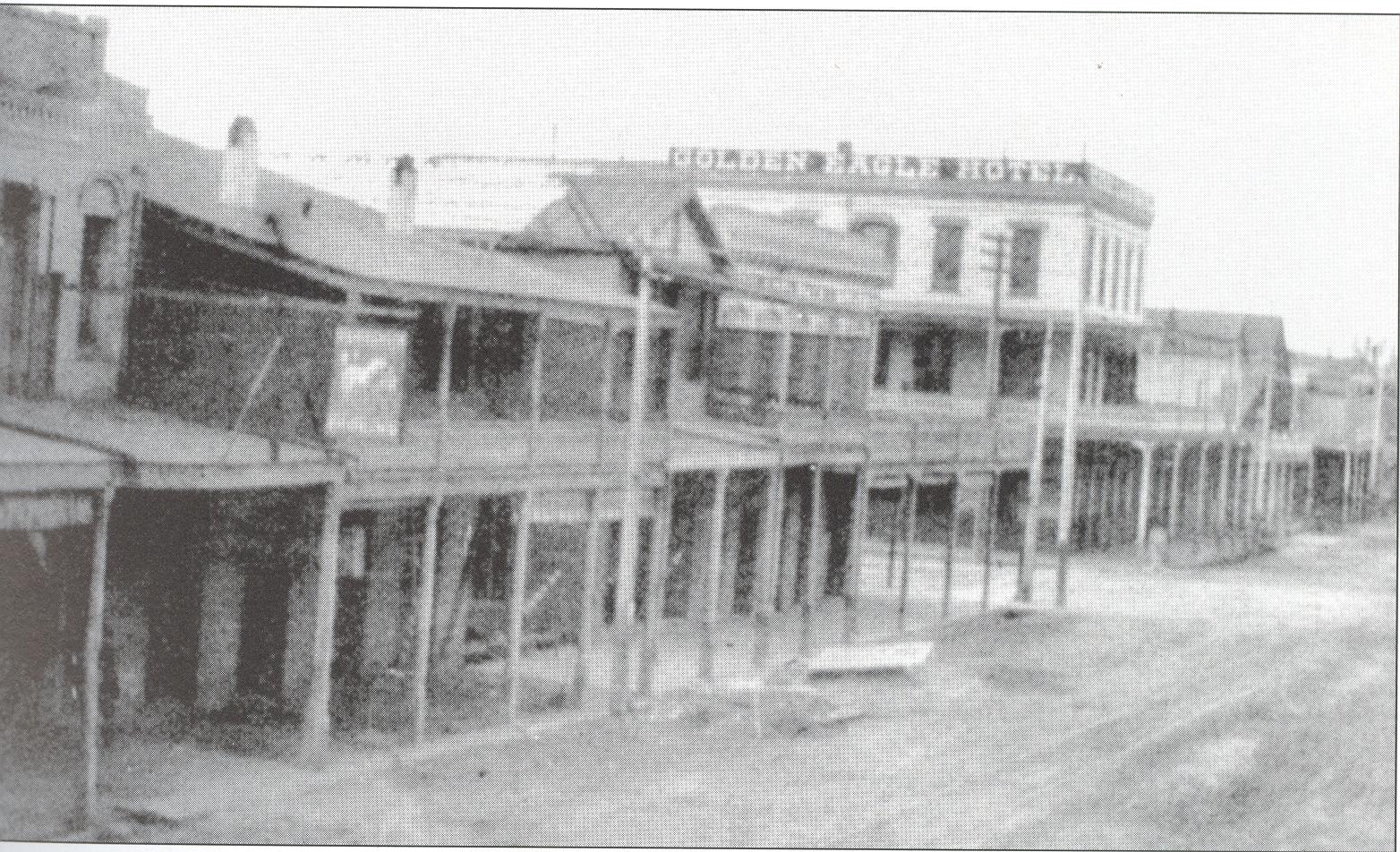 Another glimpse of life on the frontier as we look south down C Street at the Golden Eagle Hotel.
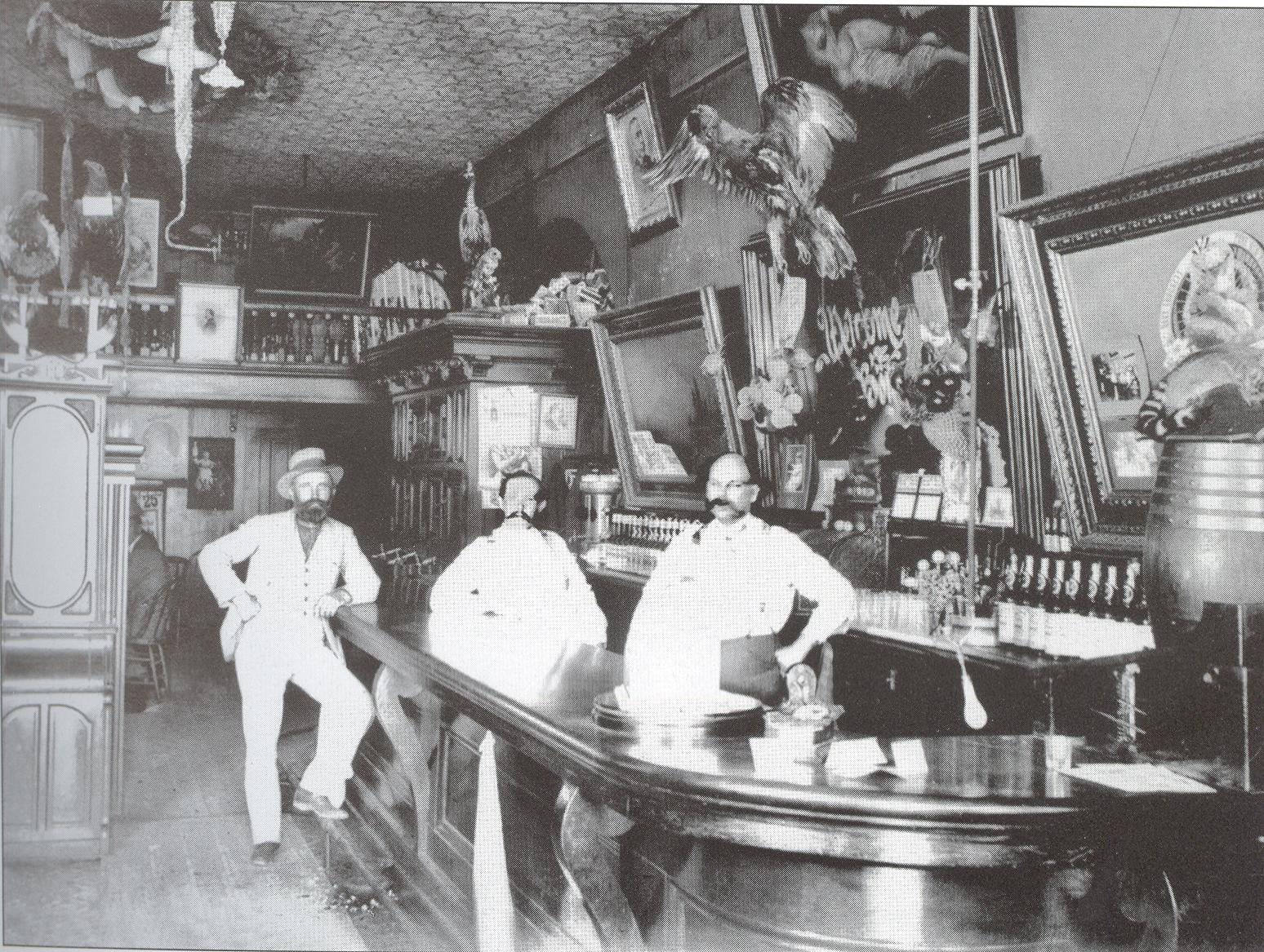
The Golden Eagle’s interior.
 Looking south down C Street at the grassy vacant lot (just beyond the cement traffic pillars) where the Golden Eagle once stood. I don’t know if it burned down, but I kind of suspect it did.
 To be replaced with a coffee shop. (In the 1990’s, this was called “Mahler’s,” and you’ll be reading about it in an upcoming This Used To Be My Playground.)
 Up until the 1950’s, the Del Pero’s California Market was the most modern and pristine supermarket to be found north of Sacramento, pioneering developments in portion control and freeze-drying, and employing a fleet of vehicles to make home deliveries. (If you squint, you can make out the slogan We’re Glad To Meat You on one of the trucks. If this is what passed for humor in the 1950s, you can tell why the world was ready for Lenny Bruce.)
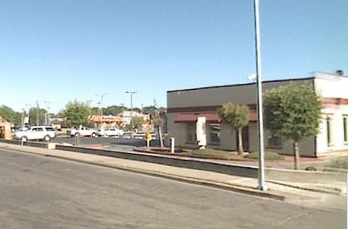 Looking for it today? Uh-uh. Burned down. Evidently, a sausage-making machine went kerflooey on Christmas Day, 1956, and roasted the joint, taking the Masonic Lodge building next door with it for good measure. True story. Today it’s a Jimboy’s and its associated parking lot.
 The Masonic Lodge that perished in the Great Christmas Sausage Fire of 1956.
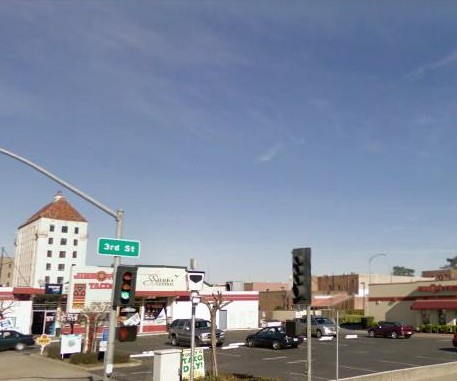 The parking lot where the Masonic Lodge used to be.
 The Western Hotel once stood at the corner of 2nd and D. In its early years of operation, it was a miracle of 19th-century hotel design, boasting the only elevator, steam heaters, and electricity in any hotel between Sacramento and Portland.
 I guess I can’t technically say the Western “burned down,” but the inevitable fire caused enough damage that the building was demolished in 1956.
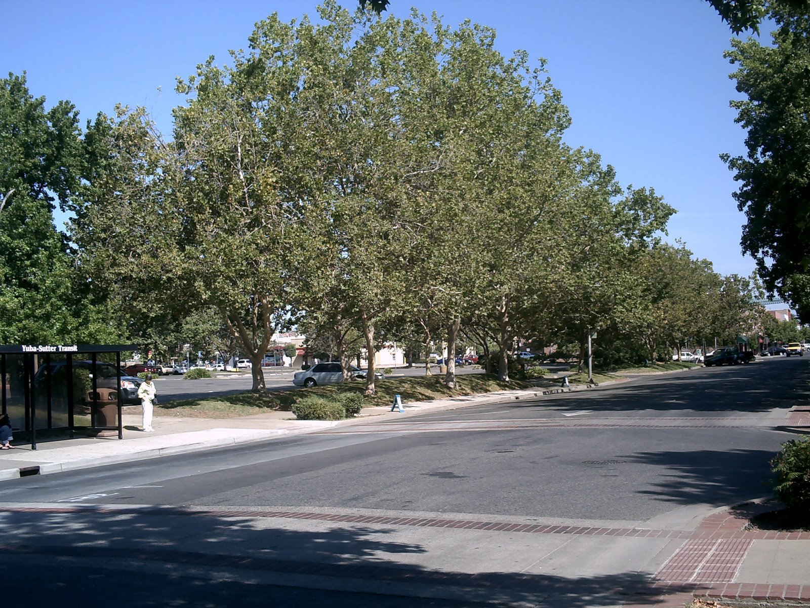 Today, the area where the Western Hotel once was is occupied by a bus stop and the tree-lined parking lot of Mervyn’s, which went out of business at the end of 2008. The large Mervyn’s building now sits empty, staring eerily out at the downtown business district it was meant to save.
Tired of fires? Okay.
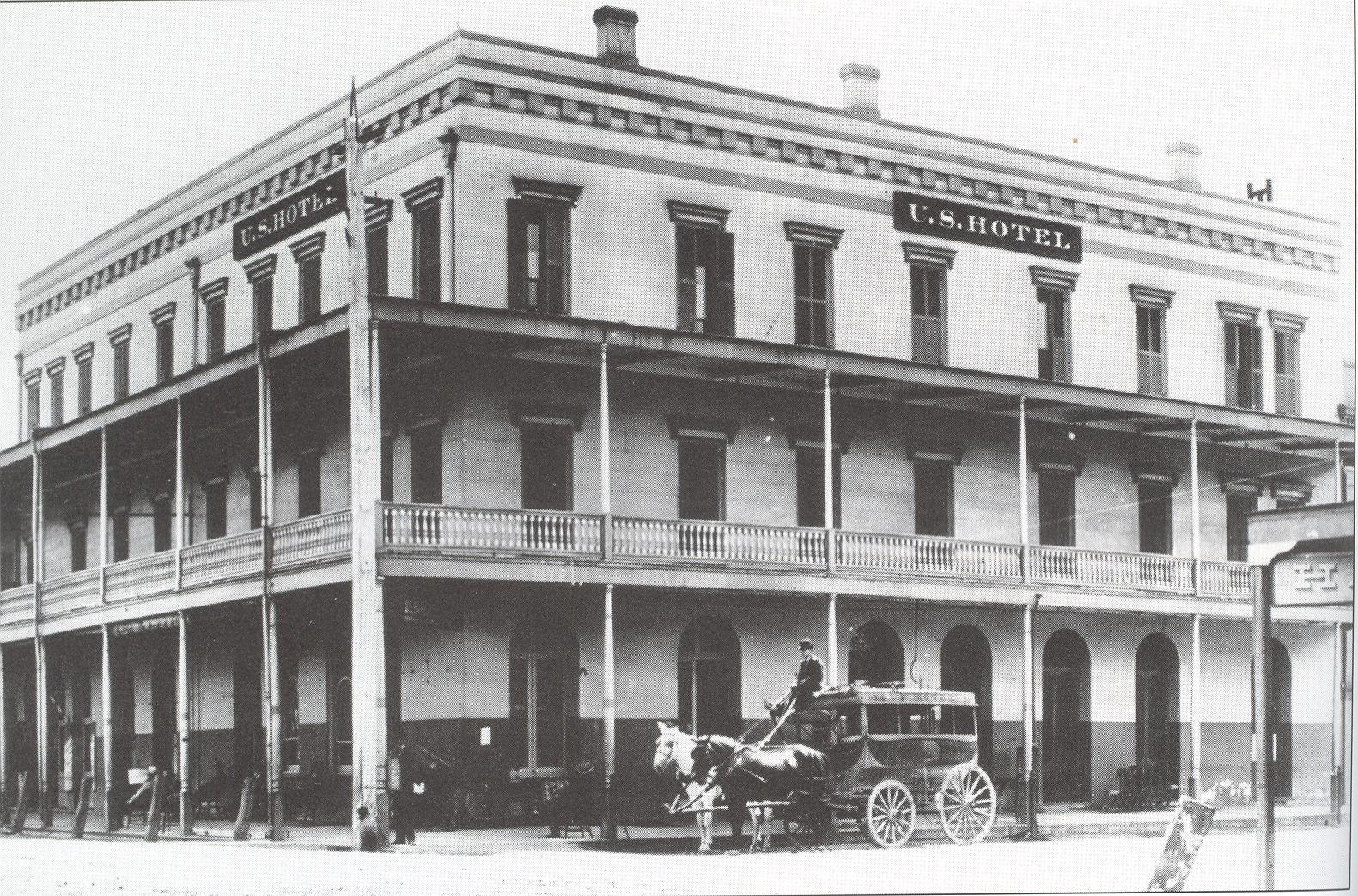 Here’s the equally prestigious United States Hotel on 3rd and C Streets.
My otherwise reliable Marysville book states fancifully that “In 1867, while campaigning, Ulysses S. Grant stayed at the [U.S.] Hotel.” For one thing, Grant was still in the military in 1867, had his hands full dealing with Reconstruction, and never left D.C. For another, no self-respecting 19th-century presidential candidate would “campaign”(as we understand the term) a full year before the election, before receiving the nomination, and certainly not in the wilds of California. Grant did not even attend his own party’s convention in 1868. A little research and common sense is all it takes, people! Get it right if you’re going to put it in a book. (Blogs get more leeway.) If Grant stayed in the hotel (I’m not saying he didn’t), it was most certainly in the fall of 1879, when he was on his post-presidential world tour. He passed through California after crossing the Pacific from Yokohama. OK, lecture mode “off.”
 Where the United States Hotel once stood is now the shady backside of the Yuba County Library.
 Next to the U.S. Hotel was Marysville’s original City Hall and Fire Station.
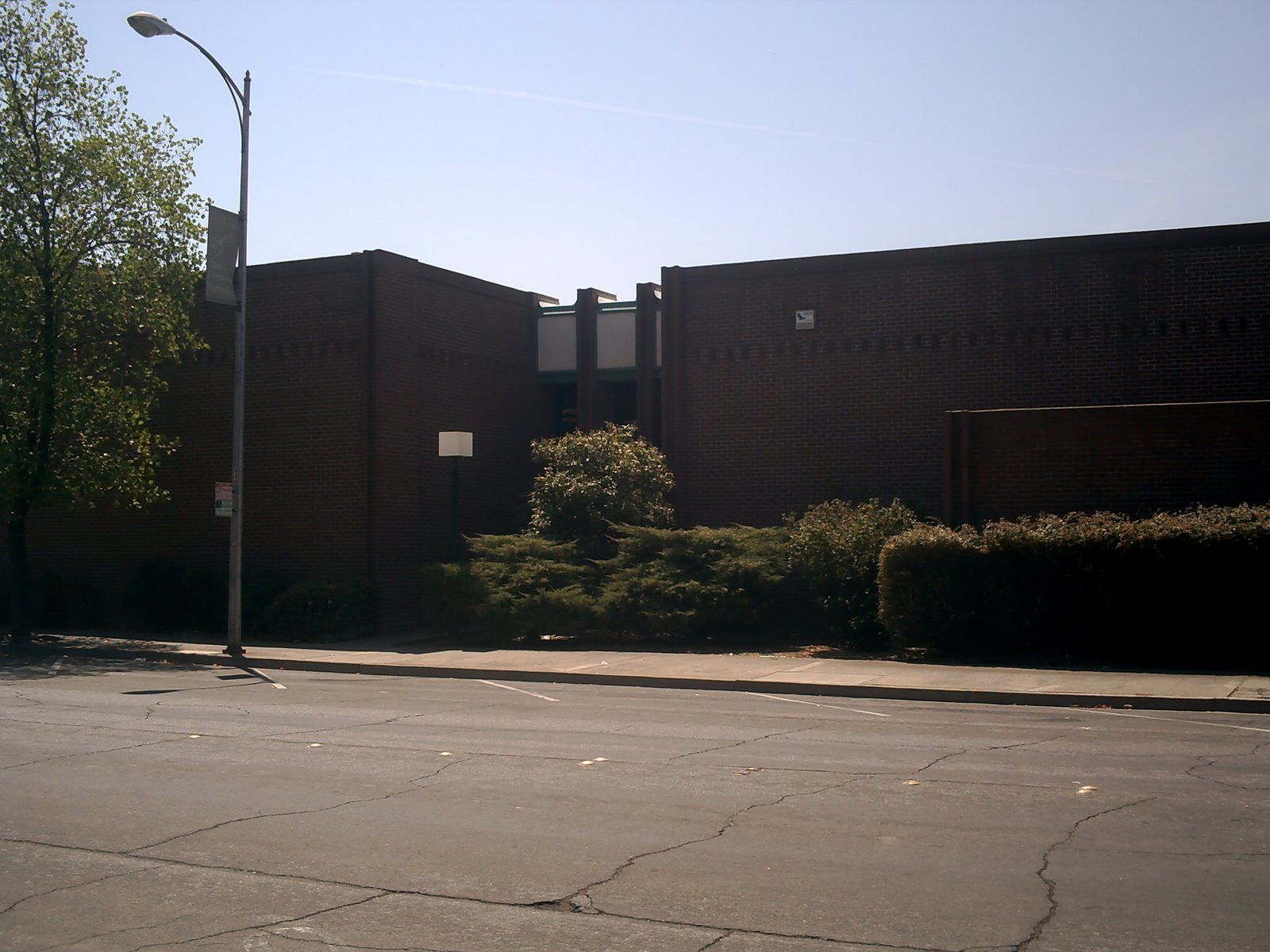 Which leads us to a continued view of the ass-end of the Yuba County Library that now occupies the spot.
 The parking lot of the Gold Country Bank has a historical marker to indicate the old court house’s location.
 What about the “new” courthouse? Well, here’s a look at Cortez Square, a shady spot bordered by 5th & 6th Streets and B & C Streets, and site of the fifth California State Fair in 1858.
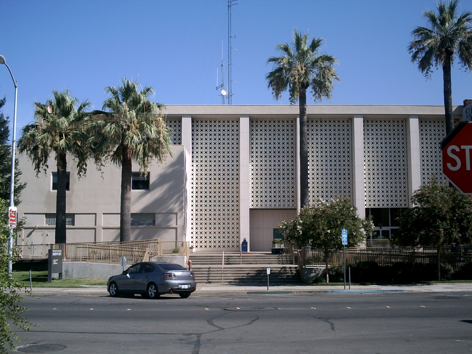 And its replacement – the eye-wateringly ugly “new” courthouse of 1962.
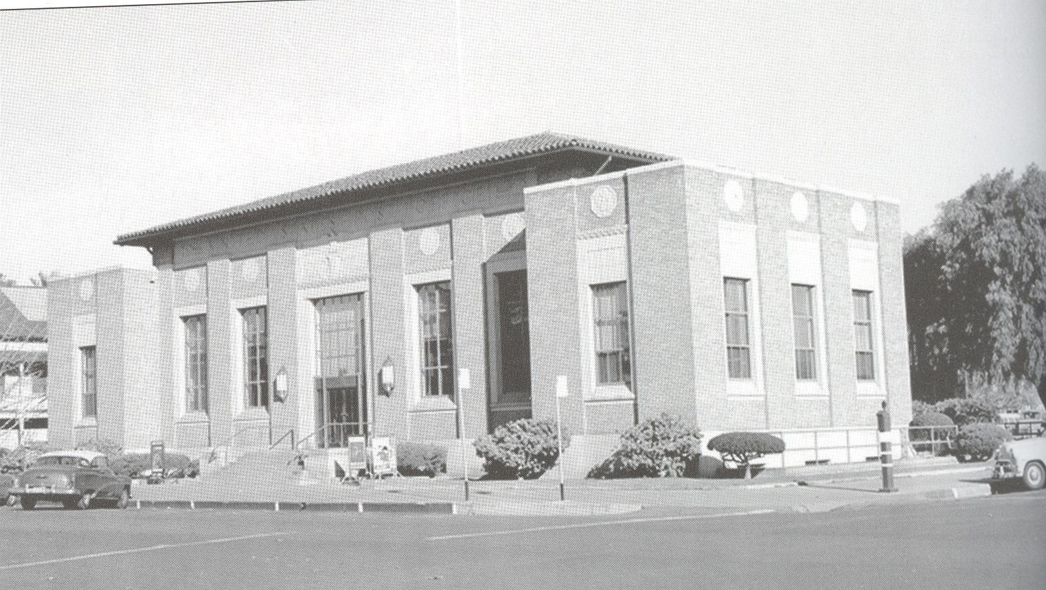 The post office building on C Street was built in 1934-39.
 And little has changed. I mean, how much can you really do with a post office building?
 The Packard Library across the street from the post office opened in 1906 as the first free library west of the Mississippi. (Most libraries charged a small membership fee back in those days.)
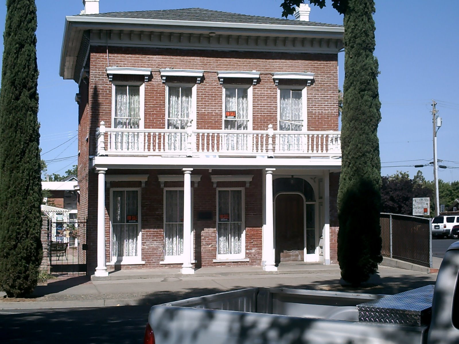
Some pretty nice old private residences still exist in the area west of E Street, but a lot of the ostentatious mansions of the city’s founders are gone.
 The house of Mayor Norman Rideout once stood on 5th and E Streets. It was later converted to a hospital that bore his name.
 The Marysville Hotel got less than a half-century of glory. It was derelict and abandoned long before I moved to the area as a child. Every once in awhile, there’s some big talk about refurbishing it into “luxury condominiums” or “prime office space,” but look at it, for chrissakes. No one’s ever going to do anything with it except put it out of its misery, and even that won’t come anytime soon.
 This was the home of the Ellis family at 8th and D, who gave their name to the lake that lies a block to the north.
 It is now the site of St. John’s Episcopal Church.
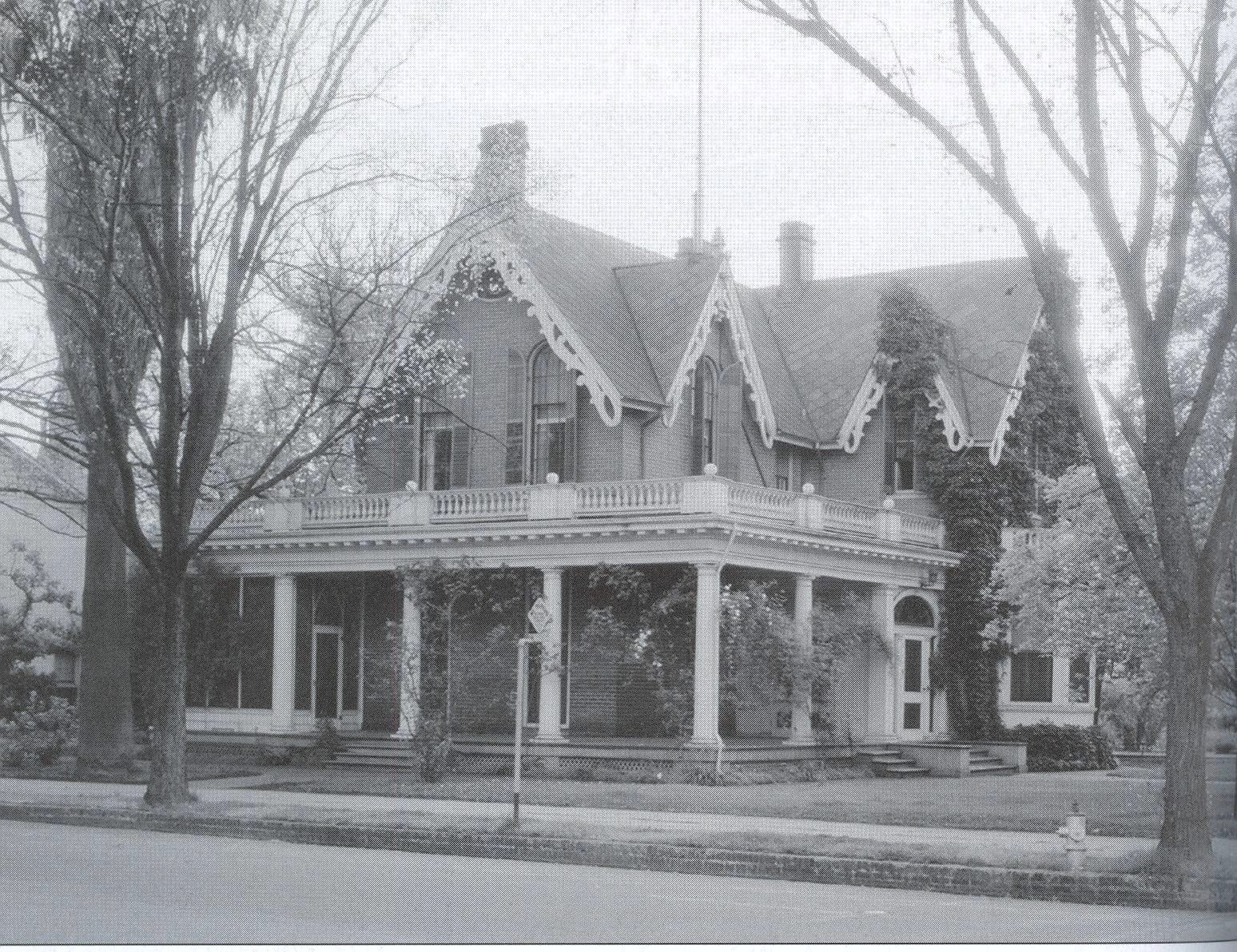 The Belcher family were prominent city attorneys instrumental in halting the destructive hydraulic mining on the Yuba River. Their home stood on C Street.
 The “new” City Hall (dating from 1939) now occupies a space just to the north of where the Belcher house once stood.
As it happens, three of the oldest houses in Marysville are still standing.
 The place still looks pretty much the same, though it’s in need of some restoration, and instead of looking out on Cortez Square, it now looks out at the new courthouse. Scroll up if you need a reminder of what that dungpile looks like.
 Former adjutant general for the state of California and founder of the California National Guard, Edward Forbes lived in this house on D Street, built in 1854.
 Until recently, the building served as the Historic Forbes House Restaurant, but now sits vacant.
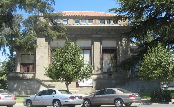
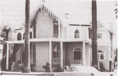
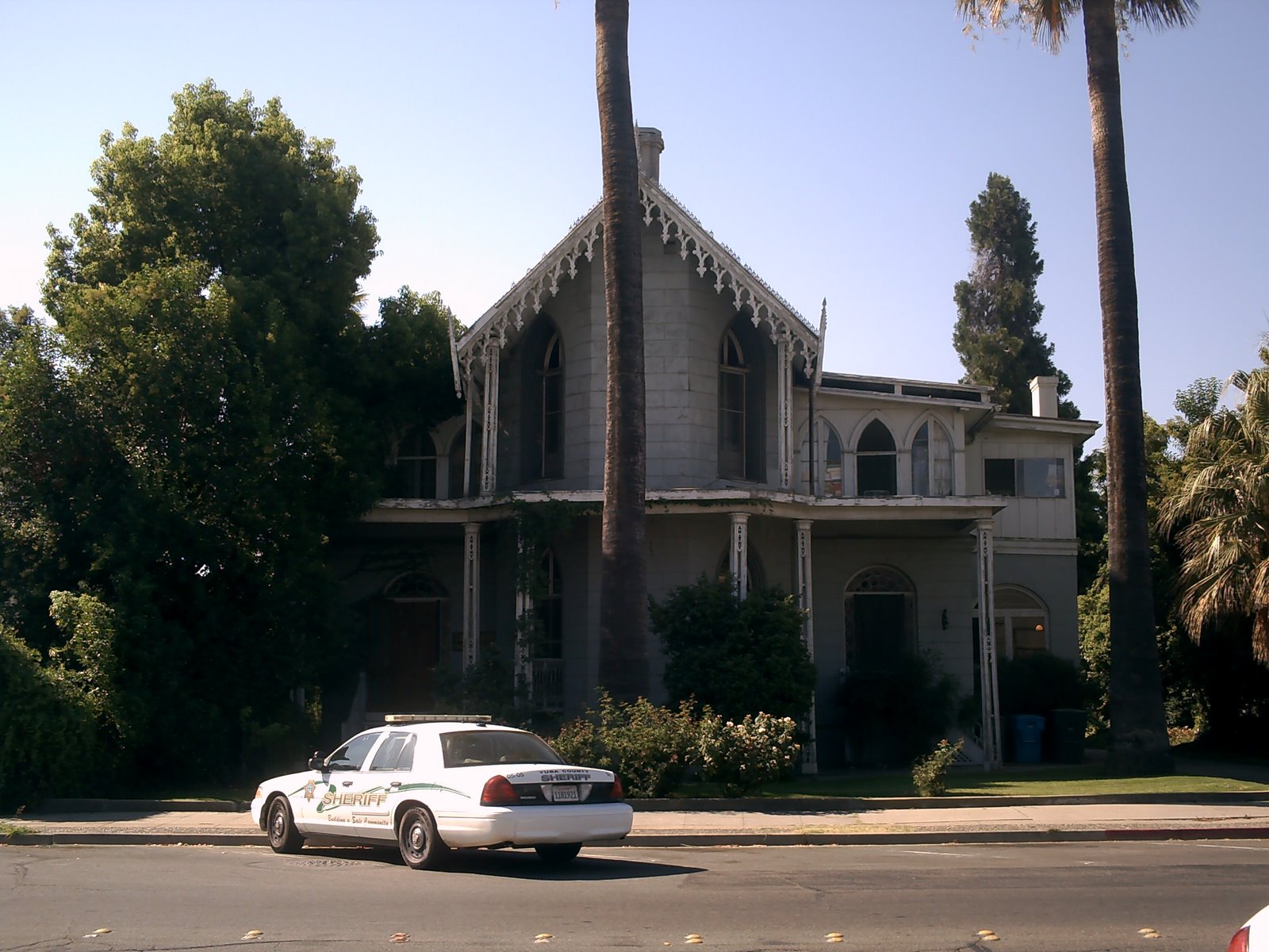
 The 1856 house of Francis Aaron, founder of Marysville Water Co. and Northern California Savings & Loan, also went for the “medieval castle” look that was all the rage in the mid-1850’s.
 Now it is the Mary Aaron Museum, a well-meaning if slightly underwhelming collection of antique furniture and clothing. They’ve got some good pictures, though.
Want more? I gots more. But let’s call it a day for now. I’ve been beavering away at this time-waster for (checks time) over five hours now. And that’s just the text. I’m committed to finishing this because I already spent last night scanning and sorting all the pictures.
Next entry coming soon. There’ll be more fires, I promise.

Matt,I've really enjoyed reading your "then and now" history of Marysville. I tripped over your blog while Googling pictures of the State Theater.I was born in Yuba City in 1964, but grew up mostly in Marysville. I think I explored every inch of the city between 1964 and 1977 (when we moved to Yuba City). I moved to San Diego in 1979 but for some reason chose to move back to the area in 1984.There's still a deep fondness in my heart for Marysville, and a deeper regret for the condition it's in now. In college (Chico State) I did my senior honors thesis on the relationship between Marysville and the gold mining industry. (I'm pretty sure I coined the term "Gateway to the Goldfields" before the signs were ever erected. Then again, I'm certain that Stephen King stole the idea for "The Dark Half" from a short story I wrote in a creative writing class at Yuba College in 1989.)Anyway, it's nice to see someone with the same regret for the slow death of a once-great city.Love your writing style. Excellent flow and great humor. I literally LOL'd at one comment.Good work!David CowardJohns Creek, Georgia
Thank you for compiling this! I work at the old Marysville Library building- and stumbled across your blog while fulfilling my usual quest for knowledge about our building/ city's past. I think you should remember the State Theatre, too! Remember it burned in 2006 or 07… with minimal structural damage…. just another fire to throw on the…. fire…. Thanks again for putting this together… AND, btw… Friday Night Live is a youth development organization…… Yes, we want teens to be sober, but that doesn't encompass aaaalllllll of our programs…… : )Too bad you moved away! Thanks for still having a heart for the little city…
Yes, thank you! It makes me want to learn more about the history of the town, the buildings and the people who lived in them. I’d also like to hear about the old Marysville High School building. That HUGE, beautiful brick building with the historic theatre.
Thanks again!
Sadly, the theatre now unusable after the storms this winter. Looks like unless there is a rich benefactor that comes to its aid, that is another beautiful historic place that will be boarded up.
Old MHS is and has been for awhile the home to the district office for MJUSD. The old beautiful theater was used by MCAA (an arts high school I graduated from in 2014) for quite some time, until they were told they could only have after school events in there. Now the district office entrance sits right in front of one of the side doors to the theater, so I believe it is not being used.
Thank you for putting all of this together. I went to elementary school at St. Joseph’s on C street from 1975-82. Then to marysville high school. I often thought about all the lost history to, not only fire, but to the tearing down of old buildings and homes. So many stupid decisions by local officials to change things. The only thing Marysville had going for it was its history and most of it has been wasted. I have fond memories of old Victorians and places like the Chislers Inn… Gone now. My father was a local businessman and became a county supervisor. It became apparent durning his tenure that Marysville is a bit of a lost cause. The only thing that thrives is met, transients and revenue officers…errr police. All they do is write tickets. Don’t park on D street.
Awesome history lesson, would love some history and pics of Yuba city
I am not really thrilled with your glib description of the Native Maidu’s in that area. How dare you, you ass hat
Well, then, luckily for both of us, providing you with “thrills” is not really in my mission statement. Thank goodness the Maidu have someone as eloquent as you to look out for their interests.
Best wishes,
The Holy Bee
… Yes.
It is true, none the less and if you dont like it.write your own article and make them heroes.
I grew up in Yuba City in the 70 and 80’s. Very interesting , some things I didn’t know. Really liked the pics.
Possible interesting anecdotal information about the Ramirez Castle. I have a buddy who used to live behind that house and swears the property was violently haunted. Whether or not you believe his stories, or in the existence of malevolent spirits, he terminated his lease early due to rolling closet doors inside his apartment slamming on their own, women’s screams seeming to come from inside the Ramirez Castle, apparitions appearing in the yard, and a few other scary stories I was too drunk to properly file in my memory banks. Fun stuff! Thanks for the entertaining post, you have a new fan.
Interesting read. My grandmother was born in La Port. My grand father drove the stage. And lived on 8th street. My other grandfather was a barber at Chislers Inn. My father was a barber in a shop called Chrises across from Chislers.
Nice job, I remember the JC Penny fire. I lived in Sutter, and you could see the smoke very distinctly. I also remember the Brunswick Hotel where the old Mervins building sits today. I am looking forward to the next installment.
nice to see some history still stands , but I know a lot of it has been destroyed one way or another. but thanks for the history lesson it was nice. too see.
Did you have a band called Chocolate Honey Monkey? Great writing, very colorful memories, thanks for sharing
“The Chocolate Honey Monkeys” as my mother insisted on calling them was not my band, but I was friends with all of them. I still run into Jeannie and Allen frequently, Angie and Tony are mostly just Facebook friends these days since they lit out for other areas…
Thanks for reading
Great historical documentation with humor added. Thanks for the history lesson of an area I have haunted since 1960s having lived in Yuba City over the past 24+ years. Old Marysville was much more vibrant in the 60s with businesses that drew folks from adjacent counties, referring to the Yuba City/Marysville area as the “city” (as opposed to the rural towns from which we traveled: Williams, Colusa). I appreciate the Now and Then photos. Can’t wait to read your next instalment.
I was born and raised in the area in the 50’s and 60’s. Interesting readind!
this is so interesting, thank you for this post. I drive through Marysville on the way to plumas on occasion and often wonder what it used to look like.
I lived in Marysville from 1957 until the miod 70’s. Gray Ave in Yuba City was Named after my grandfather Dr. Everett E.Gray. As a Child I lived on D St near Ellis Lake. So many fond memories of that Era. THe history lesson here is some I will inclued in passing on to my Grand Children. I reallly enjoyed reading it. Thank you so much
Everett E. Gray III, CPPB
CW03 USMC Ret.
I am a Marysville transplant (from San Jose, and prior to that, born and raised in Hawaii. Don’t ask.) I thoroughly enjoyed this! I love your writing style and look forward to more posts.
HAHA, this was fun to read. I am from Chico (moved there in 8th grade and have been there for 22 yeas since) and have recently moved to Marysville. I got a job in Sac and my wife is in school in Chico so we figured it was half way for both to move to Marysville. The attitude of this post is the same way that I feel about living in this place. The history is very interesting, but besides that I live in fear of the dam breaking upstream and flooding the place ( I had to evacuate as part of the Oroville dam spillway failure right when I moved here 🙂 ). Good stuff, had me me laughing my ass off.
Enjoyed the read. Who are you?
I’m fine, thanks, who are you?
I really enjoyed reading this blog. Do you know who the architect was for the “New” City Hall in Marysville (1939)? I cant seem to find the information anywhere. Thank you
Thanks for the information and history, good stuff! I’m researching a man Named Adam Smith a hotel owner in the mid 1800’s.
Good morning, Matt. My great grandfather, Guy Wilson, owned a bakery in Marysville in the 30s, 40s and 50s. We are trying to find out more information about the bakery and Guy, if you happen to have some, we’d love to talk to you about it. My email is terristeffes1117@gmail.com Thanks!
Although you say “I” a lot in your narrative, you never give your name. I would like to know it. Just so that I can put a label to the arrogant, self-important, snarky, little snot that, after 2 long years years of living in Marysville, can render such definitive judgments of it’s long history.
I’ll admit that the most basic facts in your article are accurate to the best of my best of my knowledge. But your tone and your opinions reflect intellectual laziness, meanness, and a pathological misanthropy that … but if I continue my thought unrestrained, I would risk being as unfair to you as you have been to my beloved home. I only ask that seek to understand before you judge.
Write your own or die mad about it.
Signed: A childhood resident who is appalled at what has happened to my beloved hometown.
This is the greatest historical read of all time. I can just see you, pipe, leather elbow patches, and all.
Question: Can you tell me anything about the darker side of Marysville history, specifically anything about itinerant/homeless/transient camps circa 1953 at the foot of A Street on the Yuba River? I just got the death certificate for a long lost and unfortunate family member who died alone in Marysville, and whose address was listed as the above mentioned area. When I zoom in on Google Street View, I can see there are some weird paths in that area along the river next to the tracks, around what could have been buildings at one time, or even a camp possibly. Do you know anything about that area at all?
Also, what would bring a transient to Marysville in the early 1950’s? Agricultural work, railroad work, or other? This man spent his entire life in the Minnesota area and only showed up once in California: in Marysville, where the one documented event is his death. He is my long lost and long suffering grandfather, who died young and lived what seems to have been a difficult life. Any information you can help me with, or any direction you can point me, would be so appreciated.
Thank you for the work you are doing. Feel free to email me directly!
Hi Chrystene
Sorry for the late reply, don’t know if you’ll see this. I’m afraid I can’t be of too much help. The darker side of Marysville is not something the civic leaders and local historians want to emphasize too much, so there’s not many legitimate historical sources out there to review.
I know in the essay I made it sound like I was only in the area for a couple of years (which seemed to irrationally anger Mr. Bonney in the comment above yours), but rest assured I grew up locally, left for college, and then returned (briefly) as an adult.
Marysville was a magnet for transients in the post-war years, from the ‘50s to the ‘70s, and it was pretty much entirely due to the agricultural work widely available, as you indicated. Railroad work, as far as I can tell, was dying off by then, but anyone who could handle a shovel could find employment in the acres of fields and orchards. (Look into writings about notorious serial killer Juan Corona if you want to know more about this sort of thing.)
Even before the end of the ‘50s, Marysville had a notorious “Skid Row,” which was D Street between Third and First. It’s been re-developed now (to varying degrees of success), but at one time it was all bars, brothels, and seedy theaters. My own father, as a teenage Navy petty officer, hitchhiked his way to Marysville all the way from San Diego because of the “action” that could be found there. (That’s where he got his tattoos — my 82-year-old dad is way cooler than me, BTW.)
A Street fell outside of my self imposed “rectangle” that I wrote about in the essay. Most of that street runs along elevated train tracks, and…this is a purely personal, subjective observation…that part of town has an eerie vibe. As a teenage driver, you would sometimes get stuck there and find it hard to turn around and get out. The hair on the back of your neck would go up. Nothing you could put your finger on, but…it was an area mostly to be avoided. To this day, there are still a lot of “single occupancy” very low-rent living spaces to be found there.
Having walked them a few times myself, I think the trails you mentioned were mostly trodden down by fishermen and local kids on bikes. I wouldn’t call those spaces along the riverbank a “homeless camp” per se, but it’s definitely a popular fishing spot, and the fishing folk set up a lot of semi-permanent camps to catch sturgeons and stripers when in season. I don’t think I would be comfortable eating anything that came out of the Yuba River at that point in its journey, though. (Spots upriver are quite beautiful.)
Sorry I couldn’t provide more, and condolences on your grandfather…
Best wishes,
The Holy Bee
Dear Holy Bee –
Thank you for the wonderful response! I did indeed get it and got a notification on email since I have signed up to receive any comments on this post. I found your message most enlightening! What particularly sticks with me is the ‘eeriness’ of ‘A’ Street, and the way you described it, I really got the feeling of it.
In July of 1953, the same week my grandfather, who died at just 50, was pulled from the Yuba River, I have found news stories of at least two other transient men who were killed on the Yuba River or the tracks within a block or two of where my grandfather was found. I had read up on Juan Corona, and chillingly, while the spree of his killing transient men happened much later and the murders everyone knows about happened after he ‘changed’ following the 1955 flood, he actually had just moved to Marysville, a transient himself, in May of 1953, a few weeks before my grandfather was killed. So if there was any kind of migrant worker camp or hobo jungle down on the river there, the two of them may have met.
It’s been a crazy few weeks doing this deep dive to solve the many mysteries swirling around the final few years of this lost man, my grandfather, who was not from Marysville (or even California), but met his end there, most likely as he was passing through. He had been estranged from his wife and children for over 7 years when he died, so no one has ever known what happened to him. Just yesterday I got confirmation of where he is buried: in an unmarked grave in Potter’s Field, Sierra View Memorial Park.
I am an artist and making a project about this lost man, so information like yours is extremely helpful, particularly the colorful memories of skid row on ‘D’ Street and the strangeness of ‘A’ Street along the tracks, and of course, hearing about your dad’s tattoos really made my day. If he’s in his 80’s, you and I might be from about the same generation. I always wished my own dad had a tattoo or two.
I am totally comfortable with your emailing me directly if you have anything more to add; I understand that today’s Marysville would like to focus on the positive aspects of the town, and that some of what I have asked about has forced a public conversation on some of the more distasteful aspects of its history, but if this is the sum of it that’s great too; it’s more than I ever expected, and it’s especially juicy and visceral coming from a great writer like yourself.
Again, I thank you very much for the time you took to respond. You have definitely helped a great deal, and I am very grateful!
Chrystene
I purchased the Forbes House in about 1975. I took out almost all of the first floors flooring and reinforced all the exterior foundation with concrete. The brick walls of the home where built on the ground so there really was no foundation. Also put in concrete support for new pier blocks to support new beams and floor. These improvement plus others should keep this building sound for my more years. I sold the building to Mr Pasquini for restruant.
Hi there really liked the read about marysville. You made so enjoyable my family was born and raised hear yep all 3 floods . Fo you know or can you find out what the address if the the bar they called the office on 5th st.
such Wonderful Memories you Are Writing About My Favorite in High school History .Love All History Thank you So much For Your Writing Just Love It want to know More .
Thanks for reading & your kind words!